Alert
Alerts
The Rocks of Murat

IGN cards


Description
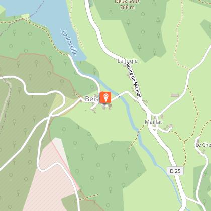
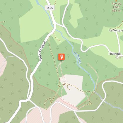
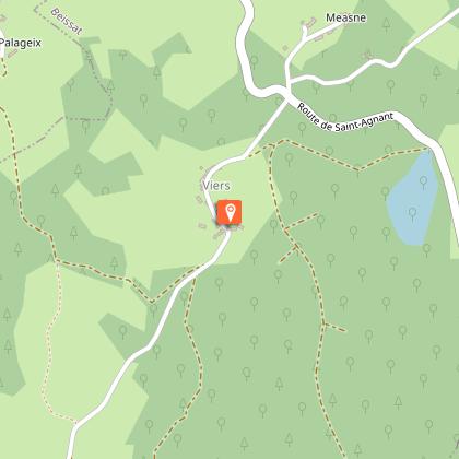
Un beau circuit ombragé qui conduit au village de granit de Viers en passant par le point de vue des Roches de Murat.Depart in Beissat, and take the small road towards the church. Park on the esplanade in front of the river, at the St-Pierre cross. After the bridge, turn left on the uphill path that goes up to the church.Continue through the village and take a tarmac path on the left. Continue on this path. When you arrive at a large crossroads, turn left to return to the road.Cross over and continue ahead. At the top of the road, take a path on the right. At the next crossroads, turn right again to join the D 25. Round trip to Les Roches: Take the road towards Murat. At the next crossroads, take the track on the left that goes up to Murat. Follow it for 500 m and then take a path on the left that leads to the Rocks (slippery in rainy weather). Retrace your steps.Take the road towards Foulnoux. Leave the Cher road on the left. Before a hairpin bend, turn left onto an uphill trail. Continue to thread your way up into the beech woods. Follow the trail straight ahead until you reach a path that you take on the left.Join a forest track that you follow on the left for 1.5 km. Go past a meadow on your right. Shortly after, a path on the left goes down to Viers.In the village, take the road on the left (go to the right for 50 m for a remarkable two-level well). After the laundry, go down the path to the right. It goes down to a stream and then up again. Turn left at the next crossroads: this trail joins a road that we take on the right to get back to Beissat.
Technical Information
Altimetric profile
Starting point
Steps
Points of interest


Additional information
Advised parking
Esplanade below the church, Beissat
Advice
Close to the military camp of La Courtine, firing takes place regularly. Don't worry, it only happens inside the military compound. The Murat rocks are slippery in wet weather
Access
From La Courtine, take the D25 towards Beissat and the camp. If the military road is closed, follow the detour. From Felletin, follow the D23 towards Magnat then Beissat.
Ambiance
Departure from Beissat, one of the smallest communes of Creuse, towards the rocks of Murat. Beautiful panorama overlooking the Rozeille valley and its dam. The walk continues in the undergrowth to the village of Viers. In addition to its two wash houses and its bread oven, it has a well with a double entrance: one at road level and a second at the house.
Arrival
Esplanade en contrebas de l’église, Beissat
Departure
Esplanade below the church, Beissat
