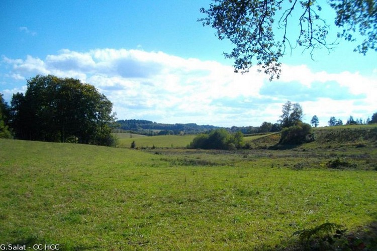
Along the Sarsonne
Description
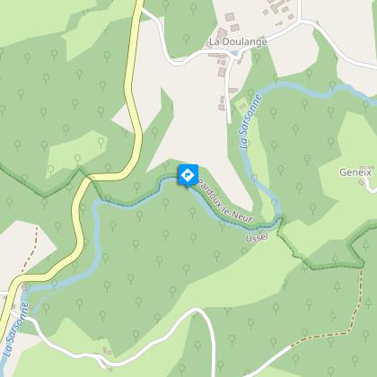
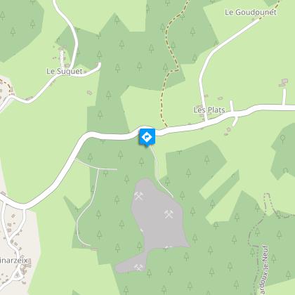
A country ramble surrounded by meadows and forests.Park in the church square. Take the road back to the crossroads.Take the road to the right. At the car park, turn right onto the D161 towards Ussel. Leave the town hall on your left. Continue and fork left towards Salagny.At the bottom of the descent, take the path on the right. At the end of the path, turn left. Continue between the meadows, leave the Doulange road on your right (round trip to the lake). The path joins a road that you take straight ahead. Cross the bridge, ignore the road to Chiret on your left; then continue on to Geneix.Before the barn on the bend, take the path on the left. Continue through the alley of beech trees. The path becomes a track and then a road that you should follow straight ahead. At the crossroads, follow the road towards Laval for 300 metres.At the entrance to the wood, take the path on the right; it runs alongside the meadows, climbs into the woods and then follows the course of the Sarsonne. Ignore all the paths on your left to get back to the road. Follow it to the right until you reach the village of Les Plaines.Take the main road to the right and then go left just after the last house. Turn right at the next crossroads to reach Le Montbelet.At the end of the track, take the path on the right; continue straight ahead, leaving two paths on the right. The path becomes a trail, go left to join a track.Follow it to the right. Turn left at the next two crossroads to reach Les Combes. Follow the road for 400 m. then the path on the right. Go left before the quarry to return to the road.Follow it to the right; past the Combeaux brook, take the track on the left. Go straight on through the woodland. When you reach the meadows, take the path on the right that goes up into the young plantation. Turn right at the next road to reach the village of Les Plats.Take the road on the left for 1.5 km to return to the starting point.
Technical informations
13 km
|
max. 752 m
min. 643 m
| |||
Altimetric profile
Starting point
Steps
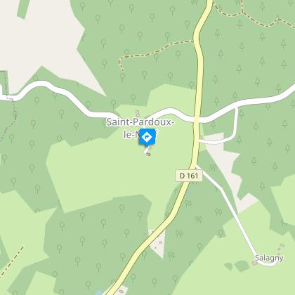
Saint-Pardoux le Neuf
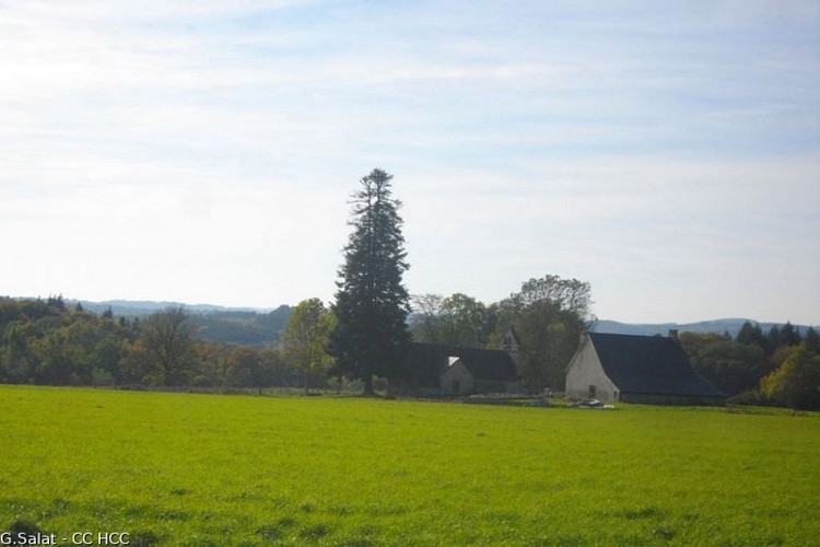
Etrange que cette église isolée au milieu des vertes prairies de la Haute-Corrèze ! Elle est dédiée à St-Pardoux, ancien abbé d’un monastère autour duquel se créera la ville de Guéret. La commune, 78 habitants au dernier recensement, est en fait composée de plusieurs villages et fermes isolées.
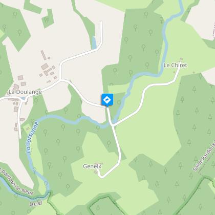
Etang de la Doulange
Si la Haute-Corrèze est souvent identifiée comme le château d’eau de la France en raison des nombreux cours d’eau qui y prennent leurs sources, elle est également riche d’une multitude d’étangs. Tous artificiels, ils ont été créés par l’homme qui a le plus souvent endigué un ruisseau au sortir d’une zone humide, essentiellement pour la pêche.
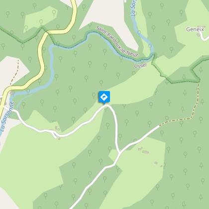
Le bois de Conrot
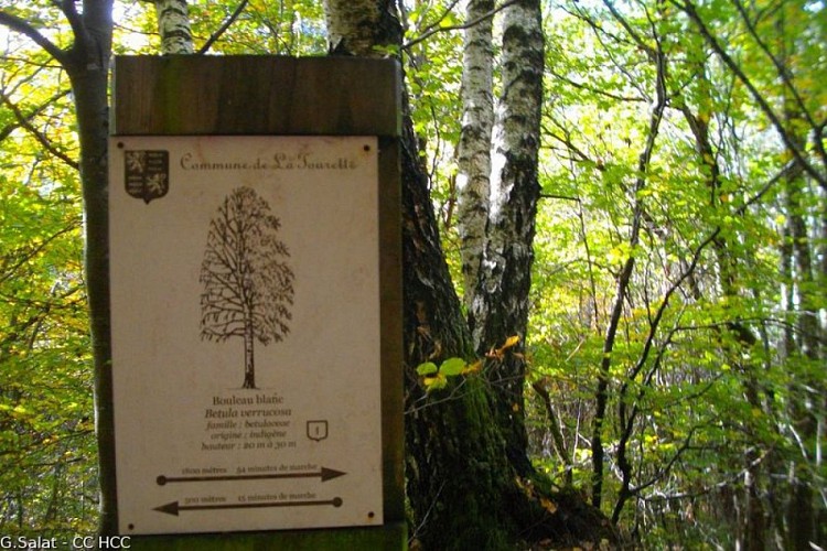
Cette forêt communale en bord de Sarsonne a fait l’objet d’une valorisation touristique avec un inventaire des essences d’arbres présentes. Le circuit permet de découvrir plusieurs panneaux explicatifs.
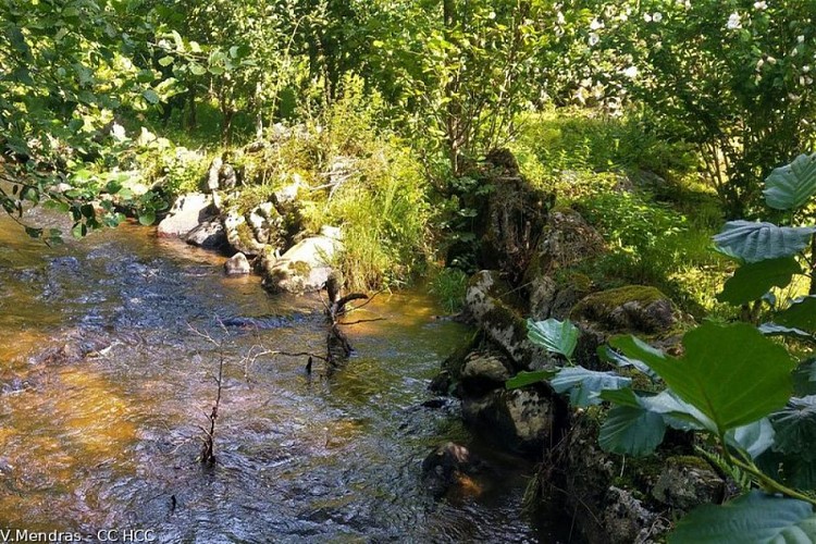
La Sarsonne
La Sarsonne prend sa source en Creuse en bordure du camp militaire de la Courtine. D’une longueur de 27 km, elle se jette dans la Diège au sud d’Ussel.
La carrière
Située sur la commune de Lignareix, cette carrière de roches exploite un granite migmatitique et produit différents types de matériaux, du bloc de pierre au sable issu du concassage de la roche. C’est un site privé interdit au public.
Points of interest
Saint-Pardoux le Neuf
It is strange that this church stands, isolated, in the middle of the green meadows of the Haute-Corrèze! It is dedicated to St-Pardoux, former abbot of a monastery around which the town of Guéret was established. The commune, with 78 inhabitants at the last census, is in fact made up of several villages and isolated farms.
Conrot wood
This regional forest on the banks of the Sarsonne has been the subject of development as a tourist attraction with an inventory of the tree species present. This circuit allows you to visit and learn from several interpretive panels.
Moulins
S’il ne reste que des vestiges de l’existence du moulin de la Mothe sur la commune, ce dernier a permis aux châtelains d’asseoir leur puissance. La roue horizontale entraînait le mouvement des meules qui écrasaient graines, faînes et chanvre pour produire du textile, de l’huile d’éclairage/alimentaire et de la farine.
Additional information
Advised parking
Place de l'église, Saint-Pardoux le Neuf
Advice
Follow the blue markings, the circuit crosses two other hiking trails marked in yellow. Saint-Pardoux is made up of several villages and the church, the starting point, is relatively isolated.
Access
From Ussel, follow the D982 towards La Courtine for 5 km then turn right towards St-Pardoux le Neuf. After the sign for St-Pardoux, take the small road on the right up to the church.
Ambiance
Saint-Pardoux le Neuf isn't one village but several villages that make up the commune; this hike will allow you to explore some of them. Part of the hike will follow the Sarsonne, the river which rises in Creuse and flows for 27 km before flowing into the Diège. Halfway round, the Bois de Conrot arboretum offers you the opportunity to identify different tree species.
Arrival
Place de l'église, Saint-Pardoux le Neuf
Departure
Place de l'église, Saint-Pardoux le Neuf
