Mills and rocks
Description
The hamlet of Servières, the "plank bridges" over the Chandouille and the Château de Tarnac on the way back all have one thing in common, the use of local material: granite.Take the road towards Peyrelevade for 800 metres.At the last house, follow the "Chez Troussas" trail on the right. It rises into the undergrowth above the road. After 45 minutes of walking, leave this path and climb up to the right through the woods for 20 metres; a path goes down to the edge of the forest.Take the track on the right that runs alongside a meadow and forms the arc of a circle. At the next crossroads, turn left: this wide track goes to the hamlet of "Chez Troussas".Continue until you reach the hamlet of La Gane. Cross the road; the track opposite goes down to the Vienne. Cross the bridge and go up on the left until you reach the hamlet of Servières. (It is possible to go up the Vienne on the right before the bridge to reach the small Servières dam, a 15 min return trip via a slabbed pathway).Follow the track to the left in the hamlet for 150 m (or to the right to go into this superb granite village). Then, take the small path that descends on the left. Pass the ruined "Bombard" mill; you will arrive on the Rochers de Servières site. The path continues along the banks of the Vienne and then on a paved path that goes up into the undergrowth.Where the tracks cross, turn left towards Le Trech. Cross the Chandouille on several small flat stone bridges called "planks". You will arrive on a path that goes up into the undergrowth to reach the road we take on the left to reach the hamlet of Le Trech.Cross the road and go into the hamlet. As you leave, at the crossroads, follow the path on the right. At a crossroads of tracks, descend on the left in the direction of Tarnac. Then continue the descent by the tarmac road.100 metres after a chalet, take the track on the right which goes to the hamlet of Lagorce. Continue, then turn right onto the path to go down to the bridge over the Vienne. Go back up the path until you reach the road to Tarnac and turn right to enter the village.
Technical informations
13 km
|
max. 810 m
min. 630 m
| |||
Altimetric profile
Starting point
Steps
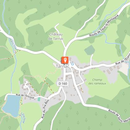
L'Eglise de Tarnac
L'église Saint-Gilles et Saint-Georges de Tarnac a la particularité d'être d'origine romane du XII siècle, agrandie au XIV et XV siècle par un collatéral gothique. Cette caractéristique en fait un monument unique dans la région.
La Fontaine Saint-Georges
La fontaine Saint-Georges date du XVIIe siècle et comprend également un lavoir non loin de l'église. Cette fontaine est à l’image de nombreuses fontaines christianisées du Limousin, un saint leur est dédié, conférant ainsi à cette eau des vertus de guérison. C’est pourquoi l'eau de cette source était autrefois considérée aussi pure et sainte que l'eau bénite. Saint-Georges est un saint martyr légendaire, patron des chevaliers, il personnifie l'idéal chevaleresque ; il a engagé avec le dragon un combat acharné dont il triomphe avec l'aide du Christ.
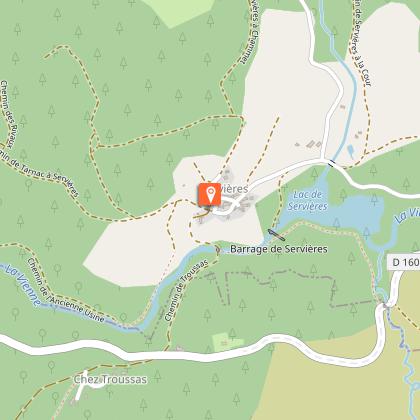
Le Hameau de Servières
Village de granit authentique des lieux de vie locaux et qui représente encore aujourd’hui une part importante du patrimoine corrézien.
La Vienne
Cette haute vallée de la Vienne avec ses rochers, ses trous d’eau et ses moulins offre des points de vue remarquables, notamment sur l’écoulement de cette grande rivière de 370km qui se jette dans la Loire.
Les Rochers de Servières
Site mystérieux que celui de Servières où la roche granitique est affectée par une fracturation à la fois horizontale et verticale, qui la découpe en blocs de plusieurs mètres de largeur. Les fissures (ou diaclases) horizontales confèrent un aspect de "millefeuille ».
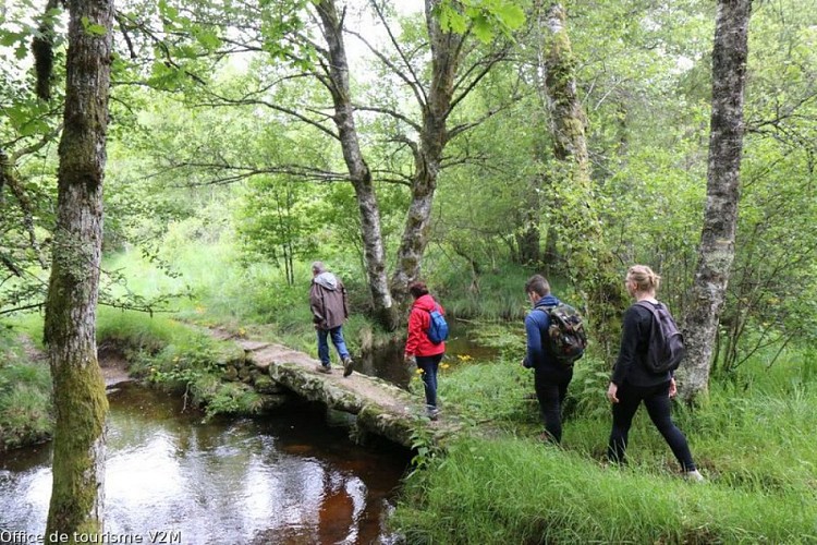
Les petits ponts de pierres plates
Permettant de franchir de petits cours d’eau, ces « pont-planches » sont typiques du Plateau. Formés de plusieurs dalles de granit, reposant sur des piles de pierre dressées dans le lit du ruisseau, ils permettaient aux bergers de passer avec leurs bêtes.
Le pont de La Gorce
Pont qui fut anciennement en bois et remplacé aujourd’hui par un pont en métal, le pont de La Gorce permet toujours la traversée de la Vienne aux promeneurs et offre une vue sur cette rivière de 370 km.
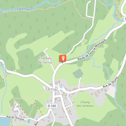
Le Château de Tarnac
Le château de Tarnac est caractéristique du début du XVIIe siècle. C’est, à ce jour, une propriété privée qui ne se visite pas. Il possède un corps de logis rectangulaire avec deux pavillons carrés en retour et des lucarnes à fronton triangulaire surmontées de boules. En façade arrière, l'accès s'effectuait par un perron, aujourd’hui supprimé. A l’intérieur, il possède un escalier droit central qui traverse le corps de logis de part en part et qui détermine deux vastes salles de part et d'autre. Au sous-sol, se trouve l'ancienne cuisine à la voûte en berceau appareillé, conservant sa cheminée avec son four à pain. Au rez-de-chaussée, deux salons conservent leurs plafonds à la française, dont les poutres maîtresses ont les arêtes moulurées.
Points of interest
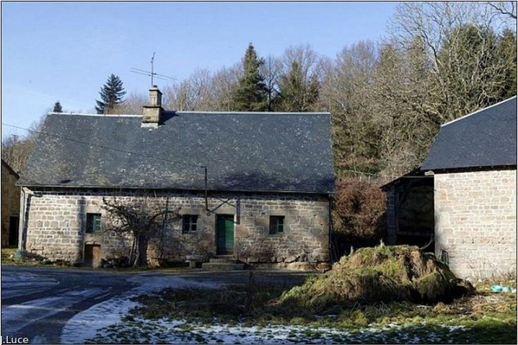
The Hamlet of Servières
An authentic granite village of traditionally built dwellings which still represents an important part of the Corrèze heritage today.
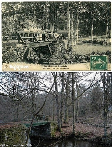
The bridge of La Gorce
A bridge that was formerly made of wood and is now replaced by a metal bridge, the La Gorce bridge still allows walkers to cross the Vienne and offers a view of this 370 km long river.
Additional information
Public transport
Nearest railway station: Bugeat (10 km)
Advice
It is possible to do this itinerary by trail bike.
Advised parking
Place de l'église, Tarnac
Access
30 km from Treignac, take the D940 then right on Bugeat the D979 then right on Toy Viam/D160
Arrival
Place de l'église, Tarnac
Ambiance
This path, considered by some to be one of the most beautiful in Corrèze, starts from Tarnac and goes up part of the course of the Vienne. It passes by a public spring located just behind the 11th-century church and placed under the protection of Saint George. Its water has healing properties.
Departure
Place de l'église, Tarnac
