To see around
See more
Open
Close
Show
Show
Show
Show
Show
Show
Show
Show
Show
Show
Show

Oups... It would appear that Cirkwi does not have permission to use your location.

Description
Map
Steps
Points of interest
Ratings and reviews
See around

The Milan Trail

The Milan Trail
Credit : G.Salat - CC HCC

Description

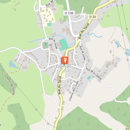
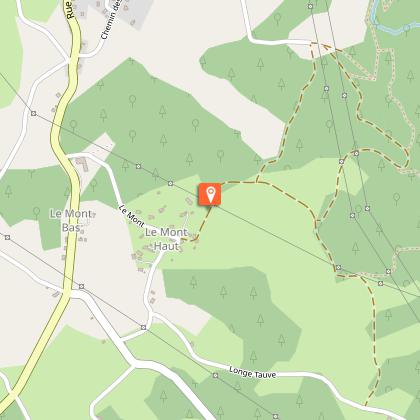
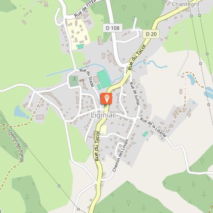
Don't forget your binoculars; you will regret it if you have the chance to observe a raptor flying over the Dordogne gorges!Departing from the old railway station at Liginiac. Go up to the grocer's shop and turn left on Rue du Roc Grand. Continue straight on through Rue de la Liberté.At the last house, follow the tarmac road to the right. At the crossroads after the brook, take the track that goes up to the right. Turn left at the road and go back to the Mont.Go through the village; the road becomes a trail. Continue past a path and then a track on your left. At the next crossroads, take the track on the left.When you arrive at the interpretation trail, take the trail leading to the belvedere. Make the round trip to the belvedere and then to the waterfall. At the top of the steps, turn right. Turn right at the next crossroads, and then right again to cross the stream by the footbridge. The trail becomes a path that goes to Les Chaux.In the village, take the road to the left for 200 m. Cross several fences and enter the meadow following the fence on the right-hand side to return to the road.Turn left to reach the Juillac mill. Go around the pond, over the dyke and up a small path. Follow the track on the left to go through Juillac. In the village, take the road on the right to return to Liginiac.

Technical informations

This circuit was updated on: 07/05/2024
6.6 km
2 h
max. 639 m
min. 470 m

Altimetric profile

Starting point

Lat : 45.414984Lng : 2.333599

Steps

image du object
1

Ancienne voie du Tacot

Entre 1913 et 1959, un tramway appelé le Tacot opérait entre Tulle et Ussel, desservant Liginiac. La gare actuelle n’est pas celle du Tacot (qui se trouvait un peu plus bas) mais une gare pour les autocars construite sur le modèle des gares du Tacot.Le bâtiment est composé de trois parties aux fonctions distinctes. Sa partie centrale dédiée à l’accueil des voyageurs est encadrée par un hangar à marchandises avec un quai de chargement et par un large auvent servant d’abri aux voyageurs.

- Syndicat mixte d'aménagement et de gestion du Parc naturel Régional de Mlillevaches en Limousin -
Consulter
image du object
2

Bourg de Liginiac

Dominant le bourg, l’église du XIIème s. et l’ancien château (actuelle mairie) mériteront un crochet au départ ou au retour de votre balade.La mise en circulation du tramway a accompagné le regroupement et la structuration du bourg de Liginiac. La rue du Tacot est ainsi devenue l’artère principale de la commune, dès lors fourmillante d’activité.Tous les ans fin juillet, le festival de création artistique contemporaine Sculpturama invite des artistes à mettre en valeur le patrimoine bâti et naturel.

- Syndicat mixte d'aménagement et de gestion du Parc naturel Régional de Mlillevaches en Limousin -
Consulter
image du object
3

Vue sur les Monts du Cantal

Au-delà de la Dordogne, les Monts du Cantal se présentent à nous au cours de cette randonnée. Ce massif est en fait le vestige d’un stratovolcan né il y a 13 millions d’années, le plus grand d’Europe, démantelé par des phénomènes d’effondrement et d’érosion glaciaire.

- Syndicat mixte d'aménagement et de gestion du Parc naturel Régional de Mlillevaches en Limousin -
Consulter
image du object
4

La Dordogne au Roc Grand

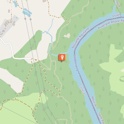
Prenant naissance dans le Massif du Sancy, la rivière Dordogne conflue avec la Garonne pour former l’estuaire de la Gironde. Entre Corrèze et Cantal, la présence de gorges a favorisé la construction de barrages hydro-électriques. Le site du Roc Grand se trouve en amont de la retenue de Marèges.Sur votre gauche, vous pouvez apercevoir le château d’Anglard ; dominant la Dordogne, cette forteresse occupait une place stratégique au cours des XVème et XVIème s.

- Syndicat mixte d'aménagement et de gestion du Parc naturel Régional de Mlillevaches en Limousin -
Consulter
image du object
5

Le Saut de Juillac

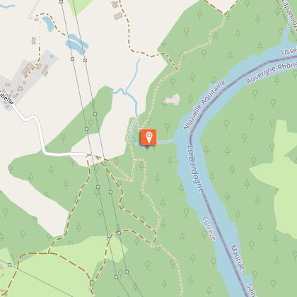
Haut d’une vingtaine de mètres, le Saut de Juillac fait partie d’un site classé en 1988 intégrant le Roc Grand. Le cours d’eau formant ce saut prend plusieurs dénominations : ruisseau de Froidefont à sa source ou encore ruisseau de l’Eau Large lorsqu’il traverse Liginiac. Juillac est le nom du village au niveau duquel la cascade se jette dans la Dordogne. Affluent de rive droite, le cours d’eau dévale un versant d’une centaine de mètres en une succession de chutes au milieu d’éboulis rocheux.

- Syndicat mixte d'aménagement et de gestion du Parc naturel Régional de Mlillevaches en Limousin -
Consulter

Additional information

Advised parking

The old Tacot railway station

Advice

Be sure to wear sturdy shoes: take care in the vicinity of Roc GrandNo dogs allowed through or in the fields

Access

The departure point is at the edge of the D20 at the crossroads in Liginiac.

Ambiance

Starting from the town of Liginiac, this walk takes you to the Roc Grand belvedere. After a distant view of the Monts du Cantal, you will enter a beech grove on an interpretation trail to discover one of the most beautiful viewpoints on the Dordogne gorges.

Arrival

The old Tacot railway station

Departure

The old Tacot railway station
Ratings and reviews

To see around
See more
Open
Close
Show
Show
Show
Show
Show
Show
Show
Show
Show
Show
Show