Alert
Alerts
The Pierre Percée
Description
This hike will take you to the Pierre Percée, a natural arch situated 1220m above sea level. From there you will be able to enjoy a stunning view of the Matheysine plateau. The route also passes through the forest, which is splendid in the summer.
Technical Information
Altimetric profile
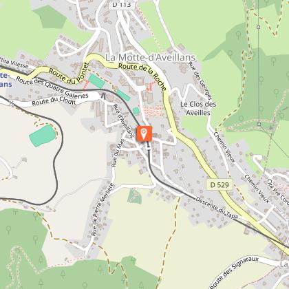
Starting point
Points of interest


Additional information
Open period
Open every day.
Subject to favorable weather.
Tips
You can visit the musesum "La Mine Image", discover the authentic galleries of anthracite and enter in the fascinating universe of the mine and the "gueules noires".
You will have a great view on the plateau Matheysin and the lakes of Laffrey, Petichet and les Cordeliers.
Location complements
Guide book: La Matheysine / IGN Map (French Institute of Geographic and Forestry Information) TOP 25 n°3336OT La Mure
Contact
Phone : 04 76 81 05 71
Email : contact@matheysine-tourisme.com
Website : https://www.matheysine-tourisme.com
Type of land
Ground
Grit
Not suitable for strollers
Updated by
Isère Attractivité - 25/03/2026
www.alpes-isere.com
Report a problem
Guidebook with maps/step-by-step
Park in the Fontalon car park in Pierre-Châtel.
Go straight up in the direction of Chante Merle until you reach the old charbonnière de Picardon. Turn to the left for a few switchbacks to Plan de la Rivoire. Continue straight on to reach the spectacular Pierre Percée.
The return is done by the same route.
Animals
Yes
