Hike to La Croix de Cassini
Description
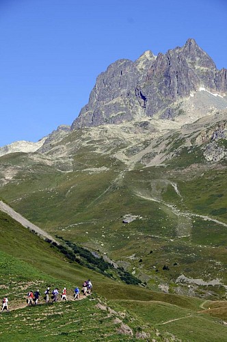
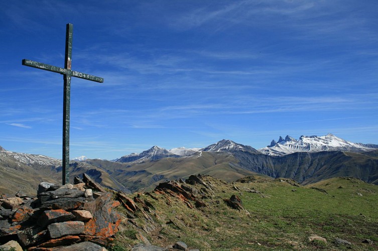
This is one of the most spectacular 360° views, from which you can admire the Meije, Muzelle, Pic Blanc and Aiguilles d'Arves. If you're lucky, you may spot marmots, lammergeier vultures and chamois.
La Croix de Cassini is a 90-minute circular walk for medium-fitness hikers starting from the Col de Sarenne, although more experienced hikers have the option of starting from Clavans for a 3½ hour hike (950m height gain).
The recommended route is from the Col de Sarenne.
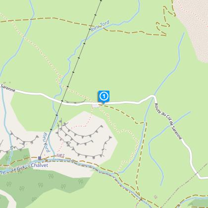
From Grenoble, drive to Bourg d'Oisans (D1091) and then on to the Col de Sarenne either via Alpe d'Huez or the Ferrand Valley, which is an opportunity to visit the traditional villages of Mizoen, Clavans and Besse (after Bourg d'Oisans, follow signs to Briançon and then after crossing the Chambon dam, take the first on the left towards Clavans and then on the the Col de Sarenne). From Alpe d'Huez, park at the Rocher du Goulet car park or drive to the Col de Sarenne.
Park at the Col de Sarenne (1999m), from where you can walk to the Croix de Cassini along the ridge. Take care though, as, although not marked on maps or signs, this route (the most direct) does have a few tricky sections. So, even though the view from the ridge is amazing, this route is only suitable for sure-footed hikers.
More cautious hikers should carry on down the road a little after the Col (towards Alpe d'Huez and some chalets) and take the path to the Col Grange Pellorce from Le Sella (on the left). This is a slightly longer route (around 90 minutes to reach the top), but it is safer underfoot. If you're lucky, you may spot marmots, lammergeier vultures and chamois. Once at the Croix de Cassini (2361m), your efforts will be rewarded with a unique panoramic view over the surrounding peaks and valleys.
In the 18th century, César-François Cassini was assigned the ambitious task of mapping the Kingdom of France. His name has been given to a number of summits, including the Croix de Cassini, which he used to make his measurements. Cassini maps, which were drawn over 250 years ago, are as precious as our modern IGN maps.
Technical informations
13 km
|
max. 2369 m
min. 1717 m
375 m
| |||
Public : Family | ||||
Altimetric profile
Starting point
Points of interest
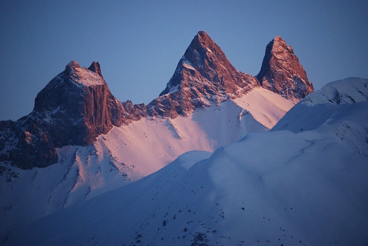
Les Aiguilles d'Arves
An emblematic silhouette in Maurienne. The Aiguilles d'Arves dominate the Arvan valley. The prettiest trilogy of the Alps according to the british Coolidge who was the first to officially ascent it in 1878.The highest of needles peaks at 3514 meters, it is the Southern Needle. Others are named the Central Needle (3513m) and the Northern Needle also called The Head of Cat (3 358 m and 3 364 m). Accessible out of the snowy period and depending on the weather conditions. Information about the access and weather forecast : contact the tourist office. In winter, the site of Le Chalmieu is inevitable to practice snowshoeing in our Mountains of Arvan-Villards. 3 ideas of hikes in summer : - The Easy Walk of Discovery The Savoy Les Aiguilles d'Arves: Easy walk. Accessible to strollers and people with reduced mobility. Duration: 1h30/2h. Circuit marked by interactive bornes : discovery of high mountain pastures and th life of the alpine inhabitants. - The Foot of Les Aiguilles d'Arves: departure hamlet Le Chalmieu 73300 Albiez-Montrond (1900m) - arrival La Basse du Gerbier (2578m) - 5h30 round trips. - Departure from Entraigues (1250m) in St. Jean d'Arves, hike making a loop route, to do with a bivouac : one made uneven positive of 1400 meters. Without a bivouac : have 2 cars, one parked in le Chalmieu.
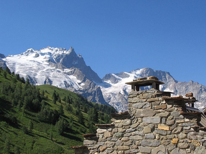
La Meije
La Meije is a mountain in the Massif des Écrins, located at the border of Hautes-Alpes and Isère départements. It overlooks the nearby village of La Grave,a mountaineering centre and ski resort,well known for its off-piste and extreme skiing possibilitiesNeighboring peaks are Le Râteau (3,809 m) to the west, past the Brèche de la Meije (3,357 m) and fr:Le Pavé (3,823 m) and Pic Gaspard (3,881 m) to the southeast, past the Brèche Maximin Gaspard (3,723 m) The central summit has five teeth, the highest of which is known as Doigt de Dieu (English: Finger of God). This summit was reached from the northeast on June 28, 1870, by Christian and Ulrich Almer and Christian Gertsch, guiding Meta Brevoort and W.A.B. Coolidge. The ridge from the central to the main, western peak, which is 13 meters higher, was considered an insurmountable obstacle for the next 15 years. The true summit of La Meije is notorious in that there is no "easy" path to the top and it was the last major peak in the Alps to be summited. The first ascent was eventually made from the southwest on 16 August 1877 by father and son Pierre Gaspard and their client Emmanuel Boileau de Castelnau. Their approach, over the south buttress Arête du Promontoire and further over the Glacier Carré and the southwest face of the Grand Pic is now the normal route. On July 26, 1885, Ludwig Purtscheller and the brothers Otto and Emil Zsigmondy made the first traverse from the central to the main summit, via the "insurmountable" gap that is now known as the Brèche Zsigmondy, in what is still considered a classic route. The traverse in the opposite direction was accomplished 6 years later by Ulrich Almer, Fritz Boss and J.H. Gibson. The south face is widely considered to be the most difficult of La Meije. Within two weeks after their successful traverse, the Zsigmondy brothers, together with Karl Schulz, tried to reach the Brèche Zsigmondy over the south face, but Emil died in the attempt. The first successful attempt was not until twenty-seven years later, in 1912 by Angelo Dibona, Luigi Rizzi, and the brothers Guido and Max Mayer, while a direct route over the south face to the Grand Pic was only climbed in 1935 and that to the Central Pic in 1951
La Croix de Cassini
The Croix de Cassini is named after Cassini III of Le Freney who used it for his measurements under the reign of Louis XV. Cassini maps, drawn over 250 years ago, are just as accurate as our current IGN maps.The 2361-metre Croix de Cassini offers THE 360° panoramic view, one of the most spectacular in Oisans over the neighbouring valleys and mountain ranges. In the 18th century, César-François Pasini was entrusted with the ambitious assignment of mapping the kingdom of France. A number of cartographers before him had already offered their work, notably Nicolas de Nicolay, born in La Grave in the 15th century, commissioned by Catherine de Medici. Under Louis XIV, the task was then entrusted to Abbé Picard, who consulted the best engineers and, in particular, an outstanding astronomer named Gian Domenico Cassini, or Cassini I. The Cassini family, which included 4 generations of topographers from father to son, changed maps from a naive style to geometrical triangulation and toponymic surveying. Their maps were drawn between 1750 and 1790, with France being divided at the time into 181 maps. Previously the Croix de Cassini was named the Croix de Tournefort after the French botanist Joseph Pitton de Tournefort (1656-1708), who explored Savoy and the Dauphiné regions. Louis XV's surveyor, Cassini III, chose this summit to map the region in 1739 due to the unique characteristics of this open view point. The summit took his name in order to keep a record of the visit to this valley of the illustrious king's representative. Thanks to the magic of geometry, the Cassini maps, drawn over 250 years ago, are just as accurate as our current IGN maps and can be laid over the IGN maps or any satellite maps from the Internet, with hardly any noticeable differences. It is worth noting that there are many Monts Cassini in the mountains of France. The Croix Cassini itself was erected by Maximin Reymond and François Pichoud in 1975, although the exact date is unknown. Every year since 1999, on the last week of August, members of the association "La Montée de Cassini" raise a glass to friendship in front of the Cross, before sharing a good-hearted, friendly meal at the Col de Sarenne. Source: Mr Albertino ()
Additional information
Updated by
Isère Attractivité - 29/04/2024
www.alpes-isere.com
Report a problem
Open period
All year round.
Subject to favorable snow and weather conditions.
Contact
Phone :
04 76 80 05 82
04 76 11 44 44
Email : info@alpedhuez.com
Website : www.alpedhuez.com
Location complements
Map and guidebook: "Oisans au bout des pieds" no. 2 / IGN TOP 25 no.3335 ET
