Le Plateau d’Emparis (from Mizoën)
Description
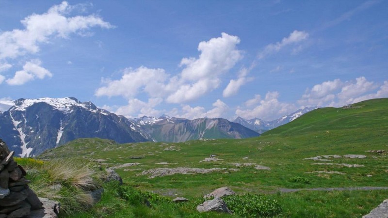
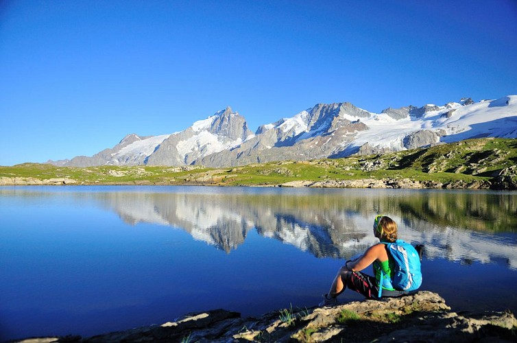
Located on the border of the Ecrins National Park, the plateau has THE most wonderful views of the "Queen Meije" and surrounding mountains. Not surprisingly, it's a paradise for hikers and outdoor enthusiasts and is perfect for picnics!
The GR54 winds its way up through pastureland to join a track, which then leads to the Emparis plateau and the basin known as the Rif-Tort. Walk east across the Rif-Tort following the right-hand track (GR54) to the Col du Souchet (2365m). Then leave the GR54 (which goes down towards Le Chazelet) to head uphill in a grassy valley leading to Lac Lérié. Carry on to the right above the lake to reach the Lac Noir and enjoy the outstanding views over the Meije and the Râteau, with the Grandes Rousses to the north. From the lake, carry on along the path northwards heading back to the Rif-Tort. Retrace your steps to Les Aymes.
Technical informations
24 km
|
max. 2456 m
min. 1273 m
1572 m
| |||
Public : Family | ||||
Altimetric profile
Starting point
Date and time
- From 01/06/2024 to 31/10/2024
- From 01/06/2025 to 31/10/2025
Additional information
Updated by
Isère Attractivité - 19/04/2024
www.alpes-isere.com
Report a problem
Open period
From 01/06 to 31/10.
Subject to favorable snow and weather conditions.
Contact
Phone : 04 76 80 00 85
Email : info-ferrand@oisans.com
Website : www.oisans.com/a-voir-a-faire/activites-sportives/randonnee-en-oisans/
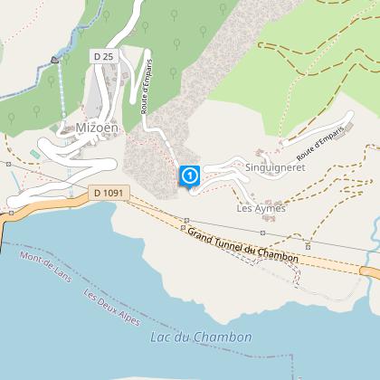
Location complements
From Bourg d'Oisans, follow signs to Briançon until the Chambon dam. Just after the dam, turn left towards Mizoën (D25). Once in the village, turn right to Les Aymes and park in the hamlet.
