Alert
Alerts
Lakes of the Plateau d'Emparis - hike from Les Aymes (Mizoën)
1 alert on this circuit
Visitor alert
The site is subject to heavy traffic in July and August.
We invite you to discover our nearby suggestion to take full advantage of our territory.
As this itinerary is potentially subject to severe damage due to major meteorological events, and its viability may be uncertain, please enquire before embarking on it.
Description
Situated on the edge of the Ecrins National Park, the plateau offers magnificent views of the Meije and surrounding glaciers. It's a paradise for hikers, lovers of wide open spaces and picnic enthusiasts!
TECHNICAL INFORMATION
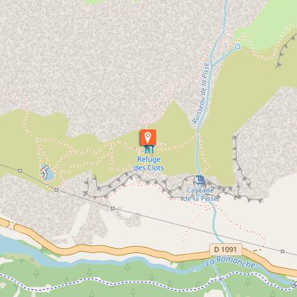
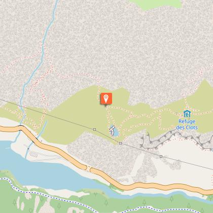
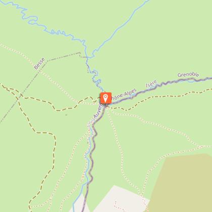
Start: Parking des Aymes (Mizoën). Altitude: 1,300 m.
Difference in altitude: 1377 m
Round trip time: 8 h 30
Return distance : 20.6 km
Level: Very difficult
Caution: Balcony trail on certain sections. It may present difficulties for people prone to vertigo.
MAP AND TOPO
- IGN TOP 25 map no. 3335 ET (Bourg d'Oisans - Alpe d'Huez)
- OBP map and topo n°3 (Oisans au Bout des Pieds): trails n°343 and n°416 (in part) on the outward journey, then n°359 and again n°343 on the return. On sale at Oisans Tourisme tourist offices.
ITINERARY
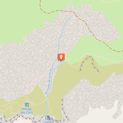
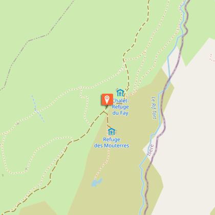
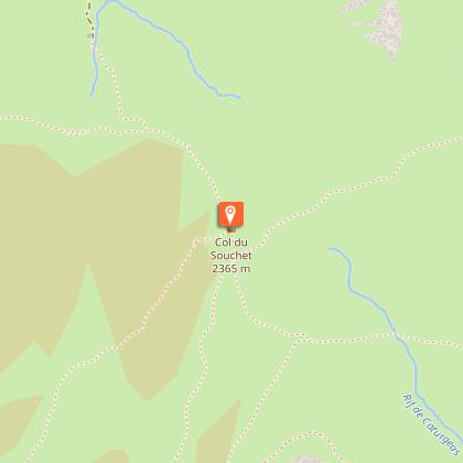
Take the path that starts at the end of the Aymes parking lot, and continue straight on to the hamlet of Les Clots, following the GR markings (red and white). The path is initially wide and shady, but after a few minutes becomes narrow, balcony-like and open. This part of the trail is not very steep. After this, you can make a detour to Lac Lovitel and its discovery trail leading to an orientation table. Shortly afterwards, you'll reach the refuge des Clots, with its panoramic view of the Meije and the Fontaine Pétrifiante waterfall. To reach the plateau, take the path towards the waterfall. From this point on, the path becomes steeper (approx. 600 m ascent over 1.6 km). Stay on the path and follow the GR markings until you reach the plateau, where the trail continues to climb, but less steeply. At the Fay and Mouterres refuges, the trail gradually descends along the Rif Tort towards the center of the Emparis plateau. Once you reach the center of the plateau, you'll have a 360-degree view of the plateau's Alpine pastures, with their air of Mongolian steppes. At the center of the plateau, take the right-hand track (GR54) towards the Col du Souchet (2365 m). At the pass, leave the GR54 (which leads down to Le Chazelet) and turn right into the grassy Combe leading to the edge of Lac Lérié. Continue right over the lake to reach Lac Noir. From here, an exceptional panorama of the Meije and Râteau peaks awaits you, with the Rousses massif to the north. From the lake, follow the path north to the center of the plateau. Follow the same route down to Les Aymes.
THINGS TO SEE ALONG THE WAY
- Petrifying Fountain waterfall
- Refuges du Fay and des Mouterres
- Rif Tort marshes
- Lac Noir, Lac Lérié, Lac Cristallin
- Alpine pastures
- Panoramic views of the Meije and Écrins mountains
NEARBY ATTRACTIONS
- Village of Mizoën
Technical Information
Altimetric profile
Starting point
Steps
Date and time
- From 01/01/2026 to 31/10/2026
- From 01/01/2027 to 31/10/2027
Additional information
Sustainable tourism
Please note: this site has been awarded the Natura 2000 label and is subject to numerous measures to preserve its biodiversity. We therefore invite you to adopt the right reflexes when you come to protect this sensitive area.
The Emparis plateau is an alpine pasture. You may come across dogs guarding the herds. For more information on how to deal with these dogs, visit pasto-kezako.fr.
Updated by
Isère Attractivité - 12/03/2026
www.alpes-isere.com
Report a problem
Environments
Overview on river
Mountain view
Panoramic view
Lake view
Waterfall view
Open period
From 01/01 to 31/10 daily.
Subject to favorable snow and weather conditions.
Contact
Phone : 04 76 80 00 85
Email : info-ferrand@oisans.com
Topo guides and map references
Topo guides references :
OBP map no. 3 (Oisans au Bout des Pieds): trails no. 343 and no. 416 (in part) on the outward journey, then no. 359 and no. 343 on the return. On sale at Oisans Tourisme tourist offices.
Map references :
IGN TOP 25 map no. 3335 ET (Bourg d'Oisans - Alpe d'Huez)
Type of land
Stone
Ground
Grit
Not suitable for strollers
Location complements
From Bourg-d'Oisans, follow signs for Briançon as far as the Chambon dam. After the dam, turn left towards Mizoën (D25). In the village, turn right towards "Les Aymes". At the end of the hamlet of Les Aymes, a very narrow road leads to the parking lot at the start of the hike. You can also park in the hamlet and walk to the start.
