Alert

Alerts

To see around
See more
Open
Close
Show
Show
Show
Show
Show
Show
Show
Show
Show
Show
Show

Oups... It would appear that Cirkwi does not have permission to use your location.

Presentation
Description
Map
Points of interest
Ratings and reviews
See around

Lake of Paladru

1 alert on this circuit
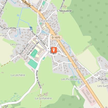
LE LAC DE PALADRU:

Alerte visiteurs

Le lac de Paladru est sujet à de fortes affluences durant la période estivale avec un pic de fréquentation les week-ends de beaux temps et jours fériés.
Préférez plutôt la semaine pour venir en toute tranquillité ! N'hésitez pas à passer voir les conseillères en séjour à l'office de tourisme pour des suggestions alternatives à proximité.

Lake of Paladru

IGN cards

3335OTR - GRENOBLE RESISTANTE CHAMROUSSE BELLEDONNE
Editor : IGN
Collection : TOP 25 RÉSISTANTE
Scale : 1:25 000
17.20€
3334OTR - MASSIF DE LA CHARTREUSE RESISTANTE SUD
Editor : IGN
Collection : TOP 25 RÉSISTANTE
Scale : 1:25 000
17.20€
3335OT - GRENOBLE
Editor : IGN
Collection : TOP 25 ET SÉRIE BLEUE
Scale : 1:25 000
13.90€
3334OT - MASSIF DE LA CHARTREUSE SUD
Editor : IGN
Collection : TOP 25 ET SÉRIE BLEUE
Scale : 1:25 000
13.90€
TOP75002 - CHARTREUSE BELLEDONNE
Editor : IGN
Collection : TOP 75
Scale : 1:75 000
9.80€
TOP75001 - MASSIF DU VERCORS
Editor : IGN
Collection : TOP 75
Scale : 1:75 000
9.80€
TOP100D73 - SAVOIE CHAMBÉRY ALBERTVILLE PARC NATIONAL DE LA VANOISE PNR DU MASSIF DES BAUGES
Editor : IGN
Collection : TOP 100
Scale : 1:100 000
8.40€
202 JURA ALPES DU NORD
Editor : IGN
Collection : TOP 200
Scale : 1:200 000
6.80€
D04-05 ALPES-DE-HAUTE-PROVENCE HAUTES-ALPES
Editor : IGN
Collection : CARTES DÉPARTEMENTALES IGN
Scale : 1:150 000
5.90€
D07-26 ARDÈCHE DRÔME
Editor : IGN
Collection : CARTES DÉPARTEMENTALES IGN
Scale : 1:150 000
5.90€
D38 ISÈRE
Editor : IGN
Collection : CARTES DÉPARTEMENTALES IGN
Scale : 1:150 000
5.90€
NR16 PROVENCE-ALPES-CÔTE D'AZUR
Editor : IGN
Collection : CARTES RÉGIONALES IGN
Scale : 1:250 000
6.80€
NR14 AUVERGNE-RHÔNE-ALPES RECTO/VERSO MASSIF CENTRAL
Editor : IGN
Collection : CARTES RÉGIONALES IGN
Scale : 1:250 000
6.80€
NR15 AUVERGNE-RHÔNE-ALPES RECTO/VERSO MASSIF ALPIN
Editor : IGN
Collection : CARTES RÉGIONALES IGN
Scale : 1:250 000
6.80€
EUROPE
Editor : IGN
Collection : DÉCOUVERTE DES PAYS DU MONDE IGN
Scale : 1:2 500 000
7.00€

Description

A gentle start along the Isère which will lead you without difficulty by the Col de la Placette to dominate the hills of Valdaine and the blue waters of Lake Paladru.

From Grenoble, from the Quai de France, take the lane on the bank of the Isère right bank to the Veurey Bridge. After the bridge, join Voreppe by taking the Roise footbridge on the right.
In the village turn left on the D520 and attack the Col de la Placette (the climb is pleasant thanks to the corridor fitted out for cycle tourists). From the pass, go down to the Demay bridge and turn left towards St-Etienne-de-Crossey, then in the village take the D49 opposite towards St-Nicolas-de-Macherin and Chirens by a small portion of the D1075.
At Chirens, turn left towards Clermont and Colletière and take the D50d to reach Paladru and follow the lake towards Charavines. Shortly before Charavines, turn right on the D50e towards Oyeu, then left on the D520e towards Colombe and Rives, and finally left towards Renage.
Descend towards Tullins along the Fure, in the village, take the D1092 at the traffic lights on the right, and then shortly after on the left take the D45 in the direction of St-Quentin-sur-Isère.
Before the Isère Bridge, find the cycle path on the bank on the left for a return to Grenoble by the opposite route.
(Distance about 45 km)

Technical Information

Racing biking
Difficulty
Hard
Duration
7h
Dist.
105 km
Show more

Altimetric profile

Starting point

38000   Grenoble
Lat : 45.193561Lng : 5.722547

Points of interest

1 alert
image du object

Lake Paladru

5km long, 1km wide and 392 ha in surface area, it is the 5th largest natural glacial lake in France. Did you know that, in addition to giving the lake its beautiful turquoise color, the lake chalk that covers its bottom is good for the skin?Shaped during the Ice Age, its banks were home to one of the Isère's 1st human communities in 2700 BC (the Neolithic village of Les Baigneurs). Later, knights from the An Mil period settled on the Colletière site. The remains unearthed during numerous archaeological digs are now on display in the new Musée archéologique du lac de Paladru ( MALP ) in Paladru. The site is also remarkable for its 7 protected natural areas, including the Grands Roseaux to the north of the lake, an ideal nesting ground for birds (mallards, swans, coots and great crested grebes) and spawning grounds for fish (carp, tench, etc.); these reed beds remain inaccessible. To discover the flora and fauna, take the greenway to join the marsh path, which has 4 discovery stations. At a depth of 36 m, its temperature rises to 25° in summer. It is fed by two tributaries, the ruisseau de Courbon and the ruisseau du Pin. At its southern end, the overflow is evacuated via an outfall that forms the La Fure spring. Water is released via surface sluice gates, combined with a weir when the lake's "zero" level is exceeded, and via a deep-water draw-off device (siphon at -30 m), which discharges into the Fure 5 m downstream of the sluice gates. The lake is accessible via 4 municipal beaches: 3 are fee-paying (plages du Pin, Paladru and Montferrat) and 1 is free (plage de Chararvines). SWIMMING is permitted ONLY on these supervised beaches. Animals are not allowed on the beaches. 2 recreation areas, Le Bois d'Amour in Charavines and La Verronière in Montferrat, are freely accessible for picnics by the lake. Please note: barbecues are prohibited in all Tour du Lac areas. The "Blue" lake is not only unique in its color, it's also a private lake that promotes tranquility and family activities. It is also open to fishing and boating. For more information on boating, fishing, swimming and other water sports, visit www.lacpaladru.com/reglement or ask one of our Tourist Office advisors... Whether you're a keen hiker, mountain biker or cyclist, you'll be able to tour the lake and discover all its facets. There's something for everyone, depending on the route you take! And if you'd like to see all the marked trails, the hiking map is available for €5, while the mountain bike map is available free of charge from our reception desks.

- Office de Tourisme du Pays Voironnais -
Consulter

Additional information

Tips

During your trip, you can cool off at Lake Paladru.

Updated by

Isère Attractivité - 21/09/2025
www.alpes-isere.com
Report a problem

Open period

All year round.

Subject to favorable weather.

Contact

Phone : 04 76 42 41 41

Email : info@grenoble-tourisme.com

Website : www.grenoble-tourisme.com/fr/

Ratings and reviews

To see around
See more
Open
Close
Show
Show
Show
Show
Show
Show
Show
Show
Show
Show
Show
Caution!
We have no information on the difficulty of this circuit. You may encounter some surprises along the way. Before you go, please feel free to inquire more and take all necessary precautions. Have a good trip! 🌳🥾