Alert
Alerts
The APAGE trail
Description
Departure from Gorges d'Enval. From Riom, follow signs for Mozac, then Enval
by D455 then D138. On leaving Enval, take the D15 towards Châtel-Guyon until you reach the parking lot 300 m on the left.
Follow the road to the right (toward Volvic) along the guardrail. At the end of the guardrail, take the path up to the right.
1. Turn right under the “Sentier de l’APAGE” sign. Climb the trail beneath the chestnut trees. Cross the wooden footbridge.
2. Pass the orientation table and continue along the trail to reach the rest area, then follow the stream (the Ambène).
3. Cross the bridge and continue left along the stream.
4. You’ll come out onto Route de Beauvaleix; turn left. After 50 m, turn
right under the “Sentier des Cascades” archway. Climb up through the woods.
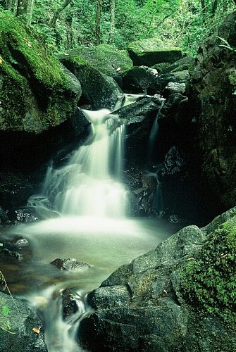
5. Head downhill and cross the Ambène again via the bridge. Walk to the Grand Gornand waterfall and back, then continue along the stream.
6. At the Petit Gornand waterfall, climb up to the left via the stairs for 50 m and
take the trail on the left.
7. Ford the stream and climb the steps (steep slope). Follow the cliff, then head back up via the path on the left.
8. Follow the gravel path (Facemeunier-Beauvaleix).
9. Turn right onto the Sentier du Renard.
10. Descend the rocky trail (view of Tournoël Castle).
11. Keep to the left until you return.
Mountain bikes are not permitted on the trail known as “de l’apage” or the trail known as “des cascades.” They are permitted on the trail known as “du Renard.”
Yellow/blue trail markers (yellow arrow with “APAGE” written in blue)
⚠️ During the summer, the waterfalls may have a low flow or even be dry, depending on the time of year.
Technical Information
Altimetric profile
Starting point
Additional information
Environments
Forest location
Waterside
Updated by
Office de Tourisme Terra Volcana, les Pays de Volvic - 12/10/2026
www.terravolcana.com
Report a problem
Open period
All year round daily.
Contact
Phone : 04 73 64 00 36
Tricky passages
Steep slope at stage 7.
Guidebook with maps/step-by-step
1/ Departure from Gorges d'Enval. Follow the road to the right (towards Volvic) behind the guardrail. At the end of the guardrail, take the path on the right.
2/ Turn right under the "Sentier de l'APAGE" sign. Climb the path beneath the chestnut trees. Take the wooden footbridge.
3/ Pass the orientation table and continue along the path to reach the rest area, then follow the stream (l'Ambène).
4/ Cross the bridge and continue left along the stream.
5/ Turn left onto the Beauvaleix road. After 50 m, turn right under the "Sentier des Cascades" sign. Climb into the woods.
6/ Descend and cross the Ambène again on the bridge. Return to the Grand Gornand waterfall, then continue along the stream.
7/ At the Petit Gornand waterfall, climb the stairs to the left for 50 m and take the left-hand path.
8/ Ford the stream and climb the steep steps. Walk along the cliff and then up the left-hand path.
9/ Follow the gravel path (Facemeunier-Beauvaleix).
10/ Turn right onto the Sentier du Renard.
11/ Go down the stony path (view of Tournoël castle).
12/ Keep to the left all the way back.
