Alert
Alerts
Alpe d'Huez, the Col de Sarenne and the Auris balconies
Description
This route starts with the 21 hairpin bends of Alpe d'Huez. Then, a plunge into the Ferrand Valley via the “Col de Sarenne”. The ride becomes wilder. Continue along the Auris balconies offering you a fabulous view over the Romanche Valley.
This route is available in the "Cyclo en Oisans" guide (Oisans Tourisme).
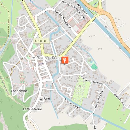
Start / Finish (loop) : Le Bourg-d'Oisans 720 m
Duration : 4 h
Distance : 57 km
Maximum altitude: 1989 m
Minimum altitude: 720 m
Vertical rise: 1978 m
Maximum gradient: 14
Cartography: Michelin Carte Département Isère, Savoie n° 333
ITINERARY
From Bourg d'Oisans, head towards Alpe d'Huez. Enjoy a short, flat kilometer before tackling the famous climb.
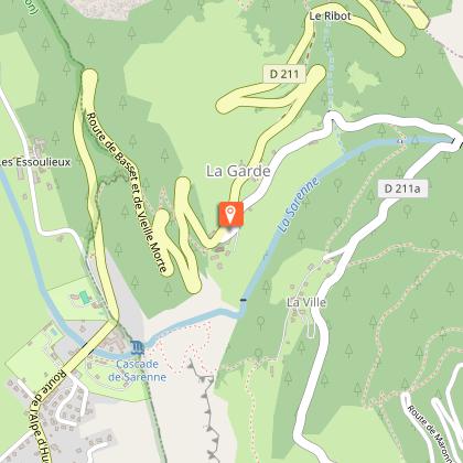
From La Garde en Oisans (turn 16), the route becomes fully signposted with "Isère à vélo n°1" signs.
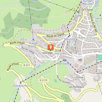
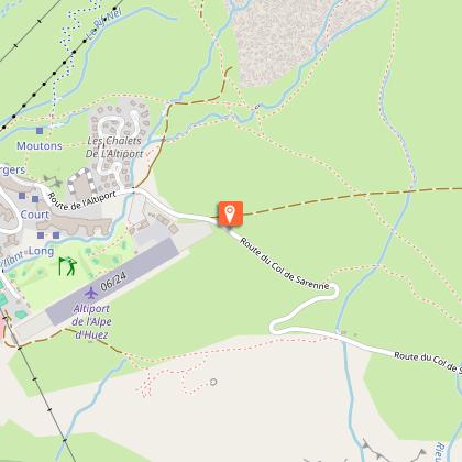
When you reach Alpe d'Huez, follow the signs for "Office de Tourisme" then "Quartier Bergers". Pass the altiport and follow the "route du col de Sarenne".
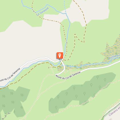
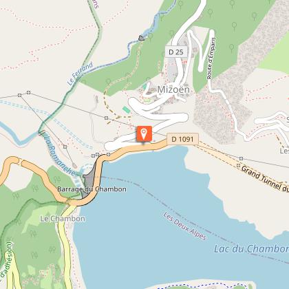
Cross the pass and descend into the Ferrand valley. Make your way to the village of Clavans le Bas and then Mizöen. At the end of a steep descent, you find the D1091. Pass over the Chambon dam, then continue to Le Freney d'Oisans.
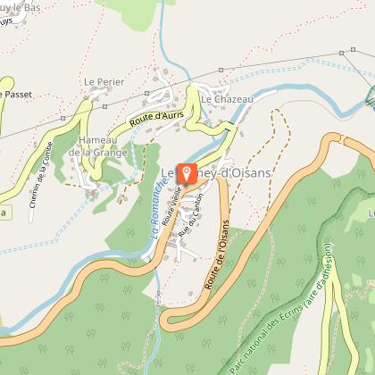
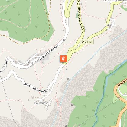
At Le Freney, shortly after the Avia service station, turn right onto the D211a and head uphill towards Auris. Follow the road to the hamlet of La Balme. Return to La Garde en Oisans via the "Route de la Roche". A narrow road punctuated by 3 tunnels, carved into the cliff face. The panorama over the plain of Bourg d'Oisans is breathtaking.
Once you reach La Garde, the D211 takes you down to Bourg d'Oisans.
VARIATION
You can take this route in the other direction, turning right at La Garde, towards Auris en Oisans on the D211a. In this direction, you'll only climb a third of the 21 mythical bends to Alpe d'Huez (at the end of the route, you'll do the whole thing downhill), but the ascent of the balcons d'Auris and the ascent of the Col de Sarenne from Mizoën are just as interesting!
ANECDOTE
On July 18, 2013, Le Tour de France, signed a piece of bravery for the riders of the Tour de France.
The brand-new route takes in the Alpe d'Huez climb twice: 21 + 21 = 42 bends! A first ascent, a descent via the Col de Sarenne to Bourg d'Oisans, to finish the bill with a second 21-turn ration...
Technical Information
Altimetric profile
Starting point
Steps
Date and time
- From 01/05/2026 to 15/11/2026
- From 01/05/2027 to 15/11/2027
Additional information
Environments
Mountain location
Updated by
Oisans Tourisme - 25/02/2026
www.bike-oisans.com
Report a problem
Open period
From 01/05 to 31/10 : open daily.
Contact
Phone : 04 76 80 03 25
Email : info@oisans.com
Website : https://www.bike-oisans.com
Topo guides and map references
Topo guides references :
Itinerary no. 1 of the “Cycling in Oisans” guide (Oisans Tourisme)
Map references :
Michelin Local Map no. 333 Isère, Savoie
Animals
Yes
Data author
