Alert

Alerts

To see around
See more
Open
Close
Show
Show
Show
Show
Show
Show
Show
Show
Show
Show
Show

Oups... It would appear that Cirkwi does not have permission to use your location.

Presentation
Description
Map
Points of interest
Ratings and reviews
See around

Lac noir du Chenaillet

Lac noir du Chenaillet
Lac noir du Chenaillet_Cervières

Description

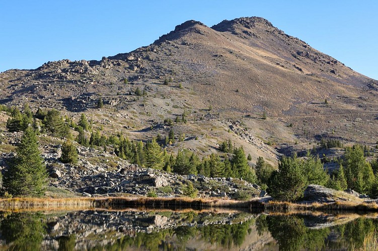
Of the old glacial lake of the plain of Bourget, there is only a flat bottom and a bolt in of curious green rocks
Hiking N°38 of the guide " 52 balades à raquettes dans le briançonnais " of J.L Charton Editions D.Richard

Join the Cerveyrette valley via the D89T, then park at the parking lot after the Mur des Aittes car park, giving access to the old Chau farms.

Follow the wide driveway through the chalets, then just after the chapel, take the path on the left that rises towards the Fraches sheepfold. The path follows the Fraches torrent up to the imposing sheepfold.
The Marais plain stretches out before your eyes, while the imposing Lasseron summit looms large in front of you.

The trail continues north towards the summit of Grand Charvia, which overlooks the cirque. The route alternates bumps and gentle slopes. We come to a fork in the path marking the arrival at the lake.

The return journey takes the same route, but a variant is possible via Lac des Sarailles.

Technical Information

Walking
Difficulty
Easy
Duration
3h
Dist.
4.6 km
Show more

Altimetric profile

Starting point

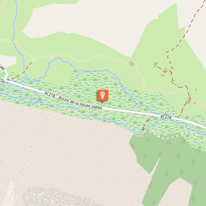
Parking du Hameau de la Chau La Chau - Fonts de Cervières Vallée des Fonts de Cervières , 05100   Cervières
Lat : 44.879042Lng : 6.747492

Points of interest

image du object

Chenaillet Massif

Rising to 2,650 meters, the Chenaillet Massif is an iconic site due to its geological richness. It is therefore a veritable open-air museum of Alpine geology, bearing witness to a past dating back hundreds of millions of years.A true witness to the ancient Tethys Ocean, Le Chenaillet is one of the few places in Europe where fossilized oceanic crust can be observed directly in the field. Formed at the bottom of the Tethys Ocean around 200 million years ago, these rocks were gradually lifted up during the formation of the Alps. Here you will find green serpentinites from the Earth's mantle, dark gabbros, evidence of ancient underwater magma chambers, and pillow basalts, remnants of underwater volcanoes. Starting from the Mur des Aittes, a marked geological trail allows visitors to discover the geological richness of the Chenaillet massif. Each panel clearly explains how the rocks were formed, how they bear witness to the movements of the Earth's plates, and how they tell the profound history of the Alps. Hikers can thus walk in the heart of geological processes that have taken place over millions of years. At the summit of Chenaillet, you can see the village of Montgenèvre on one side and various peaks overlooking it, such as Grand Chalvet, Pointe de Dormillouse, Tête des Fournéous, and more. On the other side, directly opposite, you can see Lasseron, Pic de Rochebrune and, further away, the Queyras and Briançonnais valleys and the Ecrins and Cerces massifs stretching as far as the eye can see. The uniqueness of this massif lies in this combination of science and nature, which offers a unique experience.

- Office de tourisme des Hautes Vallees -
Consulter

Date and time

  • From 01/05/2026 to 31/10/2026
  • From 01/05/2027 to 31/10/2027

Additional information

Updated by

Office de tourisme des Hautes Vallées - La Grave - La Clarée - L'Izoard - 21/04/2026
www.hautesvallees.com/la-grave/
Report a problem

Environments

Mountain location

Open period

From 01/05 to 31/10 daily.

Subject to favorable snow and weather conditions.

Location complements

From Briançon, take the D902 towards Col de l'Izoard to reach the village of Cervières. Enter the village and follow the D89T until you cross the Mur des Aîttes. Park in the second parking lot after the Mur des Aittes, in front of the Chalets de la Chau.

Topo guides and map references

Map references :
Carte IGN TOP 25 n° 3536 OT Briançon - Serre Chevalier - Montgenèvre

Reception complements

This itinerary borders on the Rochebrune - Izoard - Vallée de la Cerveyrette Natura 2000 site. Although the route is not on a listed site, it is essential to preserve the site by staying on the trails.

Animals

Yes

Data author

Ratings and reviews

To see around
See more
Open
Close
Show
Show
Show
Show
Show
Show
Show
Show
Show
Show
Show
Caution!
We have no information on the difficulty of this circuit. You may encounter some surprises along the way. Before you go, please feel free to inquire more and take all necessary precautions. Have a good trip! 🌳🥾