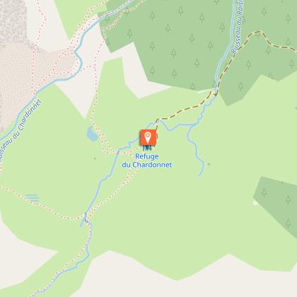
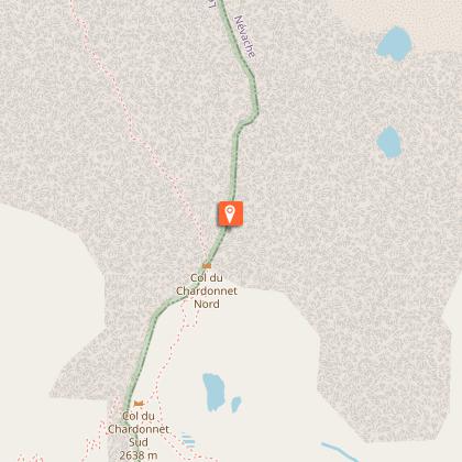
Alert

Alerts

To see around
See more
Open
Close
Show
Show
Show
Show
Show
Show
Show
Show
Show
Show
Show

Oups... It would appear that Cirkwi does not have permission to use your location.

Presentation
Description
Map
Steps
Points of interest
Ratings and reviews
See around

Col du Chardonnet

Col du Chardonnet_Névache
Col du Chardonnet
Col du Chardonnet
Col du Chardonnet
Col du Chardonnet
Col du Chardonnet
Col du Chardonnet

Description

The Col du Chardonnet is a classic in the Clarée region, offering a wide variety of landscapes, including the Chardonnet high altitude marsh.
It offers a unique panorama of the Écrins mountain range and La Meije.

Beginning with a pleasant climb through the woods, this variant of the GR57 crosses the old Laraux alpine chalets to reach the Chardonnet refuge nestled at the foot of the Queyrellin ridge at 2222 m altitude. Higher up, the vast Chardonnet altitude marsh marks the start of the final ascent to finally enjoy this unique view of the Écrins bar and the Meije.

Park at the Fontcouverte parking lot, opposite the campsite of the same name.

Enter the campsite and take the left-hand path leading to the refuge du Chardonnet. The path winds through a larch forest to reach the Laraux chalets, which continue to the right and take you to the Chardonnet refuge.

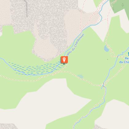
From the refuge, continue to the torrent de Raisin, (once you've reached the torrent, you have two options: by going left, you can reach the Col du Raisin at an altitude almost similar to that of the Col du Chardonnet).

Cross a small bridge to take the GR 57 (red and white markings). The path leads into a combe, which you climb up to reach a flat area.
The path leads to the magnificent Chardonnet alpine marsh. You'll find remnants of electricity poles that will lead you to the Col du Chardonnet.

Technical Information

Walking
Difficulty
Medium
Duration
5h30mn
Dist.
12 km
Show more

Altimetric profile

Starting point

Parking de Fontcouverte Fontcouverte Haute vallée de la Clarée , 05100   Névache
Lat : 45.034085Lng : 6.545337

Steps

Points of interest

image du object

Le Chardonnet graphite mines

The Chardonnet mine is one of the few graphite mines in France. Situated at an altitude of 2600m, with no road access and no real means of transport, it was mainly exploited by the valley's inhabitants from 1907 to 1937.Graphite dates from the Carboniferous age (300,000 million years ago), and is derived from coal by metamorphism: the transformation of coal under the effect of high pressure and temperature, probably during episodes of lava upwelling within ancient massifs. Graphite was mainly used in the manufacture of pencil leads and for electric motor coals. Mining began in 1824 with rudimentary equipment: shovels, baskets and wheelbarrows. From 1909 onwards, mining became more extensive, with the installation of winches and the use of perforating machines and pumps. The mine was accessible only on foot, but the ore was transported by wagon to the Guisane valley by cable. The mine was equipped with electricity and barracks. The electricity poles can still be seen, and at the entrance to the main gallery, the cable wheel was used to transport wagons to the Guisane valley. The remains of this mine now belong to the commune of Monetier les Bains, which secured the site following an inventory by BRGM (Bureau de Recherches Géologiques et Minières). For further information, please visit the Société Géologique et Minière du Briançonnais website.

Col du Chardonnet Haute vallée de la Clarée 05100 Névache
- Office de tourisme des Hautes Vallees -
Consulter

Additional information

Updated by

Office de tourisme des Hautes Vallées - La Grave - La Clarée - L'Izoard - 07/04/2026
www.hautesvallees.com/la-grave/
Report a problem

Environments

Mountain location
Presence of livestock and guard dogs

Open period

All year round daily.

Subject to favorable snow and weather conditions.

Type of land

Non-groomed itinerary
Stone
Not suitable for strollers

Topo guides and map references

Map references :
IGN TOP25 map 3535OT

Animals

Yes. Pets are welcome, but we strongly advise you to keep your dogs on a leash (presence of herds and wildlife).

Data author

Ratings and reviews

To see around
See more
Open
Close
Show
Show
Show
Show
Show
Show
Show
Show
Show
Show
Show
Caution!
We have no information on the difficulty of this circuit. You may encounter some surprises along the way. Before you go, please feel free to inquire more and take all necessary precautions. Have a good trip! 🌳🥾