Alert
Alerts
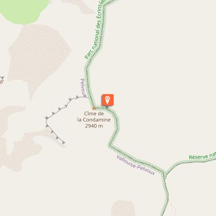
La Cime de la Condamine


Description
A remarkable lookout perched at an altitude of almost 3,000m in the heart of the Partias Reserve, this hike offers incomparable views of the Écrins massif and unique vistas of the Vallouise and Durance valleys.
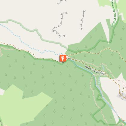
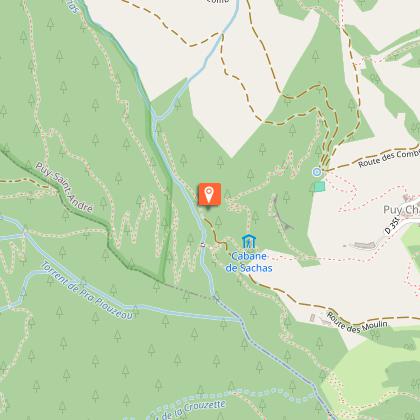
Park in the parking lot just beyond the hamlet of Les Combes.
Follow the dirt track to the barrier marking the entrance to the Partias Regional Nature Reserve. A descriptive sign explains the regulations in force and the specific features of this reserve.
Cross the barrier and continue straight into the heart of the Partias via a wide path for around 600 meters.
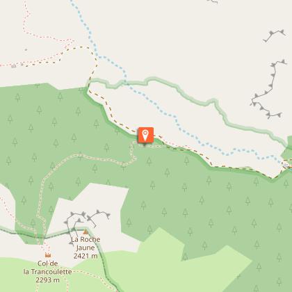
At the fork, take the left-hand path towards Col de la Trancoulette (signposted). The path climbs up through the forest below Rocher Jaune, up a valley and then begins a short, steady ascent to the pass.
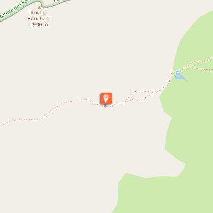
At the pass, take the right-hand path (signposted Cime de la Condamine). The path crosses the vast "Clot des Amandiers" mountain pasture and skirts two small lakes until it reaches the "Peyre du Feu" area. The path is partially marked in places, follow the cairns to the Col de Vallouise.
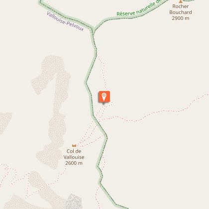
At the Col de Vallouise, take the right-hand path, which is well-marked and rises into the mountain. The path then winds a little steeper through the rocky bars, with two tricky passages in the escarpments, before reaching the large dome of the Cime de la Condamine. The return journey takes the same route.
Alternatively, you can continue via the Crête de Coste Groselière and then descend via the Col de la Pisse and Fond de Closis/Vallon des Partias.
Technical Information
Altimetric profile
Starting point
Steps
Date and time
- From 01/06/2026 to 31/10/2026
- From 01/06/2027 to 31/10/2027
Additional information
Updated by
Office de tourisme des Hautes Vallées - La Grave - La Clarée - L'Izoard - 14/04/2026
www.hautesvallees.com/la-grave/
Report a problem
Environments
Mountain view
Panoramic view
Mountain location
Open period
From 01/06 to 31/10 daily.
Subject to favorable snow and weather conditions.
Contact
Phone : 06 07 07 31 08
Email : izoard@hautesvallees.com
Website : https://www.hautesvallees.com/lizoard/
Facebook : https://www.facebook.com/Izoardtourisme/
Topo guides and map references
Map references :
Carte IGN TOP 25 n° 3536 OT Briançon - Serre Chevalier - Montgenèvre
Reception complements
Two slightly technical passages in the rocky bar above the Col de Vallouise.
To preserve this area, Reserve staff are responsible for enforcing the regulations and advising all users.
Savoir Vivre en Réserve :
- Stay on the trails
- Dogs must be kept on a leash
- Picking plants and flowers prohibited
- Bring your own garbage
- Camping and fires prohibited, bivouacs authorized
- Motorized traffic prohibited
- Respect the tranquillity of the site
Tricky passages
Two slightly technical passages in the rocky bar above the Col de Vallouise.
Animals
Yes. Dog on leash mandatory
Data author
