Alert
Alerts
Fort du Gondran from Cervières
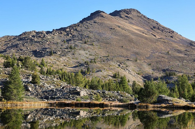
Description
This magnificent itinerary to one of the Briançonnais' most emblematic forts, culminating at 2460 meters, reveals the region's military past.
The summit of Les Anges offers breathtaking views of the Écrins, Cerces, Italy and Queyras.
Park at the parking lot just after the Aittes wall on the left-hand side of the road.
The well-marked route follows the Chenaillet geological trail to the ridge line and the customs hut.
The trail begins with steps from the parking lot, and the first signpost explains the route. Follow the signs for the Massif du Chanaillet / and Lac des Sarailles geological trail. The trail rises on a medium gradient through meadows, moorland and wetlands for around 1.8 km.
At the fork in the road, continue straight on towards Lac des Sarailles, winding a few switchbacks for 300 metres to reach the lake. From here, several paths / and shortcuts lead to Chenaillet. To avoid damaging the site, we ask you to stay on the main trail: ignore the track on the right and go around the lake and its wetland to the left to stay on the main route and reach the ridge and the Douanier hut.
When you reach the Cabane des Douaniers, continue straight on towards Lac de Sagne Enfonza.
At the fork near the lake, take the left-hand path towards the Sommet des Anges and the old Fort du Gondran. The path follows the ridge line for 1.3 km, rising one last time to the Fort.
Return by the same route.
Technical Information
Altimetric profile
Starting point
Date and time
- From 01/06/2026 to 30/10/2026
- From 01/06/2027 to 30/10/2027
Additional information
Open period
From 01/06 to 30/10 daily.
Subject to favorable snow and weather conditions.
Updated by
Office de tourisme des Hautes Vallées - La Grave - La Clarée - L'Izoard - 17/04/2026
www.hautesvallees.com/la-grave/
Report a problem
Environments
Overview on river
Mountain view
Panoramic view
Lake view
Mountain location
Contact
Phone : 06 07 07 31 08
Email : izoard@hautesvallees.com
Website : https://www.hautesvallees.com/lizoard/
Facebook : https://www.facebook.com/Izoardtourisme/
Type of land
Rock
Ground
Not suitable for strollers
Location complements
From Briançon, take the D902 towards Col de l'Izoard to reach the village of Cervières. Enter the village and continue on the D89T, winding up to cross the Mur des Aîttes. Park in the parking lot after the wall, where you'll find a hut.
Topo guides and map references
Map references :
Carte IGN TOP 25 n° 3536 OT Briançon - Serre Chevalier - Montgenèvre
Reception complements
The Chenaillet massif is an exceptional geological site.
It is now frequented by many groups.
For occasional hikers, we advise you to start this hike very early to avoid groups.
Please follow the footpath and do not take shortcuts.
Do not take samples along the route.
Entry to military facilities is at your own risk.
Animals
Yes
Data author
