Alert
Alerts
Le rocher de Roure par le torrent de Sachas


Description
This pretty loop between the Montbrison state forest and the Partias Reserve leads to a magnificent panorama from the Rocher de la Roure. A well-preserved itinerary, you'll come across a wide variety of remarkable flowers.
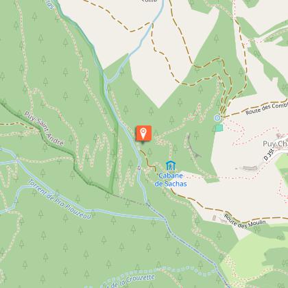
From Puy-Saint-André, follow the asphalt road past the last houses (Lieu dit du Villaret). The road then becomes a wide dirt track. The start of the itinerary is that of the GR50.
This wide track continues flat for about 1.3 km up the mountainside towards the torrent de Sacha, giving a fine view of the Tenailles de Montbrison.
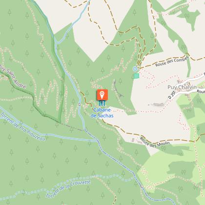
The trail ends when you reach the Forêt Domaniale de Montbrison (signposted): at this point, take the small path on the left which descends towards the torrent, then cross the Torrent de Sacha footbridge.
On the north-facing slope, the vegetation changes completely, with a multitude of orchids. The narrow path twists and turns through the heart of the forest. After the first 10 hairpin bends, the path is overlooked by the Rocher de Roure. Continue along this path, crossing the Pra Piouzéoui torrent, and over the last hairpin bends to a fork. (approx. 2 km and 280 m ascent from the Torrrent de Sacha footbridge).
At the fork in the road, leave the GR50 and take the right-hand track to the Crête des Alpes for 400 metres (Alt 1838). A magnificent panorama opens up over Briançon and Villard-Saint-Pancrace, with Cime du Mélézin and Grand Peygu opposite.
The path descends steeply through the Bois des Ayes towards the torrent. At the fork, take the right-hand track towards the footbridge.
Make a bend and ignore the footbridge: continue along the torrent, still on the right bank, to return to the footbridge.
Follow the trail back to the Villaret - Puy Saint André parking lot.
Technical Information
Altimetric profile
Starting point
Points of interest
Date and time
- From 01/06/2026 to 31/10/2026
- From 01/06/2027 to 31/10/2027
Additional information
Open period
From 01/06 to 31/10 daily.
Subject to favorable snow and weather conditions.
Updated by
Office de tourisme des Hautes Vallées - La Grave - La Clarée - L'Izoard - 15/04/2026
www.hautesvallees.com/la-grave/
Report a problem
Environments
Close to GR footpath
Mountain view
Panoramic view
Forest location
Mountain location
In a nature reserve
Contact
Phone : 06 07 07 31 08
Email : izoard@hautesvallees.com
Website : https://www.hautesvallees.com/lizoard/
Facebook : https://www.facebook.com/Izoardtourisme/
Type of land
Ground
Location complements
From the N94 marking the entrance to Briançon, turn left at the traffic lights towards Puy-Saint-André via the D35.
In the Puy-Saint-André hairpin bend, park in the small balcony parking lot on route du Villaret.
Topo guides and map references
Map references :
Carte IGN TOP 25 n° 3536 OT Briançon - Serre Chevalier - Montgenèvre
Reception complements
Part of the route crosses the Partias Regional Nature Reserve.
To preserve this area, Reserve staff are responsible for enforcing regulations and advising all users.
Savoir Vivre en Réserve :
- Stay on the trails
- Dogs must be kept on a leash
- Picking plants and flowers prohibited
- Bring your own garbage
- Camping and fires prohibited, bivouacs authorized
- Motorized traffic prohibited
- Respect the tranquillity of the site
Animals
Yes. Dogs on leash
Data author
