Alpe d'Huez, the quiet climb
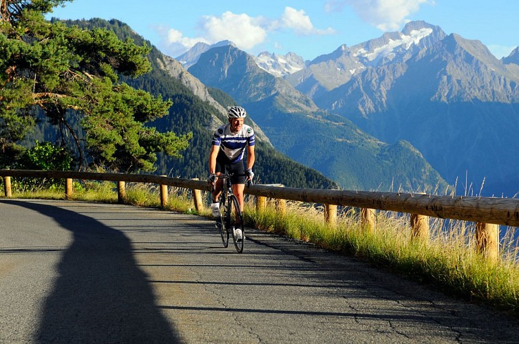
Description
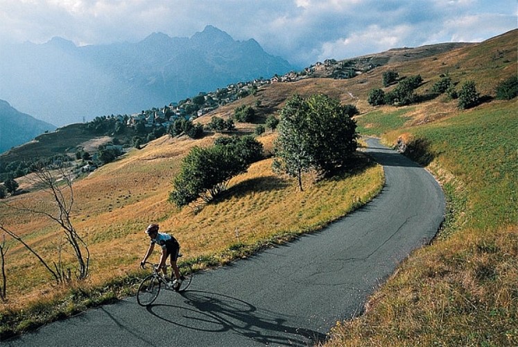
No particular difficulty for this itinerary which gently rises from the plains of Allemond and the Lake Verney. On the “Pas de la Confession” road between Villard Reculas and Huez, you will find a wonderful, panoramic view over the Bourg d'Oisans plains.
Itinerary no. 5 of the “Cycling in Oisans” guide (Oisans Tourisme)
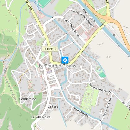
Departure / Arrival (loop): Bourg d'Oisans 720 m
Time: 3 h
Distance: 44 km
Highest point: 1850 m
Lowest point: 711 m
Total ascent: 1308 m
Max. gradient: 8%
Map: Michelin Local Map no. 333 Isère, Savoie
ITINERARY
From Bourg d’Oisans, follow the D1091 towards Grenoble.
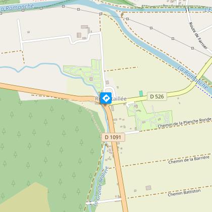
In Rochetaillée, turn right onto the D526 towards Allemond.
After the bridge “Pont Rouge” turn right towards Villard Reculas on the D44.
The road rises gently on an even slope up to Villard Reculas, passing through the hamlets of Raffour and La Beurrière.
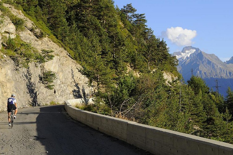
Cross Villard Reculas. Ride to Huez along the narrow, spectacular “Pas de la Confession” road.
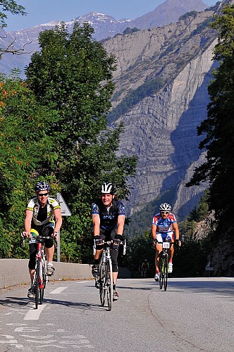
Go through Huez to get to the 21 hairpin bends of the famous road to Alpe d’Huez at bend no. 6.
Then just go back down to Bourg d’Oisans.
Technical informations
44 km
|
max. 1850 m
min. 709 m
1308 m
| |||
Accessibility | ||||
Style : Mountain Public : Cyclists | ||||
Altimetric profile
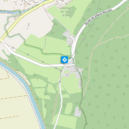
Starting point
Steps
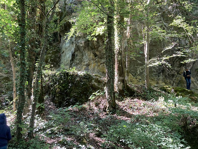
La route de la Confession
After the junction with the communal farm, follow the road towards Huez. You take an old scenic roads of the Oisans, "la route de la Confession". Legend says that before using this road (the second road to the village) you must confess yourself to arrive alive in Villard-Reculas. The road was dangerous and only pure souls arrived at the village.
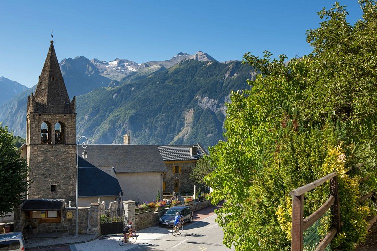
Huez village
If you go through Huez, this will take you back to the 21 hairpin bend n° 6.
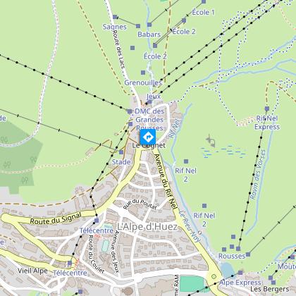
Alpe d'Huez
Once at the top of Alpe d'Huez (Rond-point des pistes), you can take a break before going back to Bourg d'Oisans by Alpe d'Huez road.
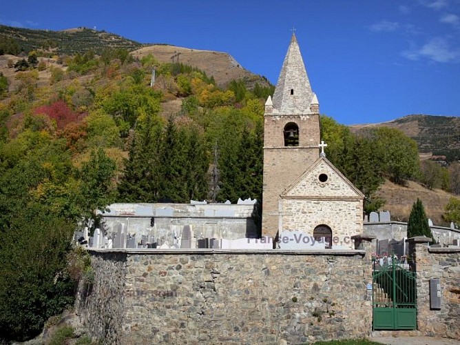
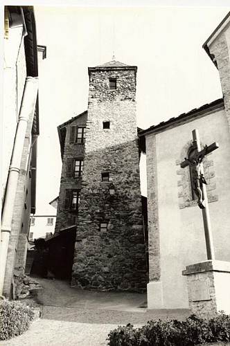
Saint-Ferréol Church
First church of Huez village, the place is famous thanks to the 7th turn of the road.
Points of interest
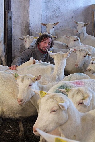
La Chèvre...rie- Breeding goats and chickens
Clément Marais breeds his Saanen goats high up in the mountains, in the heart of the Villard-Reculas pastureland. He offers a full range of goats’ cheese, including tomme, raclette and fresh cheese, together with lovely fresh farmhouse eggs.I took over the Villard-Reculas goat farm in 2012. Situated at an altitude of 1500 m, the farm has around 50 Saanen goats that give us the milk to make cheeses on the farm. What I like most about this life is working with the animals in this magnificent landscape, as well as the cheesemaking process itself. I am particularly motivated by farming that respects the environment. My specialities include goats raclette cheese, tomme, fromage blanc and dry fromage frais. Products : Goat’s tomme; Soft and matured goat’s cheese; Eggs during summer. Location : - At the farm - Market stalls : Fridays morning in Alpe d’Huez (in July and August) and Saturdays morning in Bourg d’Oisans.
Eglise Saint-Pierre de La Garde-en-Oisans
Although mentioned for the first time in documents in 1058, Saint Peter's Church is almost certainly older. Its very good current condition conceals this fact, especially following recent renovation work to replace the damaged belfry.We know from the archives that La Garde held an important position in the parishes of Oisans in the Middle Ages, as it had a castle mound (typically a mediaeval defence structure), two towers and a stronghold. The position of the church bears witness to its age, since churches were traditionally built on a rocky outcrop or promentory in order to be both seen and heard. Indeed, the sound of ringing bells had to travel far to reach the peasants in the Alpine pastures or other villages. Having survived for centuries, the church has undergone a number of changes, since architectural digs have revealed an earlier building and graves. In April 2013, the wooden belfry supporting the bells was replaced and a bell ringing the note "D" was added! A sundial can be seen on the southern face.
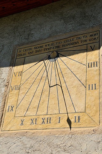
Sundial on La Garde church
In the 17th century, monks in the parish made a sundial calculated in accordance with the latitude, longitude and orientation of the south wall of St Peter's Church. This became known as "The Watch" by local residents.This is one of the oldest sundials in Oisans, dating from 1677 (slightly later than the 1669 sundial in Venosc). Renovated in 2000, a correction table enables the exact time to be calculated as indicated by the sun at any time of the year.
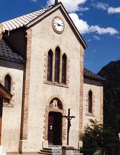
Eglise Saint-Ferrèol d'Huez
Dans les rues d'Huez village
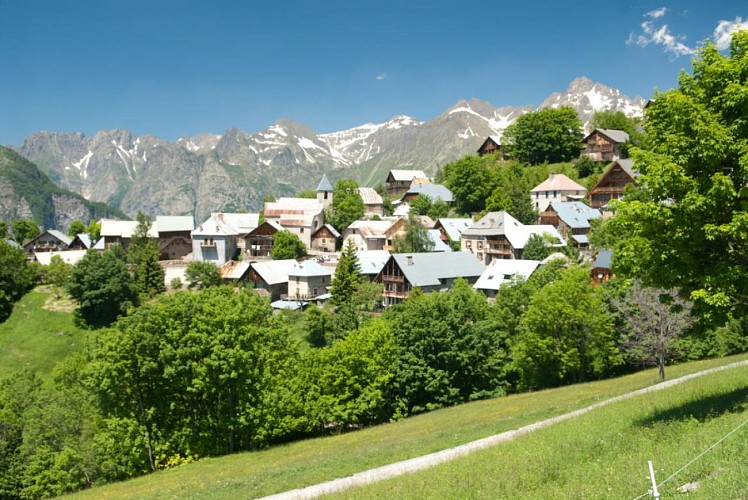
Village de Villard-Reculas
Villard-Reculas is in a location that is both difficult and ideal for a village. It is situated in a balcony above the valley, with fine pastureland and a south-facing exposure that is ideal for agriculture, but has always been difficult to access.There are several explanations of the origin of the name. "Reculas" from the French "reculé" meaning remote, or else "recula" as the village had to "retreat" following a major avalanche. In any case, once you're there it feels great, but you still have to get there! Oisans features a number of hard-to-reach places, but since 1980, access to Villard-Reculas has been along a good, well-maintained road. The village has undergone something of a revival following several years of rural exodus and, thanks to the welcoming inhabitants, tourism is flourishing. It has kept its traditional character with no large buildings being constructed and no concrete, but instead a farm, goats, chamois and a pretty little church with an interesting history. Indeed, the church was moved to make it easier to access in winter. As is often the case in Oisans, it was originally located just outside the village next to the cemetery, but was completely rebuilt in its current position and extended on the same occasion. The expression "village resort" takes on its full meaning here. Tin roofs, old farms made of slate (thanks to the nearby quarries), old-fashioned pastureland and an atmosphere that is unique to Oisans. Here's an interesting fact - this little village owes its water supply to a system...built by the Sarrazins in the sixth century! The "Canal des Sarrazins", which solved the crucial problem of supplying water to the village, is still working today and is THE monument in Villard-Reculas. Don't expect an aqueduct as the construction is modest but efficient, and has proved to be extremely resistant over time.
Scenic roads : Route de la Confession
The "Route de la Confession" was the first road to Villard-Reculas and was an exceptional achievement on account of its construction (a challenge for its time), its exposed position between two cliffs, its legend and the breathtaking views it still offers.On the road between Huez and Villard-Reculas, clinging to the edge of the cliff, a mysterious sign announces the "Pas de la Confession", because it was indeed better to approach this terrible passage, at such a steep angle, with a clear conscience! According to the legend of the road, only pure souls could venture along this narrow road, exposed to rock falls (chamois like the slopes above your head) and intimidating if you suffer from vertigo. The villagers therefore claimed to be people of good virtue... An oratory at the start of the road, on the Huez side, was an obligatory stop for confessions before going any further. But at the time it was above all a real life changer for the villagers since previously only the "Vieille Morte" (hamlet in the Romanche valley) path lead into the valley. This was impassable in winter, so it was then necessary to pass above the village to reach the mountain pastures of Huez (hence the Alpe d'Huez) and the village of Huez, from where an easier path started. Until 1980 (yes, really!) this was the only road to Villard Reculas. The village was then awarded subsidies to finally build the modern road (linking it to Allemond). The scenery is beautiful, but take care both in the car and on foot, as the road is narrow and winding, making it difficult to pass oncoming traffic.
La voie de Rochetaillée
Rochetaillée lierally means "cut rock" in French and looking up at the road carved out of the cliff face, it is clear how the village got its name. However, the exact origin of this road appears lost in the folds of history.Is this road, as many people believe, the remains of a Roman road, the indelible mark of an unstoppable sovereign population? Or, as Doctor Roussillon suggests in his Traveller's guide to Oisans, is it "the still visible trace of a path created during the existence of the lake, along the bottom of the neighbouring mountain and behind the small hamlet of Rochetaillée, from which it draws its name. Such were the circumstances in which this path was built." An observor at the end of the 19th century reported certain similarities beween the Porte des Bons and the Rochetaillée road, suggesting a close correlation between the two. Marks and tracks on the ground were reported to be similar and of exact equal width. Unfortunately, no trace of these marks has been found since and the campaign to clear and clean the site carried out by in 2004 by "Customs and Traditions of Oisans" also failed to uncover any evidence. To better understand this, it needs to be remembered that in the last century, the plain through which the road passes was like a desert without any vegetation. Both the cliff and the plain were completely bare, meaning that it was no doubt easy at the time for witnesses to observe and note the smallest details. These days, the road is virtually covered by vegetation and in some places, you can almost walk past without noticing it. But why carve the road out of the rock? If we go along with Docteur Roussillon's theory, the creation of Saint-Laurent lake would be the only tangible reason for this project, which must have involved considerable manpower and resources. The other theory, if we consider this to be a Roman road, suggests that any rapid progress towards the high mountain passes was hindered by the neighbouring plain. Perhaps it was a swamp or a lake that was liable to flooding due to the unpredictable behaviour of the Romanche river? The size of the project to build the road would also prove the importance of the "Oisans way" in the eyes of the Romans. Along the entire length of the platform, rectangular markings are carved out of the stone at regular intervals. These suggest that a structure consisting of beams and a wooden floor covered the road, widening it from 2 metres to 3 or 4 metres and making for easier progression. At suitable points, wider platforms were installed, known as "garages" that served as passing places for animals and carts. To this day, the track linking Rochetaillée to Bourg d'Oisans, via the hamlets of La Paute and Les Sables, is known as the "Chemin Romain". Source: Freneyd'Oisans.com/Mr Albertino
Date and time
- From 01/05/2024 to 15/11/2024
- From 01/05/2025 to 15/11/2025
Additional information
Environments
Mountain location
Mountain view
Updated by
Oisans Tourisme - 08/04/2024
www.oisans.com
Report a problem
Open period
From 05/01 to 10/31 : open daily.
Depending on snow conditions.
Contact
Phone : 04 76 80 03 25
Email : info@oisans.com
Website : www.bike-oisans.com
Topo guides and map references
Topo guides references :
Itinerary no. 5 of the “Cycling in Oisans” guide (Oisans Tourisme)
Map references :
Michelin Local Map no. 333 Isère, Savoie
Data author
