The hamlets of La Grave
Description
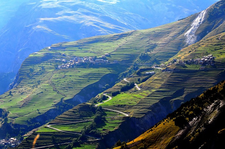
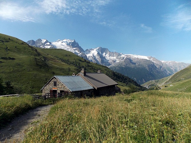
This itinerary that leads you to discover La Grave and its authentic hamlets is without any major difficulty. Along this small and balcony road, the view is stunning! You will have a front seat to admire La Meije and its glaciers.
Itinerary no. 19 of the “Cycling in Oisans” guide (Oisans Tourisme)
Departure / Arrival: Bourg d’Oisans 720 m
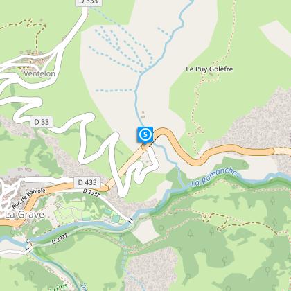
Time: 5 h
Distance (R/T): 72 km
Highest point: 1823 m
Lowest point: 720 m
Total ascent: 1981 m
Max. gradient: 9%
Map: Michelin Local Map no. 333 Isère, Savoie
ITINERARY
From Bourg d’Oisans, follow the D1091 towards “Briançon / Les 2 Alpes” as far as the Chambon dam. You will go through 4 lit tunnels on this portion. For your safety, make sure you are visible.
Once at the dam, continue towards “Briançon / La Grave” (other tunnels await you).
In La Grave, go through the village and the tunnel “Serre du Coin”. Immediately after the exit of the tunnel, fork right towards “Ventelon / Les Terrasses / Les Hières”. You climb above La Grave on a small balcony road facing La Meije.
First, you arrive at Ventelon, you can then turn right towards Les Hières. At the end of the road, make a U-turn and continue to Les Terrasses and then Le Chazelet.
When La Grave and its hamlets no longer hold any secrets for you, you can return to Bourg d'Oisans by the same route.
Technical informations
72 km
|
max. 1835 m
min. 717 m
1981 m
1979 m
| |||
Accessibility | ||||
Style : Mountain Public : CyclistsReserved for experts/confirmed | ||||
Altimetric profile
Starting point
Steps
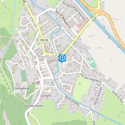
Bourg d'Oisans
From Bourg d'Oisans follow the RD1091 towards Briançon.
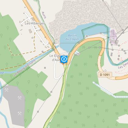
Clapier d'Auris
After 5 km turn left into the gorges of the Infernet. Be careful when cycling through the tunnel.
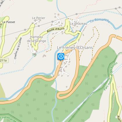
Le Freney d'Oisans
Cycle past the Chambon barrage and carry on until you reach La Grave.
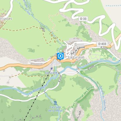
La Grave
When coming out of the ‘Serre du Coin’ tunnel, above La Grave, follow the road that forks off to the right (D33).
Towards Le Chazelet
Follow the road to the hamlets of Hyères and Ventelon.
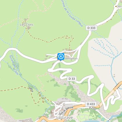
Ventelon
Near Ventelon hamlet take on the right to reach Les Hyères.
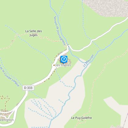
Les Hyères
Then return to Ventelon to join Chazelet.
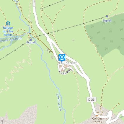
Le Chazelet
After visiting Le Chazelet, cycle down to La Grave and back to Bourg d'Oisans by the same route (RD 1091).
Points of interest
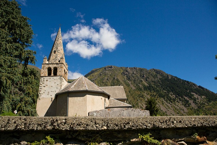
Eglise de Saint-Arey
Saint Arey was the Bishop of Gap between 579 and 614. Born into a noble Gallo-Roman family, he was ordained priest, and then Bishop of Grenoble, before continuing his vocation in the Triève and in Gap. Documents proving existence of the church date back to at least 1096.A number of legends are associated with the life of Bishop Saint Arey, but the most famous is the legend of the bear: On his way back from Rome in 605, Arey travelled over the Col du Montgenèvre on his way to Gap via Briançon. In the woods, his carriage came across a bear, which scared away one of the harnessed oxen. Arey then ordered the bear (or made a pact depending on the version,) to take the place of the ox under the yoke. The submissive animal allowed itself to be harnessed and the Bishop arrived in Gap pulled by one of the most original teams ever seen. The bear was freed and took refuge in nearby woods. According to the legend, the bear only emerged on the day of the Bishop's burial in 614. The church that we see today was built in 1840. with the first stone, blessed by the Bishop, laid on 11 May. Once the church was consecrated, a lead box sealed with the arms of the Bishop and containing the relics of several saints was placed in the tomb of the high altar, which was not consecrated itself. The former church had been dedicated to Saint-Arey and he remained patron saint of the new church. Shortly after it was built in 1878, the church received a visit, as recounted in a document of unknown origin: " The church, isolated on a rock overlooking the Romanche river, stands several stories high at an altitude of 982 m. It was rebuilt in 1841 and is shaped like an ogival-style Latin cross. The solid, old bell tower has been kept, although it is in the 11th century Roman style. The chimes are very pretty, even though the bells are not heavy. The church portal is truly remarkable, built with a type of large grain porphyry - a rare stone that is found locally. The interior of the church is very simple, without any decoration or stained-glass windows. The altar is made of white marble and is rather elegant. Some pictures of certain merit decorate the Sanctuary, representing Saint-Arey, the patron of the Parish, talking with Pope Gregory VII." Information from freneydoisans.com/freneytique/ Sources: Associations Coutumes et Traditions de l'Oisans / Freneytique - Fonds d'Archives numériques André Glaudas
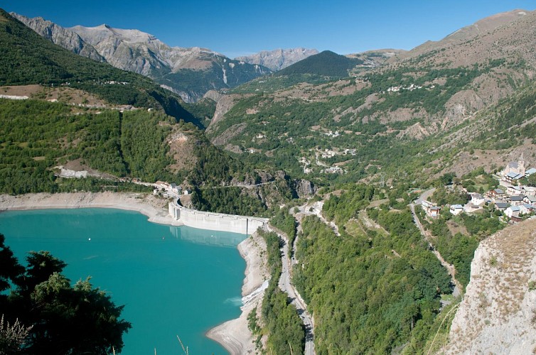
Barrage du Chambon
The Chambon dam was built between 1929 and 1935. In 1918, the industrialist Henri Frédet discovered the potential of this narrow, 75m long section of the Romanche river. It proved to be the ideal location for regulating the flow of the river.In 1921, studies showed that the presence of hard, cristallin schist in the soil provided a perfect seal for the water. The potential of hydroelectricity drew the attention of speculators during the 1920s stock exchange boom. Despite having to flood the villages of Le Chambon,Le Dauphine and Pariset, work began on the dam. During the construction period, a temporary cable car was set up over a 10.5 km stretch from Bourg d'Oisans to Le Chambon to supply the site with cement and other materials more rapidly. This cable car had 193 huge buckets that could each carry 250 km of cement. 62 metal pylons were built 900 m apart, some up to 40 m high, to bear the weight of the 22.5 km steel cable. The reservoir filled with water between 24 April and 9 October 1935. As early as May 1935, the turbines of the Sainte-Guilherme power plant were being driven by water and intake from the neighbouring Ferrand Valley was later added to boost the supply of water.
Date and time
- From 01/05/2024 to 15/11/2024
- From 01/05/2025 to 15/11/2025
Additional information
Environments
Mountain location
Mountain view
Updated by
Oisans Tourisme - 08/04/2024
www.oisans.com
Report a problem
Open period
From 05/01 to 10/31 : open daily.
Contact
Phone : 04 76 80 03 25
Email : info@oisans.com
Website : www.bike-oisans.com
Topo guides and map references
Topo guides references :
Itinerary no. 19 of the “Cycling in Oisans” guide (Oisans Tourisme)
Map references :
Michelin Local Map no. 333 Isère, Savoie
Data author
