The tour through the plateau of Matheysin
Description
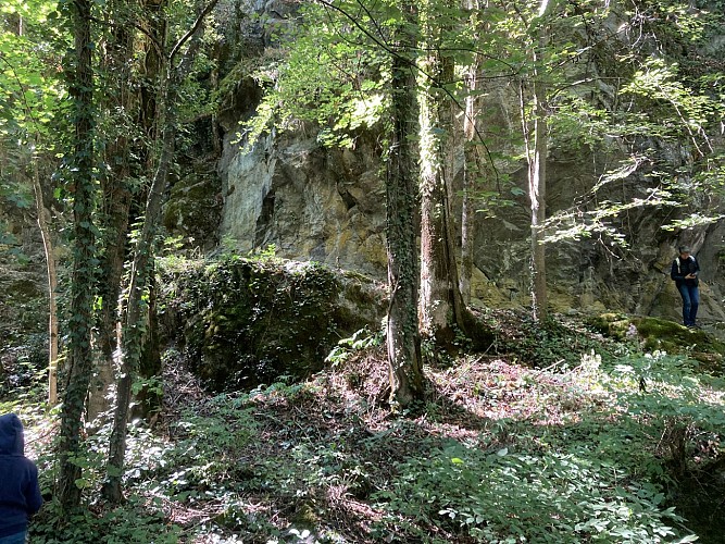
This big loop is popular among local cyclists. You leave Oisans by Col d'Ornon to drop down to Valbonnais, then to the plateau of Matheysin. You will climb up to La Morte by a pretty route with little traffic.
Itinerary no. 11 of the “Cycling in Oisans” guide (Oisans Tourisme)
Departure / Arrival (loop): Bourg d’Oisans 720 m
Time: 5 h 30
Distance: 100 km
Highest point: 1380 m
Lowest point: 360 m
Total ascent: 2010 m
Max. gradient: 10%
Map: Michelin Local Map no. 333 Isère, Savoie
ITINERARY
From Bourg d’Oisans, follow the D1091 towards Grenoble.
After the second kilometre turn left and follow the D526 towards Valbonnais - La Mure - Ornon. From the pass, go down to Valbonnais.
From Valbonnais, turn right and follow the D26 towards La Mure.
In Sievoz, turn right and cycle on the D114a towards La Morte (ski resort of Alpe du Grand Serre).
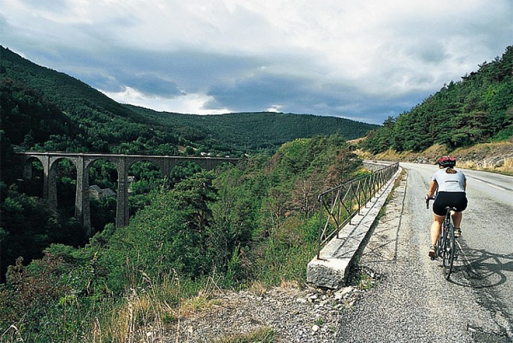
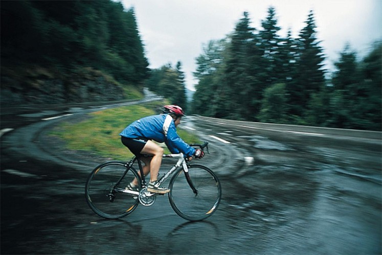
Then go to Séchilienne (be careful on the downhill slope) and turn right on the D1091 to come back to Bourg d’Oisans.
ALTERNATIVE ROUTE Via Laffrey
From Siévoz, ride to La Mure on the D26.
After La Mure, take the D115c. Cross through St Honoré, Fugières, Villard Saint Christophe and Cholonge before to go down to Laffrey.
After Laffrey, turn right on the D113 towards Saint Barthélémy de Séchilienne. Then go to Séchilienne (be careful on the downhill slope) and turn right on the D1091 to come back to Bourg d’Oisans.
---
Distance: 97 km
Time: 5 h
Total ascent: 1836 m
Technical informations
100 km
|
max. 1372 m
min. 361 m
2010 m
| |||
Accessibility | ||||
Styles : MountainTrainingRoadtrip Public : SportsmenCyclistsReserved for experts/confirmed | ||||
Altimetric profile
Starting point
Steps
Bourg d'Oisans
From Bourg d’Oisans follow the RD1091 towards Grenoble. After the second kilometre turn left and follow the D526 towards Valbonnais - La Mure - col d’Ornon.
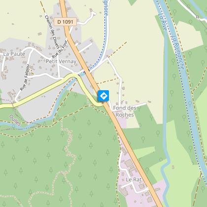
La Paute
Tourner à gauche direction "Valbonnais / la Mure / Ornon" par la D526.
Valbonnais
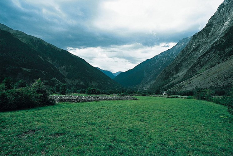
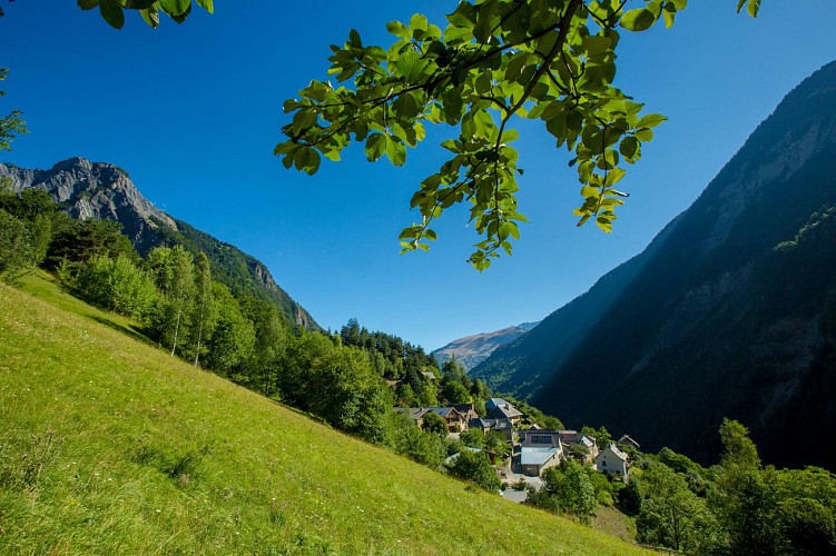
From Valbonnais, turn right and follow the D26 towards La Mure. The region of Valbonnais, which is confined to the Matheysine and situated between the valleys of Roizonne, Good and Malsanne, has an alpine character. Just above the village, the mountains of Taillefer and Oisans over 3000 meters: The Rochail, Muzelle, Breaths, the Swan and Olan, culminating point 3564 m.
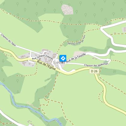
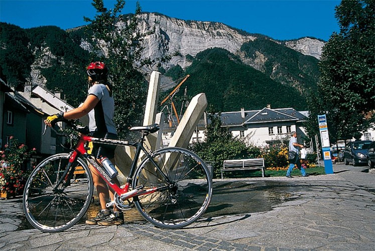
Siévoz
In Sievoz, turn right and cycle on the D114a towards La Morte (ski resort of l’Alpe du Grand Serre).
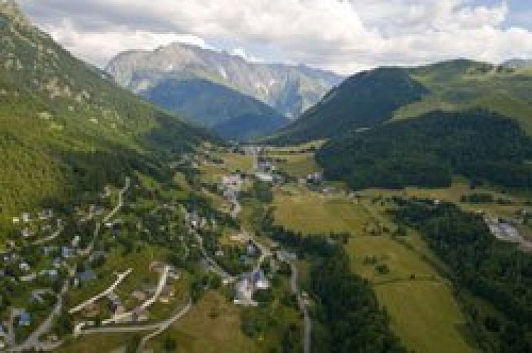
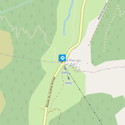
La Morte - Alpe du Grand Serre resort
Then go to Séchilienne on D114, be careful when coming down to Sechilienne.
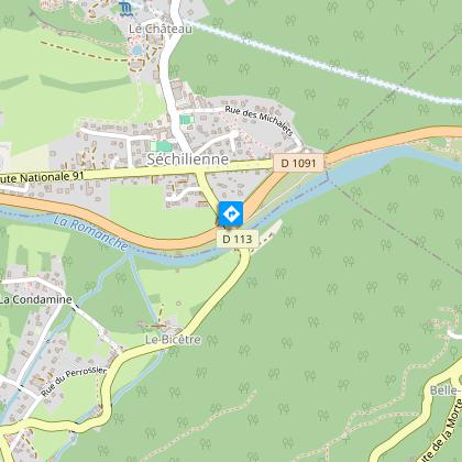
Séchilienne
Then follow the RD 1091 until you come back ton Bourg d'Oisans.
Points of interest
Ornon
Ornon sits just below the mountain pass of the same name (marking the natural boundary between Oisans and the Valbonnais), in a lovely site featuring a wide variety of scenery, from woods to the Taillefer plateau.A tapestry of crop fields and vegetable gardens surround these mountain hamlets, oozing charm and heritage. Visitors appreciate the tranquillity here, whilst benefiting from the close proximity to Bourg d'Oisans and the Oisans resorts. Ornon is the main village in the Lignarre Valley, comprising a number of hamlets dotted along the banks of the river. It covers 2000 m of height gain, from the Lignarre river and Le Clot de Barme to the top of the Taillefer. In ancient times, the Col d'Ornon mountain pass was a very busy route, linking the Drac Valley to the Col du Lautaret and then Montgenèvre, avoiding the Lac Saint Laurent (now the Bourg d'Oisans plain) and the Romache gorges. This prehistoric route, via Ornon, Venosc, Mont-de-Lans, Le Freney d'Oisans and La Grave, then became a Roman road. Roman tombs have been found dating back to the Late Roman Empire (3rd and 4th centuries BC). The top of the mountain pass has a small ski resort for all levels and a cross country skiing area in the forest, both perfect for enjoying winter sports away from the crowds. When the Mairie is closed, please contact the Bourg d'Oisans tourist office for more information.
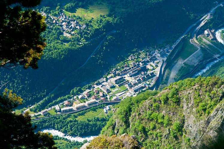
La Basse vallée de la Romanche
Driving up the Romanche Valley takes you to the cradle of hydroelectricity in Livet-Gavet, as well as giving you an opportunity to witness the ongoing developments of the EDF Romanche-Gavet project.Closed factories, dating back to the early 20th century (in particular the Vernes factory) can be seen stringed out along the valley, co-existing with the most powerful dam in France - the Grand'Maison - located above Allemond. The history of the lower Romanche Valley is intertwined with natural elements, mineral resources, hydraulic energy and reserves of timber, which have encouraged the development of different types of industries over the centuries: trip hammers in the Middle Ages, followed by furnaces, paper mills and then electrometallurgy and electrochemicals. Formally the economic lung of Oisans, the valley factories attracted peasants to work in the winter, who then returned to their herds and flocks in the summer. The very first seasonal workers! These days, after several decades of disuse, the valley is taking more care over its appearance and has launched a new large-scale hydroelectric project called the Romanche Gavet. What energy! History, just like water, continues along its way. The Romanche Museum in Rioupéroux retraces this history, depicting not only the industrial heritage of the Romanche and local geology, but also the expansion of these activities and the lives of the people involved.
La voie de Rochetaillée
Rochetaillée lierally means "cut rock" in French and looking up at the road carved out of the cliff face, it is clear how the village got its name. However, the exact origin of this road appears lost in the folds of history.Is this road, as many people believe, the remains of a Roman road, the indelible mark of an unstoppable sovereign population? Or, as Doctor Roussillon suggests in his Traveller's guide to Oisans, is it "the still visible trace of a path created during the existence of the lake, along the bottom of the neighbouring mountain and behind the small hamlet of Rochetaillée, from which it draws its name. Such were the circumstances in which this path was built." An observor at the end of the 19th century reported certain similarities beween the Porte des Bons and the Rochetaillée road, suggesting a close correlation between the two. Marks and tracks on the ground were reported to be similar and of exact equal width. Unfortunately, no trace of these marks has been found since and the campaign to clear and clean the site carried out by in 2004 by "Customs and Traditions of Oisans" also failed to uncover any evidence. To better understand this, it needs to be remembered that in the last century, the plain through which the road passes was like a desert without any vegetation. Both the cliff and the plain were completely bare, meaning that it was no doubt easy at the time for witnesses to observe and note the smallest details. These days, the road is virtually covered by vegetation and in some places, you can almost walk past without noticing it. But why carve the road out of the rock? If we go along with Docteur Roussillon's theory, the creation of Saint-Laurent lake would be the only tangible reason for this project, which must have involved considerable manpower and resources. The other theory, if we consider this to be a Roman road, suggests that any rapid progress towards the high mountain passes was hindered by the neighbouring plain. Perhaps it was a swamp or a lake that was liable to flooding due to the unpredictable behaviour of the Romanche river? The size of the project to build the road would also prove the importance of the "Oisans way" in the eyes of the Romans. Along the entire length of the platform, rectangular markings are carved out of the stone at regular intervals. These suggest that a structure consisting of beams and a wooden floor covered the road, widening it from 2 metres to 3 or 4 metres and making for easier progression. At suitable points, wider platforms were installed, known as "garages" that served as passing places for animals and carts. To this day, the track linking Rochetaillée to Bourg d'Oisans, via the hamlets of La Paute and Les Sables, is known as the "Chemin Romain". Source: Freneyd'Oisans.com/Mr Albertino
Date and time
- From 01/05/2024 to 15/11/2024
- From 01/05/2025 to 15/11/2025
Additional information
Environments
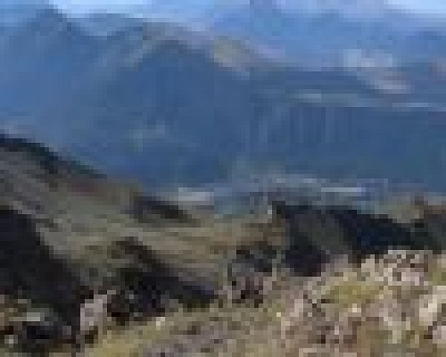
Mountain location
Mountain view
Updated by
Oisans Tourisme - 08/04/2024
www.oisans.com
Report a problem
Open period
From 05/01 to 10/31 : open daily.
Contact
Phone : 04 76 80 71 60
Email : info-allemond@oisans.com
Website : www.bike-oisans.com
Topo guides and map references
Topo guides references :
Itinerary no. 11 of the “Cycling in Oisans” guide (Oisans Tourisme)
Map references :
Michelin Local Map no. 333 Isère, Savoie
Data author
