Alpe d'Huez, the wild climb
Description
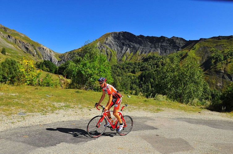
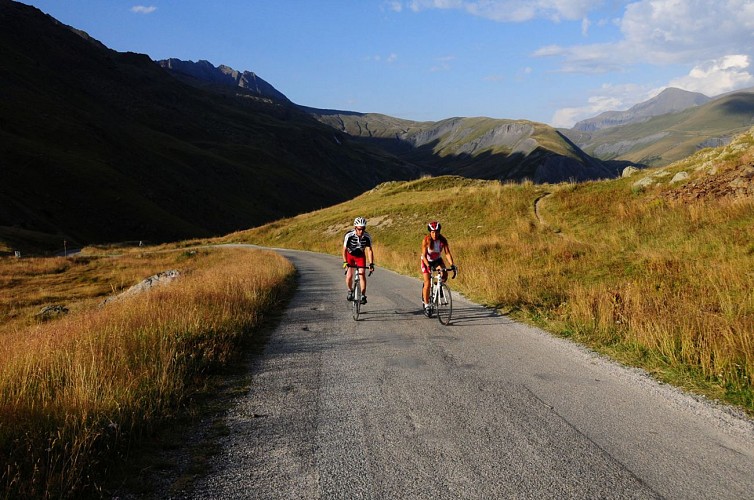
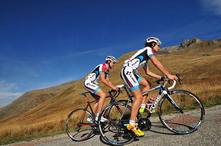
This itinerary will take you along the wild and wonderful roads of the Ferrand Valley. The first part is a good leg-warming stretch before you start the gruesome climb up to the Col de Sarenne. You will meet more sheep than cars on the road!
Itinerary no. 6 of the “Cycling in Oisans” guide (Oisans Tourisme)
Departure / Arrival (loop): Bourg d'Oisans 720 m
Time: 3 h
Distance: 52 km
Highest point: 1999 m
Lowest point: 720 m
Total ascent: 1705 m
Max. gradient: 12%
Map: Michelin Local Map no. 333 Isère, Savoie
ITINERARY
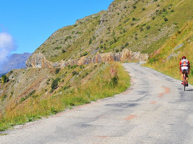
From Bourg d’Oisans, follow the D1091 towards Briançon until the Chambon dam. On this stretch, you will pass through 4 lit tunnels. For your safety, make sure you are visible.
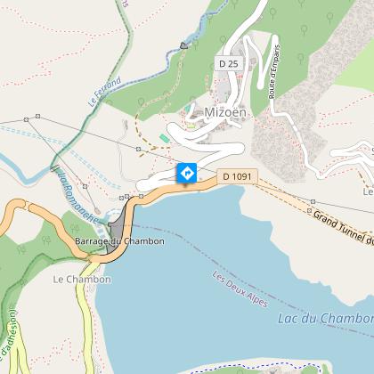
Cross the Chambon dam and after 200 m turn left to Mizoën. Follow the road (D25 then D25a) up to Clavans-le-Haut and Col de Sarenne.
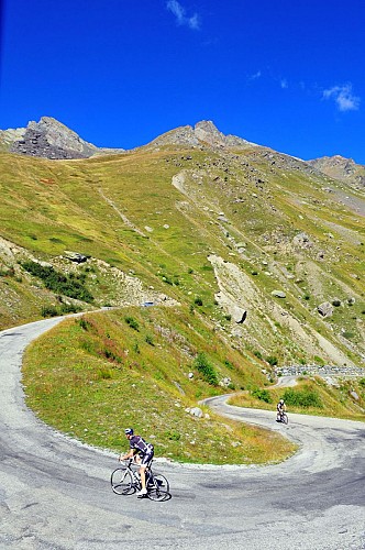
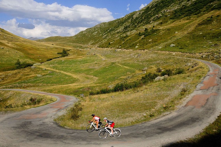
At the pass, you are now on the highest point of your route: 1999 m. You can take a break at the refuge of Col de Sarenne, then all you have to do is let yourself race down to Alpe d'Huez following the tarred road
Once in the Bergers area, take left at Europe roundabout in order to go back to Bourg d'Oisans. Or, if you are really set on reaching the centre of the resort via THE bend no. 1, go straight on...
THAT LITTLE BIT FURTHER: Besse en Oisans
You could add a trip up to Besse en Oisans. This is a listed village that is well worth going out of your way!
At the top end of the village, don’t miss the traditional bakery that is renowned throughout the region for its delicious bread baked in a wood-fired oven.
---
Distance (R/T): 8 km
Total ascent: 305 m
Time: 45 min
Technical informations
52 km
|
max. 1999 m
min. 717 m
1705 m
| |||
Accessibility | ||||
Styles : MountainTrainingTerroir Public : SportsmenCyclists | ||||
Altimetric profile
Starting point
Steps
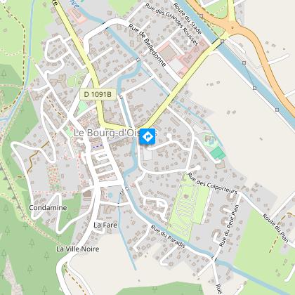
Bourg d'Oisans
From Bourg d’Oisans, follow the RD1091 towards Briançon.
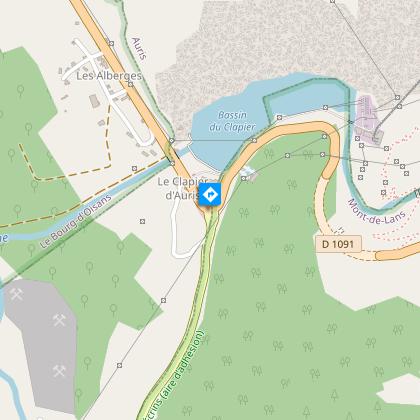
Le Clapier d'Auris
The road begin to rise from here.
Vallée du Ferrand
Cross the Chambon barrage and turn left to Mizoën - Clavans.
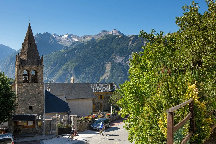
Mizoën village
Perched on a peak, Mizoen is the entrance to the valley Ferrand. This typical Oisans charming village offers a magnificent and panoramic view of Lake Chambon below the Meije, the gorges of the Romanche, and to the distant edges of Taillefer. Then follow the D25a towards Clavans le Haut - col de Sarenne.
Col de Sarenne
From the pass, go back down to Alpe d’Huez
Rond point de l'Europe / les Bergers
Au rond point suivre la direction Bourg d'Oisans à gauche. Ou, pour retrouver le centre de la station et descendre depuis LE virage n°1 ... Continuez tout droit.
Points of interest
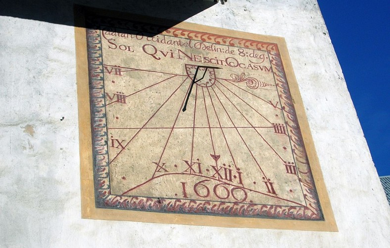
Sundials of Venosc
One of the oldest painted sundials in the "Dauphinoises" Alps.Dating from 1669, it bares an inscription stating "sun that doesn't know end" . Its needle disappeared and was replaced in 1998. The Roman numerals mark the hours with dots. The number 666 is supposed to represent the flames of hell. This must be seen in the context of the counter-reformation which saw the friars of the Bourg d'Oisans convent attempt to evangelise the Protestants in the Oisans.
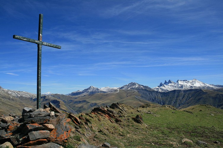
La Croix de Cassini
The Croix de Cassini is named after Cassini III of Le Freney who used it for his measurements under the reign of Louis XV. Cassini maps, drawn over 250 years ago, are just as accurate as our current IGN maps.The 2361-metre Croix de Cassini offers THE 360° panoramic view, one of the most spectacular in Oisans over the neighbouring valleys and mountain ranges. In the 18th century, César-François Pasini was entrusted with the ambitious assignment of mapping the kingdom of France. A number of cartographers before him had already offered their work, notably Nicolas de Nicolay, born in La Grave in the 15th century, commissioned by Catherine de Medici. Under Louis XIV, the task was then entrusted to Abbé Picard, who consulted the best engineers and, in particular, an outstanding astronomer named Gian Domenico Cassini, or Cassini I. The Cassini family, which included 4 generations of topographers from father to son, changed maps from a naive style to geometrical triangulation and toponymic surveying. Their maps were drawn between 1750 and 1790, with France being divided at the time into 181 maps. Previously the Croix de Cassini was named the Croix de Tournefort after the French botanist Joseph Pitton de Tournefort (1656-1708), who explored Savoy and the Dauphiné regions. Louis XV's surveyor, Cassini III, chose this summit to map the region in 1739 due to the unique characteristics of this open view point. The summit took his name in order to keep a record of the visit to this valley of the illustrious king's representative. Thanks to the magic of geometry, the Cassini maps, drawn over 250 years ago, are just as accurate as our current IGN maps and can be laid over the IGN maps or any satellite maps from the Internet, with hardly any noticeable differences. It is worth noting that there are many Monts Cassini in the mountains of France. The Croix Cassini itself was erected by Maximin Reymond and François Pichoud in 1975, although the exact date is unknown. Every year since 1999, on the last week of August, members of the association "La Montée de Cassini" raise a glass to friendship in front of the Cross, before sharing a good-hearted, friendly meal at the Col de Sarenne. Source: Mr Albertino ()
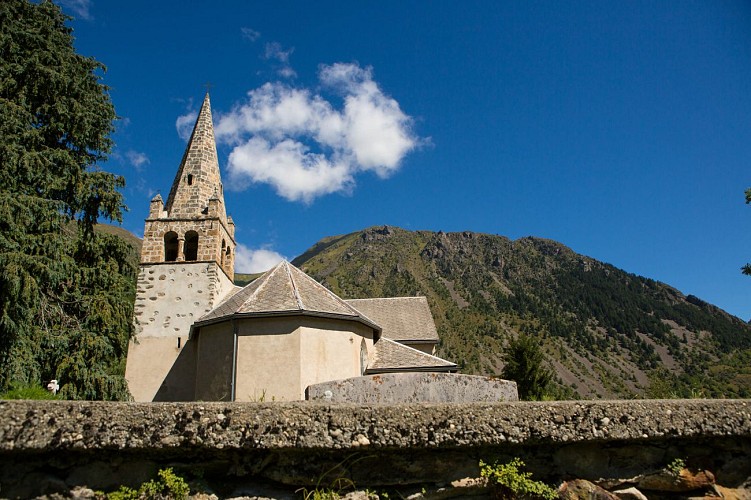
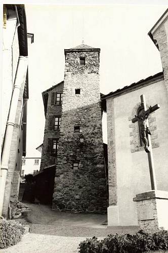
Eglise Saint-Pierre de La Garde-en-Oisans
Although mentioned for the first time in documents in 1058, Saint Peter's Church is almost certainly older. Its very good current condition conceals this fact, especially following recent renovation work to replace the damaged belfry.We know from the archives that La Garde held an important position in the parishes of Oisans in the Middle Ages, as it had a castle mound (typically a mediaeval defence structure), two towers and a stronghold. The position of the church bears witness to its age, since churches were traditionally built on a rocky outcrop or promentory in order to be both seen and heard. Indeed, the sound of ringing bells had to travel far to reach the peasants in the Alpine pastures or other villages. Having survived for centuries, the church has undergone a number of changes, since architectural digs have revealed an earlier building and graves. In April 2013, the wooden belfry supporting the bells was replaced and a bell ringing the note "D" was added! A sundial can be seen on the southern face.
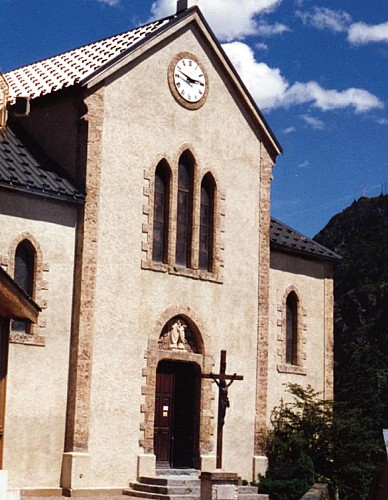
Eglise Saint-Ferrèol d'Huez
Eglise de Saint-Arey
Saint Arey was the Bishop of Gap between 579 and 614. Born into a noble Gallo-Roman family, he was ordained priest, and then Bishop of Grenoble, before continuing his vocation in the Triève and in Gap. Documents proving existence of the church date back to at least 1096.A number of legends are associated with the life of Bishop Saint Arey, but the most famous is the legend of the bear: On his way back from Rome in 605, Arey travelled over the Col du Montgenèvre on his way to Gap via Briançon. In the woods, his carriage came across a bear, which scared away one of the harnessed oxen. Arey then ordered the bear (or made a pact depending on the version,) to take the place of the ox under the yoke. The submissive animal allowed itself to be harnessed and the Bishop arrived in Gap pulled by one of the most original teams ever seen. The bear was freed and took refuge in nearby woods. According to the legend, the bear only emerged on the day of the Bishop's burial in 614. The church that we see today was built in 1840. with the first stone, blessed by the Bishop, laid on 11 May. Once the church was consecrated, a lead box sealed with the arms of the Bishop and containing the relics of several saints was placed in the tomb of the high altar, which was not consecrated itself. The former church had been dedicated to Saint-Arey and he remained patron saint of the new church. Shortly after it was built in 1878, the church received a visit, as recounted in a document of unknown origin: " The church, isolated on a rock overlooking the Romanche river, stands several stories high at an altitude of 982 m. It was rebuilt in 1841 and is shaped like an ogival-style Latin cross. The solid, old bell tower has been kept, although it is in the 11th century Roman style. The chimes are very pretty, even though the bells are not heavy. The church portal is truly remarkable, built with a type of large grain porphyry - a rare stone that is found locally. The interior of the church is very simple, without any decoration or stained-glass windows. The altar is made of white marble and is rather elegant. Some pictures of certain merit decorate the Sanctuary, representing Saint-Arey, the patron of the Parish, talking with Pope Gregory VII." Information from freneydoisans.com/freneytique/ Sources: Associations Coutumes et Traditions de l'Oisans / Freneytique - Fonds d'Archives numériques André Glaudas
Dans les rues d'Huez village

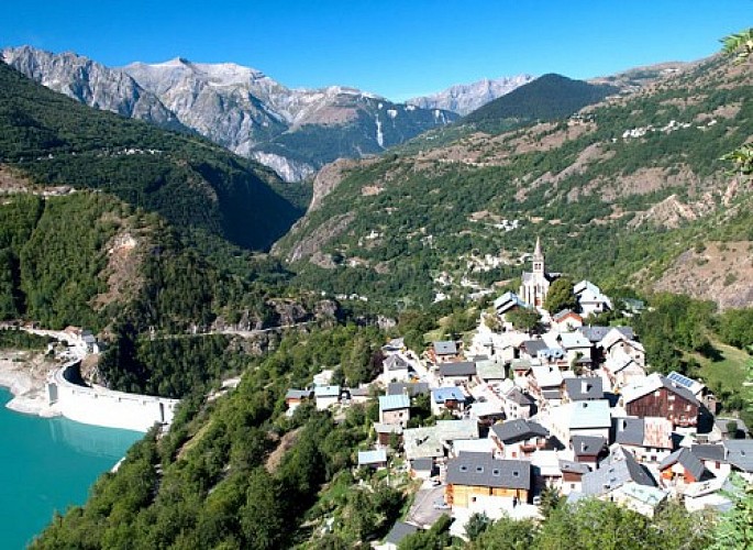
Mizoën
Sitting on a rocky peak, Mizoën is the front door of the Ferrand valley. This charming village of Oisans gives a beautiful and panoramic view on the Chambon lake, located below.Offers a beautiful view of the Meije mountain, the gorges of Romanche and the Taillefer summits. The village of Mizoën is shaped by history and legends (the Huguenots before the revocation of the Edict of Nantes, the history of the Chambon dam in 1920 – 1930,) shaped by the farmers' work, by transhumance, by its traditions and its old paths surrounded by oratories. You can also visit the museum in the Clots hamlet, located near a mountain hut, that will teach you about the life of farmers before. The village is also located in the middle of beautiful landscapes : the Clots, the Emparis plateau and its lakes. You will find in Mizoën a warm and friendly atmosphere where you will be able to rest, discover and contemplate.
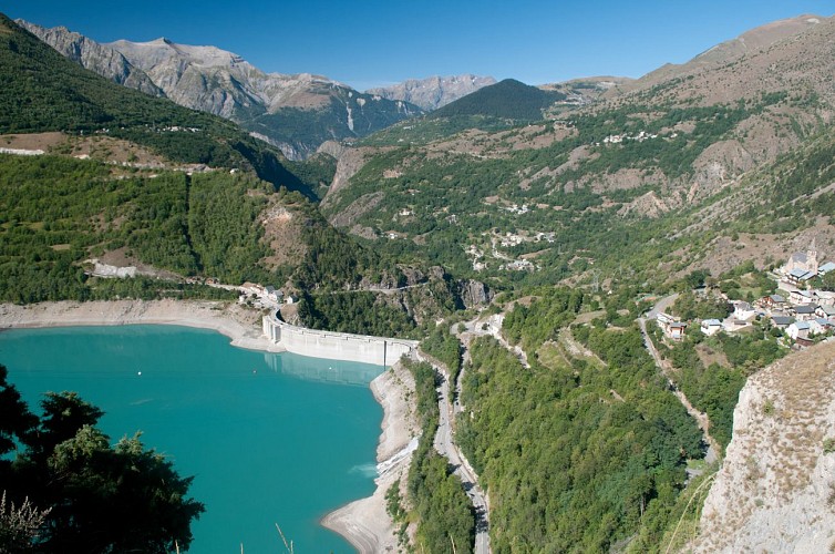
Barrage du Chambon
The Chambon dam was built between 1929 and 1935. In 1918, the industrialist Henri Frédet discovered the potential of this narrow, 75m long section of the Romanche river. It proved to be the ideal location for regulating the flow of the river.In 1921, studies showed that the presence of hard, cristallin schist in the soil provided a perfect seal for the water. The potential of hydroelectricity drew the attention of speculators during the 1920s stock exchange boom. Despite having to flood the villages of Le Chambon,Le Dauphine and Pariset, work began on the dam. During the construction period, a temporary cable car was set up over a 10.5 km stretch from Bourg d'Oisans to Le Chambon to supply the site with cement and other materials more rapidly. This cable car had 193 huge buckets that could each carry 250 km of cement. 62 metal pylons were built 900 m apart, some up to 40 m high, to bear the weight of the 22.5 km steel cable. The reservoir filled with water between 24 April and 9 October 1935. As early as May 1935, the turbines of the Sainte-Guilherme power plant were being driven by water and intake from the neighbouring Ferrand Valley was later added to boost the supply of water.
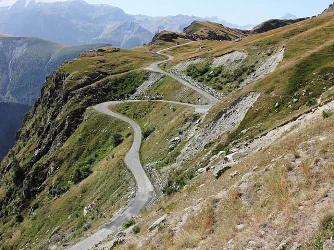
Route d'exception : le Col de Sarenne par la vallée du Ferrand
We reach the Sarenne pass by following a series of hairpin bends that slowly weaves above the beautiful Ferrand valley until the Emparis Plateau. Did you know that the word Ferrand comes from the latin term “ferus” which means wild?So much to do! The chamois is almost more common that human in this area dedicated to the mountain. A unique road to discover! A beautiful, open sky visit of the typical landscapes of Oisans. The Vallée du Ferrand, dedicated to pastoralism is completely different from its neighbour the Vallée de Sarenne. Here you are in a fragile environment, protected in order to save the animals and the pastures. So discover with care and stay on the roads.
Date and time
- From 01/04/2024 to 31/10/2024
- From 01/04/2025 to 31/10/2025
Additional information
Environments
Mountain location
Updated by
Oisans Tourisme - 08/04/2024
www.oisans.com
Report a problem
Open period
From 01/04 to 31/10.
Subject to favorable snow and weather conditions.
Contact
Phone : 04 76 80 03 25
Email : infos@oisans.com
Website : www.bike-oisans.com/
Topo guides and map references
Topo guides references :
Itinerary no. 6 of the “Cycling in Oisans” guide (Oisans Tourisme)
Map references :
Michelin Local Map no. 333 Isère, Savoie
Data author
