Alert
Alerts
Alpe d'Huez, the wild climb
Description
This itinerary will take you along the wild and wonderful roads of the Ferrand Valley. The first part is a good leg-warming stretch before you start the gruesome climb up to the Col de Sarenne. You will meet more sheep than cars on the road!
This route is available on the "Vélo en Oisans" map (Oisans Tourisme)
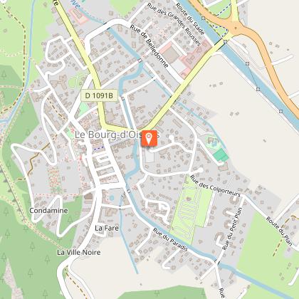
Start/Finish (loop): Bourg d'Oisans 720 m
Duration: 3 hours
Distance: 52 km
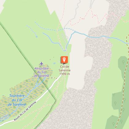
Maximum elevation: 1,999 m
Minimum elevation: 720 m
Elevation gain: 1,705 m
Maximum gradient: 12%
Map: Michelin Isère and Savoie Department Map No. 333
ROUTE
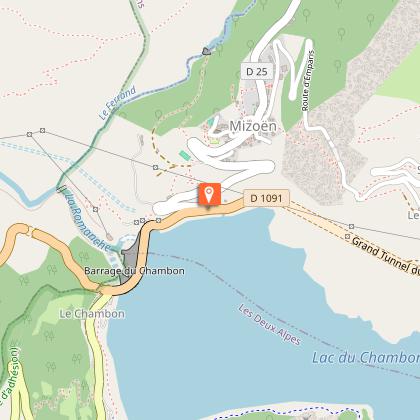
From Bourg d’Oisans, head toward Briançon on the D1091 until you reach the Chambon Dam. You will pass through four lit tunnels on this stretch; for your safety, make sure you are visible.
Cross the dam, and 200 m after that, turn left toward Mizoën. Continue on the road (D25 then D25a) to Clavans-le-Haut and the Col de Sarenne.
At the pass, you’ve reached the highest point of your route: 1,999 m. You can take a break at the Col de Sarenne mountain hut; then, all you have to do is let yourself glide down to Alpe d’Huez along the paved road.
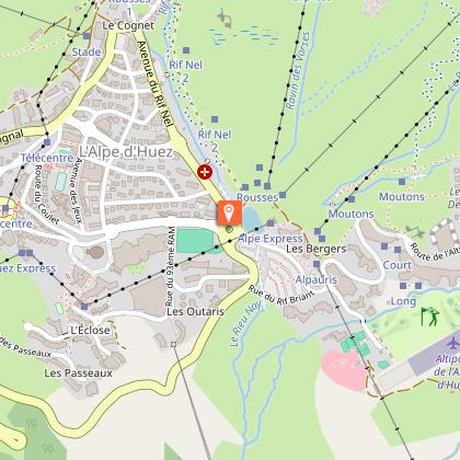
Once you reach the Bergers neighborhood, turn left at the Europe roundabout to head back to Bourg d’Oisans. Or, to return to the resort center and descend from Turn No. 1… continue straight ahead.
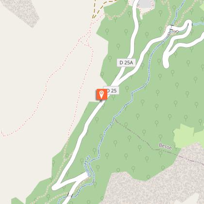
BONUS: Besse-en-Oisans
You can add the climb to Besse-en-Oisans to this route. The village is a designated historic site and well worth a visit!
As you leave the village, don’t miss the artisanal bakery known throughout the region for its wood-fired bread.
---
Distance (round trip): 8 km
Elevation gain: 305 m
Duration: 45 min
Technical Information
Altimetric profile
Starting point
Steps
Date and time
- From 01/04/2026 to 31/10/2026
- From 01/04/2027 to 31/10/2027
Additional information
Environments
Mountain location
Updated by
Oisans Tourisme - 24/06/2026
www.bike-oisans.com
Report a problem
Open period
From 01/04 to 31/10 daily.
Subject to favorable snow and weather conditions.
Contact
Phone : 04 76 80 03 25
Email : infos@oisans.com
Website : https://www.bike-oisans.com/
Topo guides and map references
Topo guides references :
This route is available on the "Vélo en Oisans" map (Oisans Tourisme)
Map references :
Michelin Local Map no. 333 Isère, Savoie
Data author
