Alert
Alerts
Col d'Ornon, Col de Parquetout
Description
This fairly easy road through the Lignarre Valley is very popular among cyclists at the beginning of the season. The bravest cyclists will use this warming up to carry on to the Valbonnais side up to Col de Parquetout, one of the toughest in the region.
This route is available on the “Vélo en Oisans” map (Oisans Tourisme)
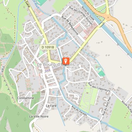
Start/Finish: Bourg d’Oisans 720 m
Duration: 1 hr 20 min
Distance (round trip): 28 km
Maximum elevation: 1,380 m
Minimum elevation: 716 m
Elevation gain: 764 m
Maximum gradient: 10%
Map: Michelin Isère and Savoie Department Map No. 333
ROUTE
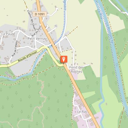
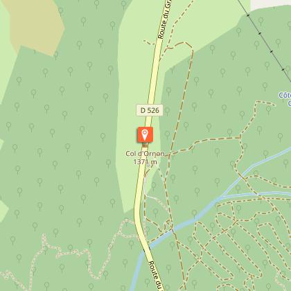
From Bourg d’Oisans, take the D1091 toward Grenoble. After 2 km, turn left toward Valbonnais–La Mure–Ornon via the D526. The Col d’Ornon is at the 14 km mark. The final kilometers before the Col d’Ornon are a bit steeper than the rest of the route, though never too grueling.
At the pass, you can stop for a break at the lodgings and restaurants in the Col d’Ornon ski resort.
THE “EXTRA BONUS”: Col de Parquetout
If you’re brave enough to make it all the way to the Col de Parquetout, the atmosphere changes dramatically! Although this climb is short, it won’t give you a moment’s respite. It’s one of the toughest passes in Isère!
Max. gradient 16%, average gradient 10%, min. gradient 9%… that sets the tone.
From the Col d’Ornon, descend toward La Mure. Pass through Chantelouve and Entraigues. At the 16th kilometer, leave the D526 by turning left just before the bridge leading to Valbonnais—easily recognizable by its wooden framework. You have 7 km left to ride on the D212f before reaching the pass.
---
Distance (round trip): 48 km
Duration: 3 hrs 30 mins
Elevation gain: 747 m
Technical Information
Altimetric profile
Starting point
Steps
Date and time
- From 01/05/2026 to 15/11/2026
- From 01/05/2027 to 15/11/2027
Additional information
Environments
Mountain view
Mountain location
Updated by
Oisans Tourisme - 25/06/2026
www.bike-oisans.com
Report a problem
Open period
From 04/01 to 10/31 : open daily.
depending on snow conditions.
Contact
Phone : 04 76 80 71 60
Email : info-allemond@oisans.com
Website :
https://www.bike-oisans.com
https://www.oisans.com/stations-et-villages/allemond/
Topo guides and map references
Topo guides references :
This route is available on the "Vélo en Oisans" map (Oisans Tourisme)
Data author
