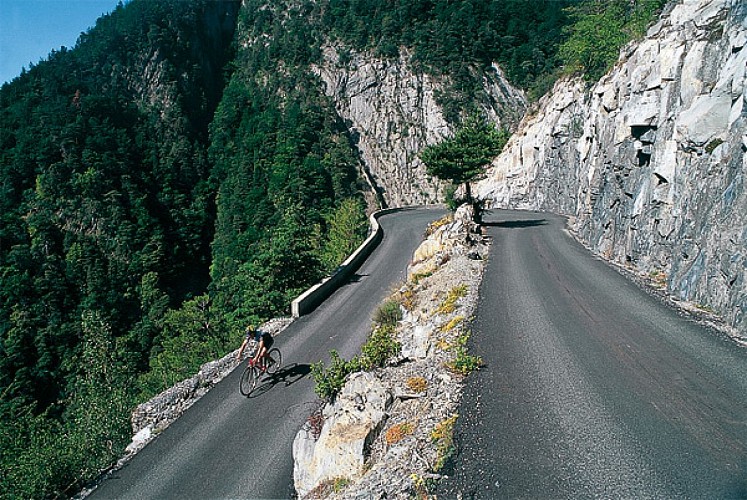
The steep climb to Oulles
Description
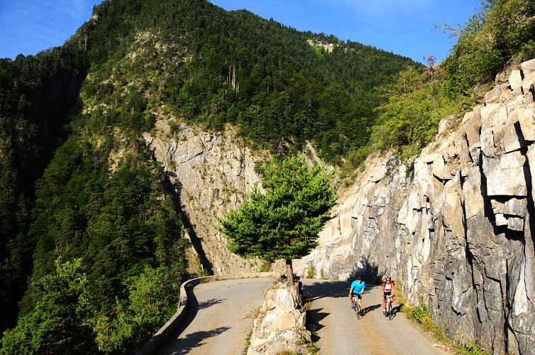
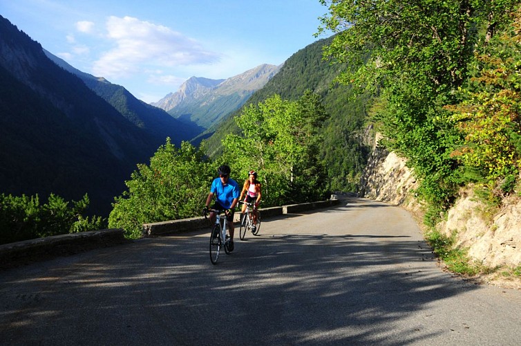
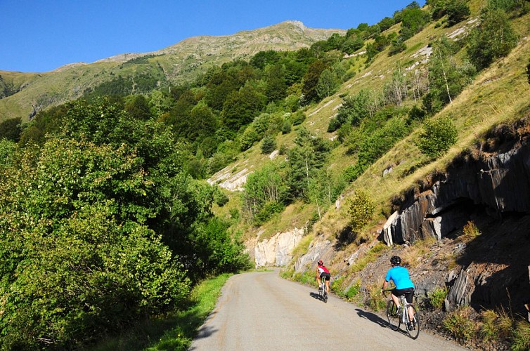
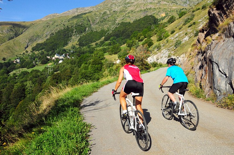
The 7 km of hairpin bends are quite strenuous, but the uphill ride remains pleasant on this small and little-used road. There is a somewhat Mediterranean feel to this south-facing, wind-sheltered slope with its covering of pine trees!
Itinerary no. 9 of the “Cycling in Oisans” guide (Oisans Tourisme)
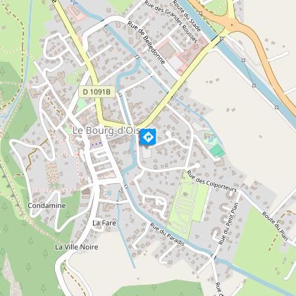
Departure / Arrival: Bourg d’Oisans 720 m
Time: 1 h 15
Distance (R/T): 22 km
Highest point: 1400 m
Lowest point: 716 m
Total ascent: 768 m
Max. gradient: 10%
Map: Michelin Local Map no. 333 Isère, Savoie
ITINERARY
From Bourg d’Oisans follow the D1091 towards Grenoble.
After the second kilometre, turn left and follow the D526 to cycle towards “Ornon / Oulles”.
After 1.6 km turn right and take the D221 to Oulles.
At the agenda, 7 km of hairpin bends on a steep slop... until the end.
This road ends in a cul-de-sac, so you will cycle the same route to go back.
HISTORY
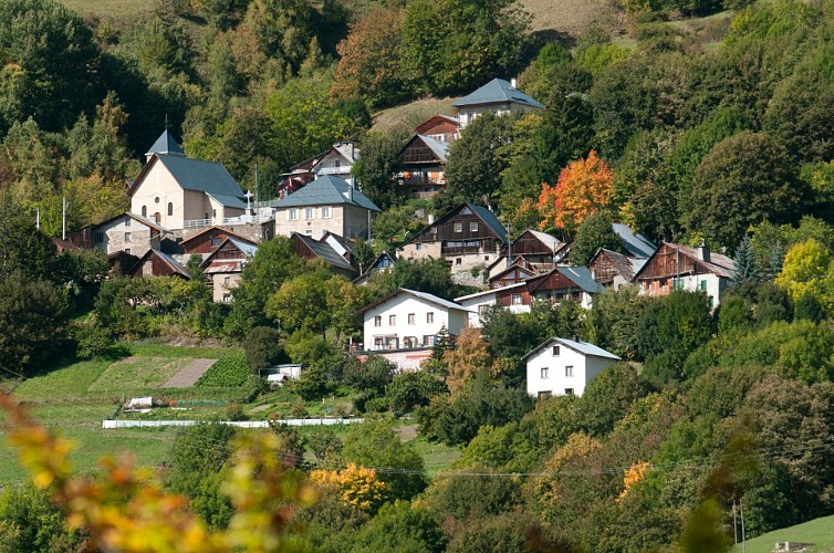
It was not until 1963 that Oulles, the smallest municipality of Isère, became accessible to vehicles with the excavation of its first proper road cut straight through the rock. The little mountain village facing the La Meije and the Ecrins mountains had therefore remained relatively cut off from the world until only recently, and has preserved all its charm.
In the Middle Ages there were also silver mines.
Technical informations
22 km
|
max. 1416 m
min. 717 m
768 m
| |||
Accessibility | ||||
Style : Mountain Public : CyclistsReserved for experts/confirmed | ||||
Altimetric profile
Starting point
Steps
Start : Bourg d'Oisans
From Bourg d'Oisans take the RD1091 towards Grenoble.
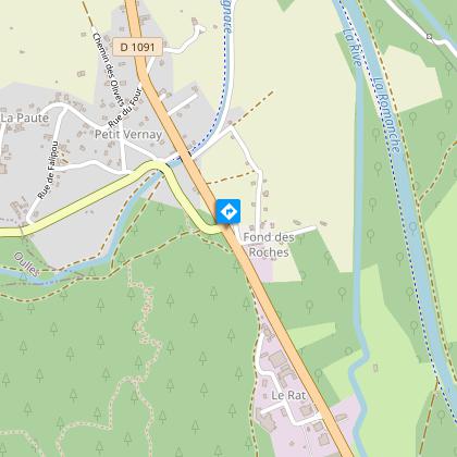
La Paute
After 2 km turn left towards Valbonnais - Ornon on the D526. After 4.2 km, turn right onto the D221 towards Oulles.
Turn right to Oulles
The road to Oulles, narrow and winding, was a challenge to build.
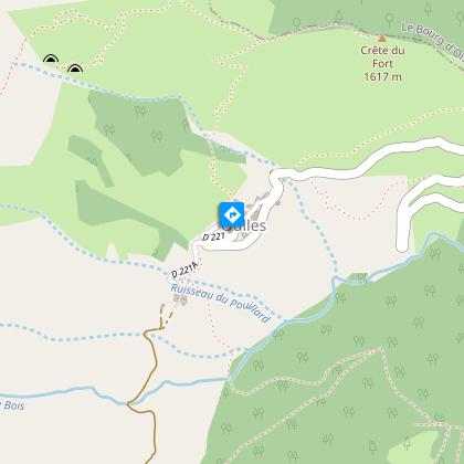
Arrivée : Oulles
Les Grandes Rousses, la Meije, la Barre des Ecrins, le panorama est à couper le souffle. C'est celui dont profite Oulles, ce minuscule village niché dans un cul-de-sac en Oisans. Retour par la même route.
Points of interest

Village d'Oulles
Oulles is one of the smallest villages in the Alps, with fewer than a dozen year-round residents. Nestling at the top end of a valley, it offers breathtaking views over the Grandes Rousses, the Meije and the Barre des Ecrins.If you climb a little higher above the village, you will be rewarded with an even greater view. Located at an altitude of 1400 m on the Massif du Taillefer, Oulles Is the least populated village in Isère. The road leading up to the village is a sign of the sheer steepness of the surrounding mountains. Locals even say that it is so steep around Oulles that the inhabitants used to shoe their chickens! But it all adds to the charm of the village. Oulles has only been accessible to vehicles via this road cut into the rockface since 1963. Immense effort was required to claw back these 7 kilometres of switchbacks from the mountainside - a miracle to create a path out of such a steep mountainside. All this gives you an idea of this incredible road that leads to the little village of Oulles, intact and with unspoilt charm, looming out of the past… (The road is narrow and winding, so drive carefully). A wide range of mountain activities can be enjoyed in Oulles. Cycling, for example, up the 7 km of switchbacks, although the climb is very pleasant on this wooded mountainside, protected from the wind. Hiking with the family on the path to Ornon or slightly more challenging hiking up to the Taillefer mountain hut, as well as the Grand Galbert, Lac du Poursollet, the summit of the Taillefer, Lac Fourchu, Puy d'Oulles and others. All this can also be explored and enjoyed in winter on snow shoes and ski touring. Last but not least, a mountain biking path starts from the village on the Chemin de Malaine, although it is suited to experienced mountain bikers, as there are 84 switchbacks over the 680 m descent! For more information if the 'Mairie' is closed, please contact the Bourg-d'Oisans tourist office.
Route d'exception : La route d'Oulles
Oulles, en Oisans, est l'un des plus petits villages des Alpes. Ce tout petit village niché dans un cul de sac bénéficie d'une vue à couper le souffle : Les Grandes Rousses, la Meije, la Barre des Écrins.En montant un peu au-dessus du village la vue s'ouvre encore. Situé sur le massif du Taillefer, à 1400 m d'altitude, Oulles est la commune la moins peuplée du département de l'Isère. La route donne le ton, le pays est très raide. Dans la région, on raconte qu’à Oulles, il y a tellement de pente qu’on y ferrait les poules ! Et c'est peut-être là tout son charme. Oulles n’est desservie par une voie carrossable taillée dans la roche que depuis 1963. 7 km d’épingles gagnés à la montagne, au terme d’efforts incommensurables pour trouver un chemin dans cette verticalité. Cela vous donne une idée de cette route incroyable sur ce versant boisé et protégé du vent qui permet d’accéder au petit village d’Oulles, intact, au charme préservé, comme surgi du passé… (Route étroite et sinueuse, conduisez prudemment) A Oulles on retrouve les principales activités de montagne ; cyclisme, randonnée familiale ou sportive, raquette et ski de randonnée, VTT
Date and time
- From 01/05/2024 to 15/11/2024
- From 01/05/2025 to 15/11/2025
Additional information
Environments
Mountain location
Mountain view
Updated by
Oisans Tourisme - 08/04/2024
www.oisans.com
Report a problem
Open period
From 05/01 to 10/31 : open daily.
Contact
Phone : 04 76 80 03 25
Email : info@oisans.com
Website : www.bike-oisans.com
Topo guides and map references
Topo guides references :
Itinerary no. 9 of the “Cycling in Oisans” guide (Oisans Tourisme)
Map references :
Michelin Local Map no. 333 Isère, Savoie
Data author
