La Marmotte
Description
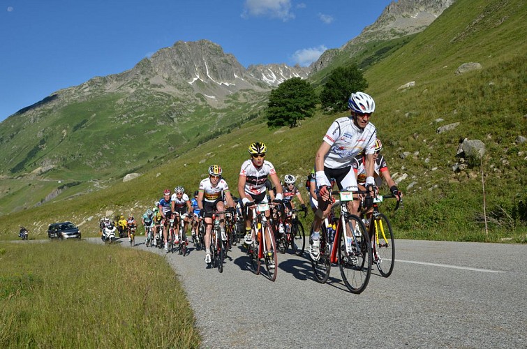
La Marmotte is one of the most beautiful bicycle racing competitions. This long and difficult route (5016m ascent) will lead you between Oisans and Savoy via Col du Glandon and Col du Galibier ending with the 21 bends of Alpe d'Huez.... So, are you ready?
Itinerary no. 16 of the “Cycling in Oisans” guide (Oisans Tourisme)
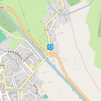
Departure: Bourg d’Oisans 720 m
Arrival: Alpe d'Huez 1850 m
Time: 8 h
Distance: 177 km
Highest point: 2630 m
Lowest point: 463 m
Total ascent: 5016 m
Max. gradient: 14%
Map: Michelin Local Map no. 333 Isère, Savoie
ITINERARY
From Bourg d’Oisans follow the D1091 towards Grenoble.
In Rochetaillée continue towards “Allemond / Col du Glandon - Col de la Croix de Fer”.
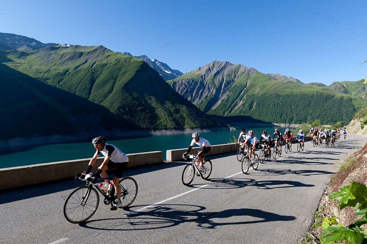
On leaving Allemond, climb up 2 hairpin bends to get to the top of the Verney dam. At the end of the dam, the route towards “Col du Glandon - Col de la Croix de Fer” will be signposted, taking you alongside the Lake Verney.
At the end of the lake, you will start a steep climb up to Rivier d'Allemond.
At Rivier, you can take a little breather before dropping down to the bottom of the valley and then attacking a new strenuous climb up to Lake Grand Maison.
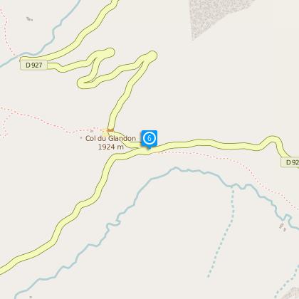
Once arrived at the lake, the steep-sided valley gives way to beautiful alpine pastures. The ride will be more easy-going from here to the Glandon Pass (1924 m).
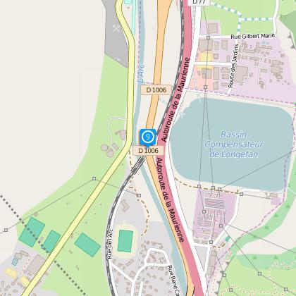
Once over the pass, continue along the D927 to Saint-Étienne-de-Cuines. Once you reached the village centre, fork to the D74 towards Sainte-Marie-de-Cuines. Pass under the motorway and take a right turn onto D1006 towards Saint-Jean-de-Maurienne, then towards Saint-Michel-de-Maurienne.
In Saint-Michel-de-Maurienne, turn right towards “Valloire / Col du Télégraphe / Col du Galibier”.
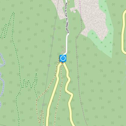
From Col du Télégraphe (1 570 m), cycle down and cross Valloire ski resort.
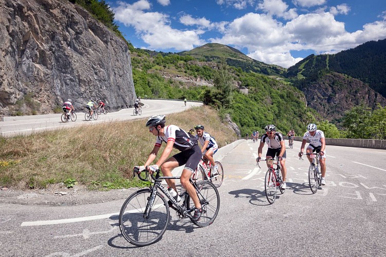
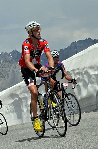
Here you are at last at the bottom of the legendary ascent of the Col du Galibier (2646 m). From the top of the pass, go down towards Le Lautaret (2058 m) to catch up with the D1091 and return to Bourg d’Oisans.
And to round it off nicely, cycle up the road to Alpe d’Huez and its 21 hairpin bends… and just breathe!
Technical informations
177 km
|
max. 2647 m
min. 462 m
5016 m
3886 m
| |||
Accessibility | ||||
Style : Mountain Public : SportsmenCyclistsReserved for experts/confirmed | ||||
Altimetric profile
Starting point
Steps
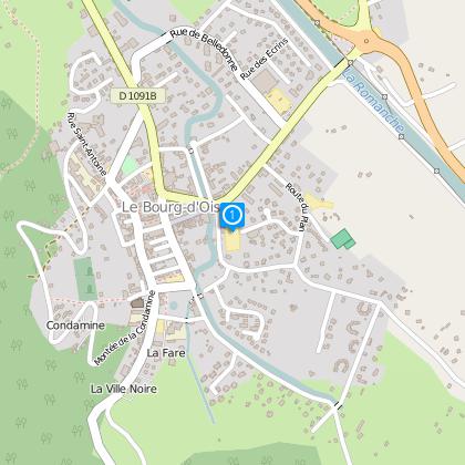
Bourg d'Oisans
From Bourg d’Oisans follow the RD1091 towards Grenoble.
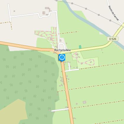
Rochetaillée
In Rochetaillée take the D526 to Allemont.
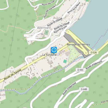
Allemont
Cycle through Allemont and take the road up to the ‘col du Glandon’.
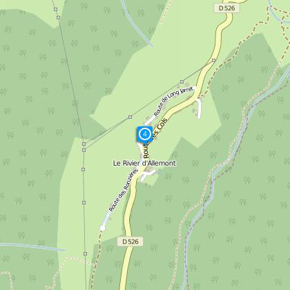
Le Rivier d'Allemont
From Rivier d'Allemont follow the road (down until the river and athletic rise to the dam of Grand' Maison).

Grand' Maison dam
From the dam the slope softens until the pass.
Towards to the col du Glandon.
Turn left onto the D927.
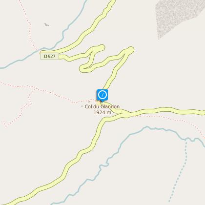
Col du Glandon
Go down the D927 to St Colomban des Villards then St Etienne and St Marie de Cuines.
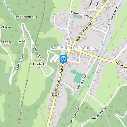
St Marie de Cuines
Join Saint Jean de Maurienne by D74.
Saint Jean de Maurienne
From Saint Jean, the D1006 will take you to Saint Michel de Maurienne.
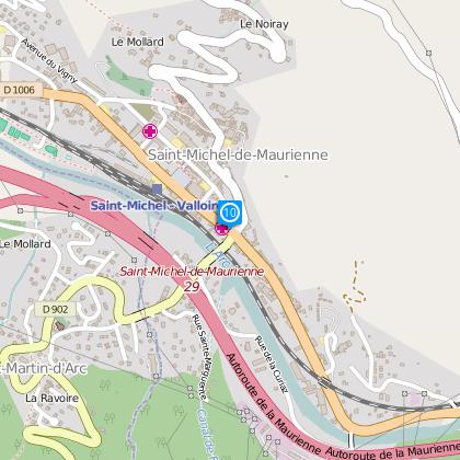
St Michel de Maurienne
From Saint Michel you should follow the D902 for the col du Télégraphe (1,570 m).
Col du Télégraphe
Go down to the ski resort of Valloire.
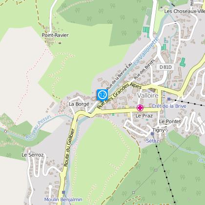
Valloire
Here you are finally at the bottom of the legendary ascent of the col du Galibier.
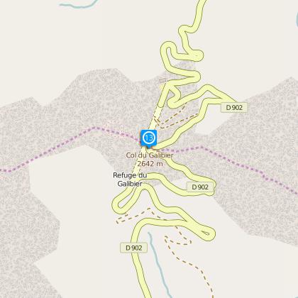
Col du Galibier
From this pass go down towards Le Lautaret.
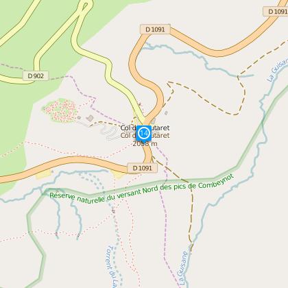
Col du Lautaret
Follow the RD1091 to Bourg d’Oisans, via La Grave, the Chambon dam and Freney d'Oisans.
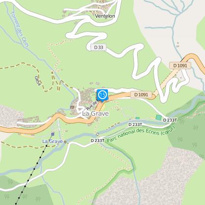
La Grave
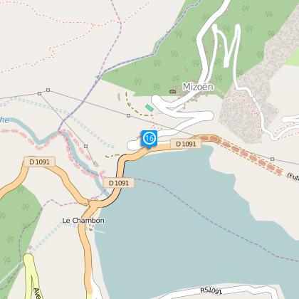
Chambon dam
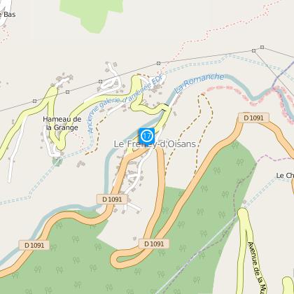
Freney d'Oisans
Bourg d'Oisans
And to round it off nicely, cycle up the road to Alpe d’Huez and its 21 hairpin bends...
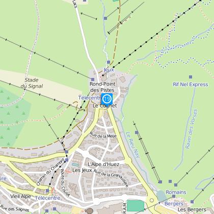
Alpe d'Huez
and ... Congratulations!
Points of interest
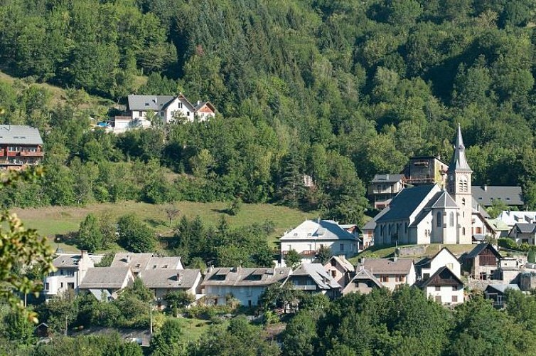
Bourg-d'Oisans village
Here you are in Bourg-d'Oisans at an altitude of 700m: all around you are mountains and underfoot is the plain. This landscape has been shaped over thousands of years at the same time as the Alps were being created.The mountains you see, and the plain you walk on, are the consequences of shifting continents, the major ice ages and the subsequent warming. Humans have also helped shape this landscape over the last few centuries, adapting to and taking advantage of natural and geological constraints. The dammed rivers and the network of drainage canals, for example, have allowed the habitat to expand and agriculture to develop in the plain, creating a mountain "bocage" with fields and hedges. However, these actions have never eradicated certain natural hazards, such as avalanches and rockfalls. Half-wild and half-tamed, this landscape and its features are home to a multitude of animal and plant species, some of which are protected. Lake St Laurent: when the Vénéon-Romanche glacier retreated, it stagnated in the lower valley and a lake of more than 5,000 hectares then occupied the entire valley from Bourg-d'Oisans to Allemond. The alluvium deposited by the Romanche and the Vénéon gradually plugged up the lake and filled in the plain to a depth of 500m. In fact, if it weren't for the lake, which gradually filled in, the village would only be at an altitude of 200m! Bourg-d'Oisans is now a delightful little town of international renown where mountain lovers come, both in summer and winter, to stay and enjoy the many activities on offer!
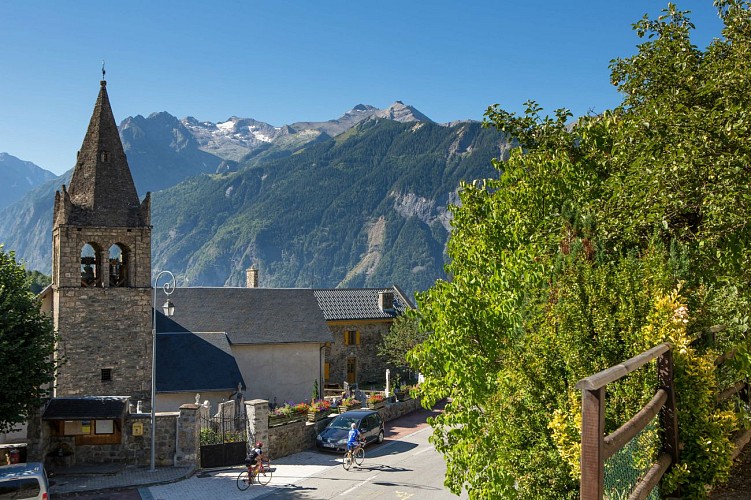
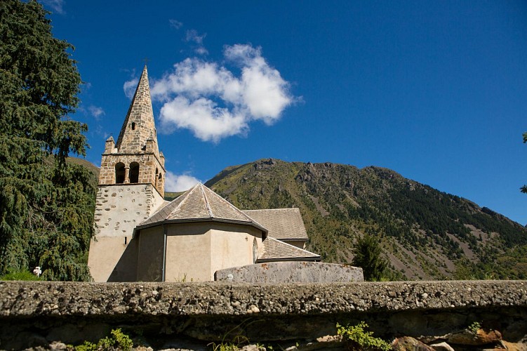
Eglise Saint-Pierre de La Garde-en-Oisans
Although mentioned for the first time in documents in 1058, Saint Peter's Church is almost certainly older. Its very good current condition conceals this fact, especially following recent renovation work to replace the damaged belfry.We know from the archives that La Garde held an important position in the parishes of Oisans in the Middle Ages, as it had a castle mound (typically a mediaeval defence structure), two towers and a stronghold. The position of the church bears witness to its age, since churches were traditionally built on a rocky outcrop or promentory in order to be both seen and heard. Indeed, the sound of ringing bells had to travel far to reach the peasants in the Alpine pastures or other villages. Having survived for centuries, the church has undergone a number of changes, since architectural digs have revealed an earlier building and graves. In April 2013, the wooden belfry supporting the bells was replaced and a bell ringing the note "D" was added! A sundial can be seen on the southern face.
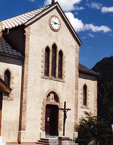
Eglise Saint-Ferrèol d'Huez
Eglise de Saint-Arey
Saint Arey was the Bishop of Gap between 579 and 614. Born into a noble Gallo-Roman family, he was ordained priest, and then Bishop of Grenoble, before continuing his vocation in the Triève and in Gap. Documents proving existence of the church date back to at least 1096.A number of legends are associated with the life of Bishop Saint Arey, but the most famous is the legend of the bear: On his way back from Rome in 605, Arey travelled over the Col du Montgenèvre on his way to Gap via Briançon. In the woods, his carriage came across a bear, which scared away one of the harnessed oxen. Arey then ordered the bear (or made a pact depending on the version,) to take the place of the ox under the yoke. The submissive animal allowed itself to be harnessed and the Bishop arrived in Gap pulled by one of the most original teams ever seen. The bear was freed and took refuge in nearby woods. According to the legend, the bear only emerged on the day of the Bishop's burial in 614. The church that we see today was built in 1840. with the first stone, blessed by the Bishop, laid on 11 May. Once the church was consecrated, a lead box sealed with the arms of the Bishop and containing the relics of several saints was placed in the tomb of the high altar, which was not consecrated itself. The former church had been dedicated to Saint-Arey and he remained patron saint of the new church. Shortly after it was built in 1878, the church received a visit, as recounted in a document of unknown origin: " The church, isolated on a rock overlooking the Romanche river, stands several stories high at an altitude of 982 m. It was rebuilt in 1841 and is shaped like an ogival-style Latin cross. The solid, old bell tower has been kept, although it is in the 11th century Roman style. The chimes are very pretty, even though the bells are not heavy. The church portal is truly remarkable, built with a type of large grain porphyry - a rare stone that is found locally. The interior of the church is very simple, without any decoration or stained-glass windows. The altar is made of white marble and is rather elegant. Some pictures of certain merit decorate the Sanctuary, representing Saint-Arey, the patron of the Parish, talking with Pope Gregory VII." Information from freneydoisans.com/freneytique/ Sources: Associations Coutumes et Traditions de l'Oisans / Freneytique - Fonds d'Archives numériques André Glaudas
Village d'Allemond
The history of Allemond has been marked by the mining industry and Alpine agriculture. Vieux Allemond, around the church and along the road leading to the Mairie, still has the traditional characteristics of Oisans villages.Allemond was known for its mining under Louis XIII and XIV, housing royal foundries (behind the tourist office), in which minerals mined around the village, mainly silver, lead and copper, were melted. For many years, the Hotel des Tilleuls (now closed) occupied some of the buildings of the former royal foundry. This hotel, featuring a superb walnut staircase, was bought in the 1920s by a former mayor of the village. His two daughters, Raymonde and Margarete, were well-known local characters who ran the hotel for many years. It was even rumoured that Napoleon III stayed there. Until the 1960s and 1970s, people lived very simple lives, nearly all as farmers. Then at the end of the 1970s, the Grand-Maison dam project was launched, providing a huge economic boost for the village and the region as a whole. The project lasted 10 years and brought many thousands of workers to the area. These days, the village lives mainly from tourism, both in summer and winter.
Barrage du Chambon
The Chambon dam was built between 1929 and 1935. In 1918, the industrialist Henri Frédet discovered the potential of this narrow, 75m long section of the Romanche river. It proved to be the ideal location for regulating the flow of the river.In 1921, studies showed that the presence of hard, cristallin schist in the soil provided a perfect seal for the water. The potential of hydroelectricity drew the attention of speculators during the 1920s stock exchange boom. Despite having to flood the villages of Le Chambon,Le Dauphine and Pariset, work began on the dam. During the construction period, a temporary cable car was set up over a 10.5 km stretch from Bourg d'Oisans to Le Chambon to supply the site with cement and other materials more rapidly. This cable car had 193 huge buckets that could each carry 250 km of cement. 62 metal pylons were built 900 m apart, some up to 40 m high, to bear the weight of the 22.5 km steel cable. The reservoir filled with water between 24 April and 9 October 1935. As early as May 1935, the turbines of the Sainte-Guilherme power plant were being driven by water and intake from the neighbouring Ferrand Valley was later added to boost the supply of water.
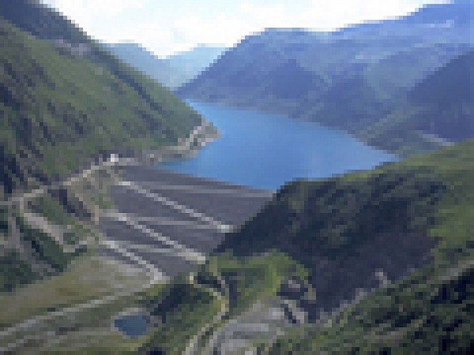
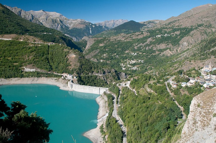
Barrage de Grand'Maison
La voie de Rochetaillée
Rochetaillée lierally means "cut rock" in French and looking up at the road carved out of the cliff face, it is clear how the village got its name. However, the exact origin of this road appears lost in the folds of history.Is this road, as many people believe, the remains of a Roman road, the indelible mark of an unstoppable sovereign population? Or, as Doctor Roussillon suggests in his Traveller's guide to Oisans, is it "the still visible trace of a path created during the existence of the lake, along the bottom of the neighbouring mountain and behind the small hamlet of Rochetaillée, from which it draws its name. Such were the circumstances in which this path was built." An observor at the end of the 19th century reported certain similarities beween the Porte des Bons and the Rochetaillée road, suggesting a close correlation between the two. Marks and tracks on the ground were reported to be similar and of exact equal width. Unfortunately, no trace of these marks has been found since and the campaign to clear and clean the site carried out by in 2004 by "Customs and Traditions of Oisans" also failed to uncover any evidence. To better understand this, it needs to be remembered that in the last century, the plain through which the road passes was like a desert without any vegetation. Both the cliff and the plain were completely bare, meaning that it was no doubt easy at the time for witnesses to observe and note the smallest details. These days, the road is virtually covered by vegetation and in some places, you can almost walk past without noticing it. But why carve the road out of the rock? If we go along with Docteur Roussillon's theory, the creation of Saint-Laurent lake would be the only tangible reason for this project, which must have involved considerable manpower and resources. The other theory, if we consider this to be a Roman road, suggests that any rapid progress towards the high mountain passes was hindered by the neighbouring plain. Perhaps it was a swamp or a lake that was liable to flooding due to the unpredictable behaviour of the Romanche river? The size of the project to build the road would also prove the importance of the "Oisans way" in the eyes of the Romans. Along the entire length of the platform, rectangular markings are carved out of the stone at regular intervals. These suggest that a structure consisting of beams and a wooden floor covered the road, widening it from 2 metres to 3 or 4 metres and making for easier progression. At suitable points, wider platforms were installed, known as "garages" that served as passing places for animals and carts. To this day, the track linking Rochetaillée to Bourg d'Oisans, via the hamlets of La Paute and Les Sables, is known as the "Chemin Romain". Source: Freneyd'Oisans.com/Mr Albertino
Date and time
- From 01/06/2024 to 31/10/2024
- From 01/06/2025 to 31/10/2025
Additional information
Environments
Mountain location
Mountain view
Updated by
Oisans Tourisme - 08/04/2024
www.oisans.com
Report a problem
Open period
From 01/06 to 31/10.
Contact
Phone : 04 76 80 03 25
Email : info@oisans.com
Website : www.bike-oisans.com
Topo guides and map references
Topo guides references :
Itinerary no. 16 of the “Cycling in Oisans” guide (Oisans Tourisme)
Map references :
Michelin Local Map no. 333 Isère, Savoie
Data author
