Hiking trail: Lac du Carroley
Description
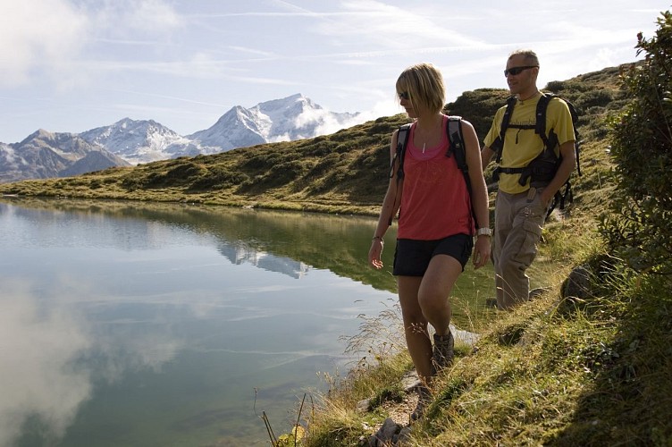
A lovely family walk with fabulous views of Mont Blanc and Mont Pourri
Les Bauches, a beautiful "secret" valley in Montchavin-Les Coches where Pramain stream marks the start of the trail before taking you to the end of the valley with lush grassy areas all the way to Lac du Carroley. You will also see herds of cows and sheep in the mountain pastures.
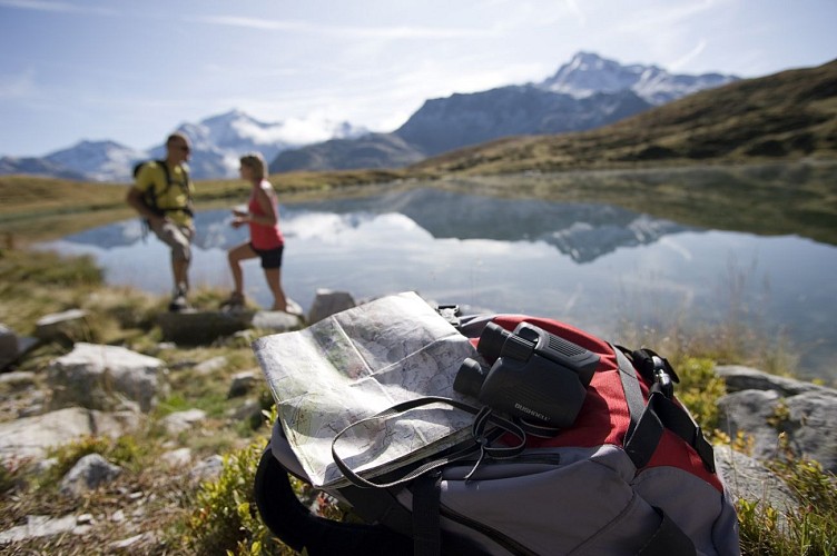
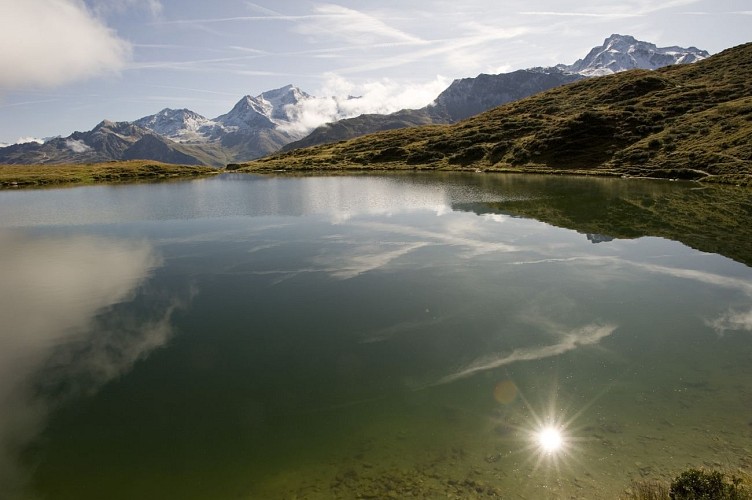
Lac du Carroley is a beautiful mountain lake where you you can observe fish, tadpoles and frogs.
Technical informations
6 km
|
min. 99999 m
416 m
416 m
| |||
Styles : HikingMountain Public : Family | ||||
Altimetric profile
Starting point
Steps
Télésiège Pierres Blanches
Comme en hiver, gagnez les sommets sans fatigue et accédez aux somptueux panoramas des Alpes tout en découvrant la montagne à votre rythme. Ce télésiège, au départ du Sauget, vous emmène au Pierres Blanches.
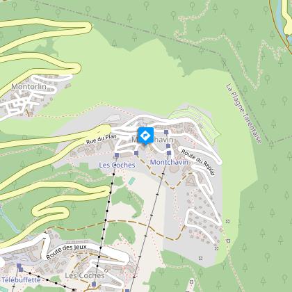
Télésiège de Montchavin (Fermé Eté 2013)
Comme en hiver, gagnez les sommets sans fatigue et accédez aux somptueux panoramas des Alpes tout en découvrant la montagne à votre rythme. Ce télésiège, au départ de Montchavin, vous emmène au Sauget.
Télésiège de Plan Bois
Comme en hiver, gagnez les sommets sans fatigue et accédez aux somptueux panoramas des Alpes tout en découvrant la montagne à votre rythme. Départ du centre des Coches, arrivée à Plan Bois.
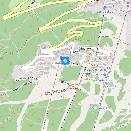
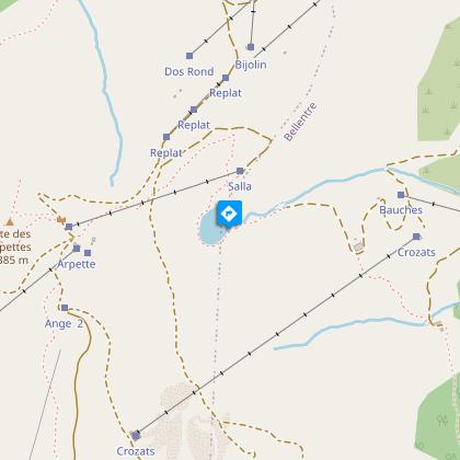
Les Bauches
Départ de la randonnée.Suivre la route puis le chemin de terre qui remonte la rive droite du ruisseau des Bauches. Après avoir traversé le torrent (gué), continuer le sentier qui marque quelques lacets jusqu'au passage du dérochoir (rochers humides).
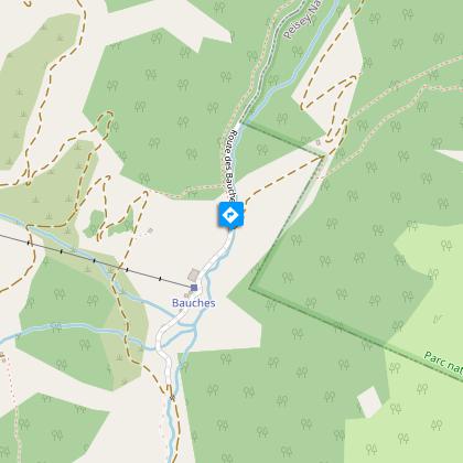
Le dérochoir
Suivre la route puis le chemin de terre qui remonte la rive droite du ruisseau des Bauches. Après avoir traversé le torrent (gué), continuer le sentier qui marque quelques lacets jusqu'au passage du dérochoir (rochers humides).Prendre alors à droite un sentier qui revient à l'horizontale. Après avoir traversé divers types de milieux, rejoindre le chalet du Carroley puis remonter quelques prairies pour découvrir le lac.
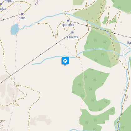
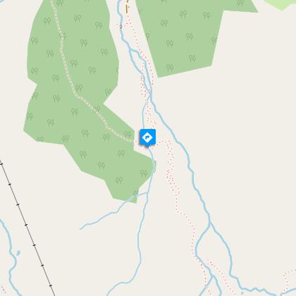
Le chalet du Carroley
Puis remonter quelques prairies pour découvrir le lac.Après un bon casse croûte, redescendre au chalet puis par une petite route bitumée, rejoindre le parking des Bauches
Le lac du Carroley
Après un bon casse croûte, redescendre au chalet puis par une petite route bitumée, rejoindre le parking des Bauches
Additional information
Updated by
Office de Tourisme de la Grande Plagne - 18/04/2024
www.la-plagne.com
Report a problem
Guidebook with maps/step-by-step
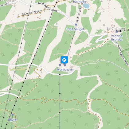
Start from: valley of Les Bauches
1/ Drive along the Les Coches road? At Fontaine Froide (junction), keep following the signs for "Les Bauches en voiture" until the end of the road (Les Bauches car park).
2/ Follow the asphalt road past the Auberge du Friolin and then the track that climbs up to the right of Pramain stream.
3/ After crossing the stream (ford), carry on up the switchbacks to Le Dérochoir (wet rocks).
4/ Once there, follow a path to the right which levels out and crosses varied terrain before reaching the Chalet du Carroley. After climbing though a few meadows, you reach the lake.
5/ After a good picnic, walk back down to the chalet and then down to the car park on the narrow road.
The trail is marked with beige signs + blue writing
Environments
Mountain location
Lake view
Mountain view
Open period
From 29/06 to 31/08/2024.
Contact
Phone : 04 79 07 82 82
Fax : 04 79 07 80 18
Email : info.montchavin@la-plagne.com
Website : www.montchavin-la-plagne.com
Facebook : www.facebook.com/montchavinlaplagne/
Tricky passages
Watch out for the creek crossing, which can be substantial depending on snowmelt and rainfall.
Topo guides and map references
Map references :
IGN map Les Arcs La Plagne 3532ET on sale in sports stores and newsagents - You can also find all our itineraries on sale in our tourist offices (€5).
Type of land
Rock
Stone
Ground
Not suitable for strollers
Reception complements
Whenever you go hiking, remember to take cereal bars, plenty of water, sunglasses, sun cream and a small first aid kit, as well as suitable clothes for your outing, according to the season and the weather forecast.
Data author
