CIRCUIT LE GUE DU SAUT XT N°2
Description
Thanks to the FFRandonnée and the village of Xertigny for the creation of this hike and for the work done by their teams throughout the year to mark out and maintain these paths. Marking: yellow rectangle n°2.
This trail – the sports version of the precedent – remains in the theme of the Sunday walk. It is longer of about ten meters to the south until the stream of Rechentreux meets the Semouse.
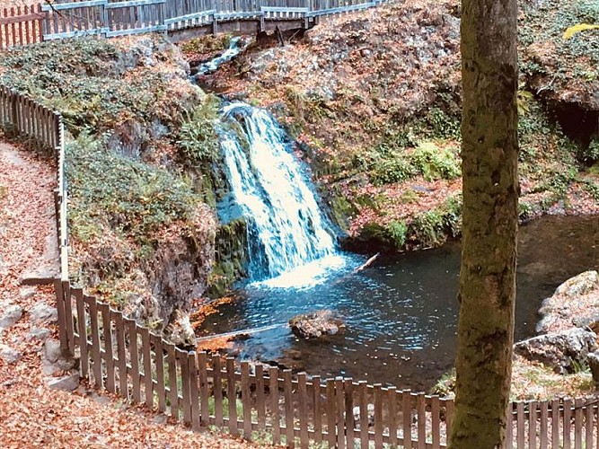
Besides the charming waterfall site, this route offers the crossing of a magnificent beech wood.
Park in the car park overlooking the waterfall. Go down to the waterfall and cross the small bridge to follow the path marked 02. The trail goes down along the Réchentreux stream until you reach the tarmac road. Turn left to the crossroads and then right just after the crossroads, the path climbs the slope. The slope is quite steep until you reach the split of path 10 which goes left to follow the 02 which continues on the right into the forest until you come down to the waterfall. Picnic tables and benches are available at the waterfall.
Key places:
• The valley of Semouse has witnessed the growth of the iron industry which was owed to the waterpower and the fuel coming from the forest, as well as the local mineral richness. It has welcomed up to 8 forges.
• The wire works of Blanc Murger is amongst the oldest manufacturing establishments, it is specialised in precision metal wire and still carries on this activity.
• The castle of Pruines (outside the route – private estate), 1km downstream of the Semouse on the D20a (3), testifies of the power of a blacksmith. You can still see nearby the former workers’ dwellings as well as the vestiges of the social organisation linked to it (schools, shops, places of worship).
• In addition, the silica of the sandstone soils and the charcoal power has enabled the development of numerous glass factories highly gathered to the west of the Vôge.
Technical informations
1.8 km
|
max. 492 m
min. 440 m
| |||
Altimetric profile
Starting point
Additional information
Producteur de la donnée
Ces informations sont issues de la plateforme SITLOR - Système d’Information Touristique - Lorraine
Elles sont synchronisées dans le cadre du partenariat entre Cirkwi, l’Agence régionale du Tourisme Grand Est et les membres du comité technique de Sitlor.
Data author
