Alert
Alerts
The Joncas and La Martelle hiking trail


Description
In a landscape imbued with tranquillity, between two valleys foreshadowing the convergence of the Sorgues and Dourdou rivers, this large hiking loop invites you to explore a discreet and surprising heritage.The starting point is the southern corner of the car park from which you reach the schoolchildren's path along the alley of poplars. Next, walk along the graveyard to get to a crossroads.Take to the left the rue du Pesquier up to the Balros intersection, carry straight on towards Vanière, le Vieuzet, Les Tombes, and le Joncas.On the edge of le Vieuzet, leave the tarred road and take a track towards Les Tombes and le Joncas to the left. Carry on for 600 m.Fork to the left side to have a look at the Visigoth tombs, which are carved into the rock (follow the markings). Then, walk back to the ascending path towards le Joncas.South-east of Balros, turn left and walk an ascending slope for 30 m, then go downhill slightly to the right. At the next intersection, south of Balros, carry straight on the trail for 600 m. take the path that rises on the left for 150 m.Once you get to the panoramic viewpoint, enjoy the scenic view over Vabres l'Abbaye and then keep walking to the south for 100 m.On the right side, you can walk there and back to visit a cave which is an old sand quarry. Or continue straight on for 50 m up to the intersection of Puech de la Martelle. Then, walk downhill to the right towards Saint-Apolit.On the intersection of Saint-Apolit, fork to the left to join the road.At the road junction, turn to the left and carry on the tarred road for 400 m. Leave the road on your right, cross the brook and walk uphill through the woodland by following the marking signs.At the Frioulas intersection, turn right in a hairpin. Go down through the woods for 1.7 km. At the road junction, turn right and follow the road for 150 m. Turn left and jump over the brook. Follow the Rougeiras path towards Vabres.Near the edge of Vabres, at the Mas de la Vigne intersection, walk straight down the schoolchildren's path, reach point n° 2, and then the car park of the starting point.
Technical Information
Altimetric profile
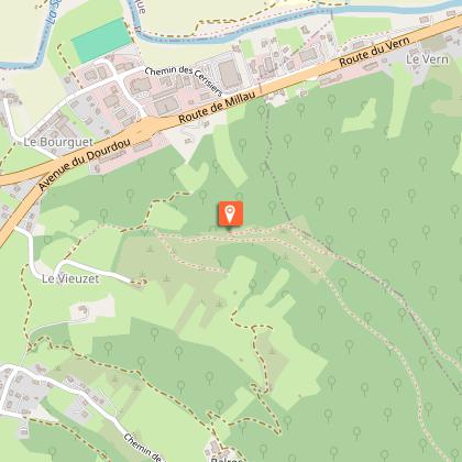
Starting point

Additional information
Public transport
Travel by bus or train: lio.laregion.fr/carpooling : BlaBlaCar, Rézo Pouce, Mobicoop, Idvroom, LaRoueVerte, Roulez malin
Advice
Box tree months are active from May to October. During the caterpillar phase, they feed on the leaves of box trees. They crawl down trees and move on long silken threads, although these threads are annoying when hiking they do not pose any health risk
Advised parking
Car park of the campervan area In Vabres-l’Abbaye
Access
On the D999 linking Millau to Albi, 4km after Saint-Affrique
Arrival
Car park of the campervan area In Vabres-l’Abbaye
Ambiance
Along this pastoral stroll which takes you to the Vabres countryside, a whole past is being reconstructed. Visigoth tombs, a disused sand quarry and the Saint-Apolit cave delineate this hike going throughout woodlands and the Joncas site, irrigated by several brooks. This route features an average difficulty and is the extended version of « the grave walking tour via Saint-Apolit ».
Departure
Car park of the campervan area In Vabres-l’Abbaye
Data author
