Alert
Alerts
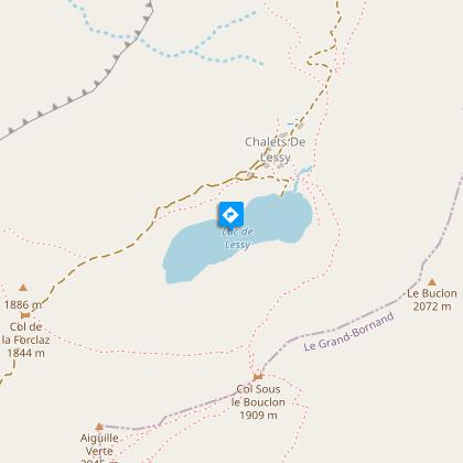
L'Aiguille verte and Le Lac de Lessy
Description
Starting from Le Grand-Bornand Chinaillon, a 2.5 hour loop during which 11 interpretive signs explain the different facets of the mountain environment: flora, fauna, habitat, geology, ...
Beware of storms on the ridge.
Alternative route possible to complete a loop with a return via the chalets of Mayse, Le Planay and the old village (elevation gain 1,100 m and 6½ hours).
Lake Lessy is part of the Natura 2000 programme, which aims to protect remarkable environments.
In terms of plant life, the lake is home to a very large population of alpine pondweed and a smaller population of thorny buttercup. In terms of amphibians, the lake has a colony of Alpine newts.
In this context, swimming is strictly prohibited.
The following are also strictly prohibited:
- Camping. It is only permitted under the stars (i.e. without tents, tarps or other types of shelter) near the communal refuge at Lake Lessy, with the permission of the caretaker.
- Campfires and outdoor fires, the use of stoves and barbecues.
- Drones.
- Slacklines.
Fishing is permitted: 1 catch per day per fisherman, single barbless hook, natural bait or fly only. River permits are available for purchase at the Grand-Bornand Tourist Office.
Technical Information
Altimetric profile
Starting point
Points of interest

Date and time
- From 15/05/2026 to 15/11/2026
- From 15/05/2027 to 15/11/2027
Additional information
Updated by
Le Grand-Bornand Tourisme - 03/04/2026
www.legrandbornand.com
Report a problem
Environments
Lakeside or by stretch of water
Mountain view
Waterside
Lake view
Mountain location
Close to a public transportation
Near shuttle stop
Village 2 km away
Location complements
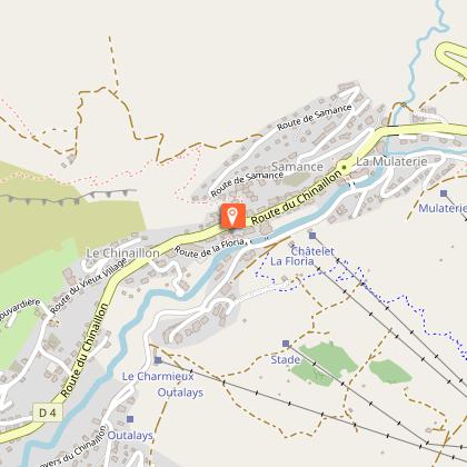
Parking on Route de l'Envers du Chinaillon, opposite the Chinaillon Tourist Office. Head towards the Tourist Office and walk up the high street until you reach Route de Samance.
Open period
From 15/05 to 15/11 daily.
From spring to autumn, depending on snow and weather conditions. Inquire about conditions before heading out. You are responsible for your own safety.
Subject to favorable weather.
Topo guides and map references
Topo guides references :
Hiking route map Tournette / Bornes / Aravis.
Map references :
Map IGN Top 25 n°3430 ET La Clusaz Grand-Bornand
Contact
Phone : 04 50 02 78 00
Email : infos@legrandbornand.com
Website :
https://www.legrandbornand.com
https://www.cirkwi.com/fr/circuit/185344-le-lac-de-lessy-et-l-aiguille-verte
Facebook : http://www.facebook.com/legrandbornand
Twitter : http://twitter.com/mongrandbo
Guidebook with maps/step-by-step
Start at the Chinaillon Tourist Office, head towards Samance by walking up the high street and then along the Route de Samance. At the first junction, continue straight on until you reach the hairpin bend where the nature trail begins; follow this trail to Sur la Queblerie. From there, continue towards the Samance ponds. Continue towards Lac de Lessy. Climb up to Sur le Freu and reach Domingit, then the summit of the Aiguille Verte by following the ridge. Return to Domingit, cross over to Sous le Buclon and descend to Lac de Lessy, skirting the lake on the right. Head back up the track towards the Col de la Forclaz, then follow the Chinaillon route via Chalets de Mayse. Descend to Chalets de Mayse and turn left to climb up to Planay. From there, descend to La Culaz, then La Bouvardière, and follow the track back to the Chinaillon.
Animals
Yes. Dogs must be kept on a lead at all times due to the presence of livestock.
Data author
