Alert
Alerts
Type of practice
Walking
Medium
3h30mn
Presentation
Description
Map
Points of interest
Ratings and reviews
See around
The Houve forest


Credit : Emmanuel Stourm 2020
Licence Open Data
IGN cards
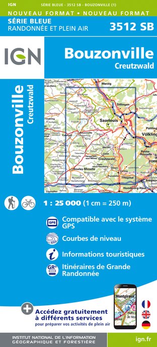
3512SB - BOUZONVILLE CREUTZWALD
Editor : IGN
Collection : TOP 25 ET SÉRIE BLEUE
Scale : 1:25 000
13.90€

TOP100D57 - MOSELLE METZ THIONVILLE PNR DE LORRAINE PNR DES VOSGES DU NORD
Editor : IGN
Collection : TOP 100
Scale : 1:100 000
8.40€
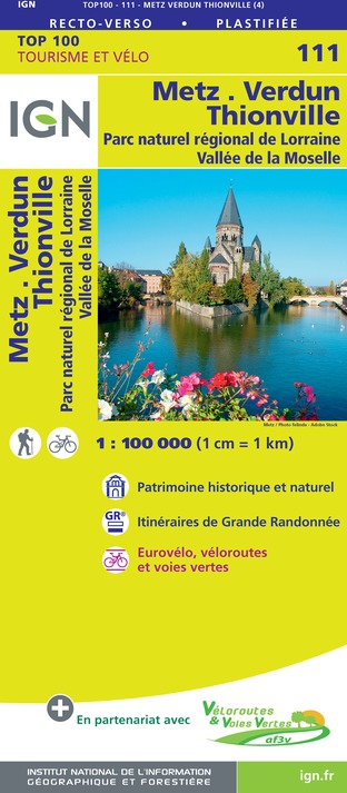
111 METZ VERDUN THIONVILLE PNR DE LORRAINE VALLÉE DE LA MOSELLE
Editor : IGN
Collection : TOP 100
Scale : 1:100 000
8.40€

201 ALSACE MASSIF DES VOSGES
Editor : IGN
Collection : TOP 200
Scale : 1:200 000
6.80€
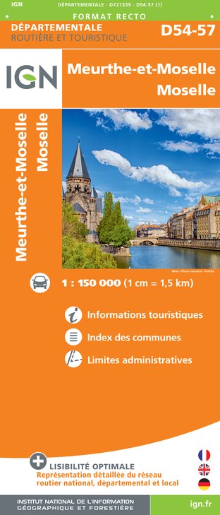
D54-57 MEURTHE-ET-MOSELLE MOSELLE
Editor : IGN
Collection : CARTES DÉPARTEMENTALES IGN
Scale : 1:150 000
5.90€

EUROPE
Editor : IGN
Collection : DÉCOUVERTE DES PAYS DU MONDE IGN
Scale : 1:2 500 000
7.00€

ALLEMAGNE
Editor : IGN
Collection : DÉCOUVERTE DES PAYS DU MONDE IGN
Scale : 1:800 000
7.00€
Description
With a surface area of over 13 km², the Houve forest is a haven of peace for those who wish to recharge their batteries. The paths accessible in all weathers allow you to discover the fauna and flora.
Technical Information
Walking
Difficulty
Medium
Duration
3h30mn
Dist.
11 km
Type of practice
Walking
Medium
3h30mn
Show more
Altimetric profile
Starting point
57880
GUERTING
Lat : 49.189069323921Lng : 6.61940084841
Points of interest


Additional information
Producteur de la donnée
Ces informations sont issues de la plateforme SITLOR - Système d’Information Touristique - Lorraine
Elles sont synchronisées dans le cadre du partenariat entre Cirkwi, l’Agence régionale du Tourisme Grand Est et les membres du comité technique de Sitlor.
Contact
Tel : 03 87 81 89 89
Email : contact@ccwarndt.fr
Site web : ccwarndt.fr/
Data author

proposed by
Moselle Attractivité
57000 Metz France
Ratings and reviews
To see around