Alert
Alerts
Circuit source de l'Avière
Description
Thanks to the Club Vosgien for the creation of this hike and for the work done by its teams throughout the year to mark out and maintain these paths.
From the car park, go through the barrier towards a shelter. Just before arriving there, take the marked path on your left (+ of red colour) which crosses a small arboretum to join a stone path while skirting the forest.
Turn left and follow the markings (red circle and red cross), which will take you through the forest and then across the fields to cross the Mauverois stream.
You then come to a tarmac road near a calvary. Take the road to the right for 300 m and turn left to enter the forest again on a marked forest track (red circle and red cross).
Some 200 m further on, pass the Fontaine de la Couleuvre and continue on the dirt track to climb towards a roundabout. Follow the marked track (red circle) to the left for just over 100 m and turn right onto the dirt track which goes alongside the fields a little further on.
When you reach a small house, turn left to get to the D51, which you cross to arrive at the left of a shed, following the marked path (red circle). This path, which goes alongside fields and forest, leads you to a small tarmac road at the place called Censes des Lois.
Go up to the left on the road to arrive near the forest house of Avière. Opposite this house, take the marked path (red circle and red cross) and leave on your right a marked path (red cross).
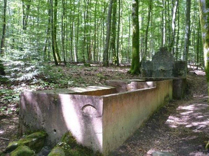
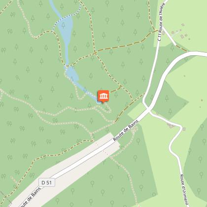
After passing a pond, you get to a gravel path which you follow to the left for almost 300 m. Turn right onto the path that leads to the Avière spring, nestled at the foot of a cirque-shaped valley with a majestic beech forest. Enjoy this magnificent setting for a few moments, since you will have to go up to the left opposite the spring on the winding, marked out path (red circle).
Follow the path, leaving a track on your right halfway up the slope and then, further on, a track on your left. Off the trail, the bravest can make a round trip (marked with a red triangle) to the stele commemorating the fall of an allied plane during the bombing in 1944.
At the top you come to a forest road. Turn left, cross the road to join the circuit 100 m further on the left which will take you back to the starting point.
Technical Information
Altimetric profile
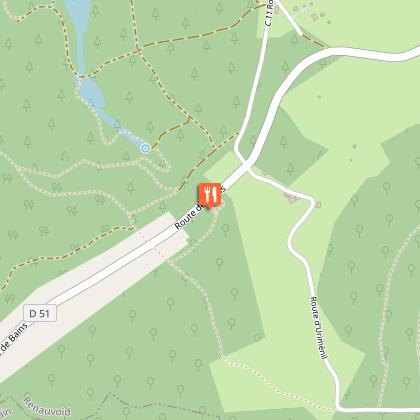
Starting point
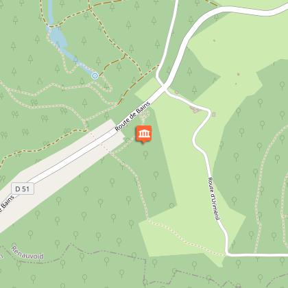
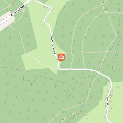
Points of interest
Additional information
Contact
Tel : 03 29 82 53 32
Site web : www.tourisme-epinal.com/sejourner/nos-circuits/source-de-l-aviere-2273010
Producteur de la donnée
Ces informations sont issues de la plateforme SITLOR - Système d’Information Touristique - Lorraine
Elles sont synchronisées dans le cadre du partenariat entre Cirkwi, l’Agence régionale du Tourisme Grand Est et les membres du comité technique de Sitlor.
Data author
