Alert
Alerts
Circuit du Bambois

Description
Thanks to the Club Vosgien for the creation of this hike and for the work done by its teams throughout the year to mark out and maintain these paths.
Marking: yellow disc 10 km
Easy trail on a forest path near the fort of Bambois.
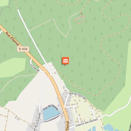
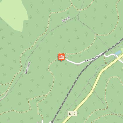
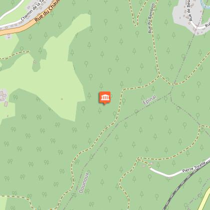
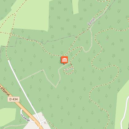
From the car park, go down 30 m to take a small road on the left, opposite the FFI monument, which passes between two houses, then turn right following the yellow solid disc markings. You will arrive on a gravelled forest road. 3 km further on you will see the sign for the Dinozé forest and continue straight ahead. You then pass near the hamlet of La Pierre Torelle, altitude 415 m. Stay on the path and start to climb further up, leaving an old military structure (battery 3) at an altitude of 433 m on your left. On your right, you can see through the trees the Moselle valley upstream of Épinal, then the Bésonfosse valley in the town of Dinozé. You will also notice this old forest of Scots pines which is at least 150 years old. After a small climb, you arrive at the crossing of the Pierre Torelle and Sauteur forest roads. Turn left and enter the Épinal forest. The route then dominates the valley of the Etranglieux and the Taviane through which you arrived from Épinal. At the crossroads with the access road to the fort, the bravest turn left - off the route - to reach the entrance to the fort (750 m round trip). The others continue to the right and arrive at a crossroads of 4 paths at the end of the forest. Turn left to walk along a field for about 100m to enter the forest again. The small road leads you straight back to your starting point. On your right as you arrive, you will see a Lorraine cross surrounded by a small botanical park.
Technical Information
Altimetric profile
Starting point
Points of interest
Additional information
Contact
Tel : 03 29 82 53 32
Site web : www.tourisme-epinal.com/sejourner/nos-circuits/circuit-du-bambois-2275872
Producteur de la donnée
Ces informations sont issues de la plateforme SITLOR - Système d’Information Touristique - Lorraine
Elles sont synchronisées dans le cadre du partenariat entre Cirkwi, l’Agence régionale du Tourisme Grand Est et les membres du comité technique de Sitlor.
Data author
