Boucle de Durbuy Commune DURBUY )
Description
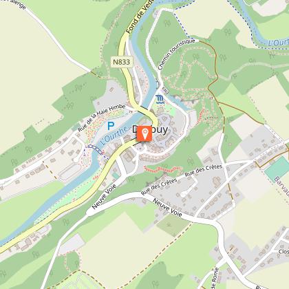
Walk n°5/21 - The Durbuy loop - 4.7 km - signpost: blue rectangle Starting point: Durbuy, in front of the Royal Syndicat d'Initiative To order the walking map of Durbuy: marando.be/catalog/index/view/id/196/lang/fr DURBUY: see walk n°4 On leaving the Syndicat d'Initiative, turn left towards the mini-golf course (avenue H. Philippart). Walk along the listed boundary wall, a vestige of the original wall of the former Récollectines convent, where you will see a doorway bearing the date "1725". On the other side, you will discover the famous anticline and its lake. At the end of the lake, continue straight on into the woods. This is a tarmac path that climbs steadily. The vegetation is made up of ash, maple, beech and oak trees, as well as tall larches. When you reach the flat, you have 2 options: either turn right onto a narrow path that leads back down through the woods to Durbuy (the path is in fact a staircase - known as the "Beguines" staircase - cut into the shale and bordered by a ramp, with a total of 16 dozen steps leading up to the anticline square); or continue straight ahead towards a "Y". Take the right-hand branch (towards Belvédère). Continue straight up the asphalt path, noting the cherry trees on your left. At the first houses, you come to a crossroads: take the road to the right. The Durbuy artisanal jam factory is on your left. Ignore a road on the left and continue straight on towards the Belvedere. Just before the Belvedere, you can take a small path to the right that leads downhill (this path is the same as the GR, and the descent is steep and difficult, with many rocks - slippery in wet weather - and steps, although there are handrails at particularly difficult points and a fine view over the town). Alternatively, continue straight on past the Belvedere, from where (when open) you can enjoy a superb panoramic view of the town of Durbuy and the surrounding area. At the next crossroads, turn right and, in the hairpin bend that follows, take the road in front of you that climbs back up, bordered on the left by ash and hazel trees. Take a dirt track on the right and continue straight ahead through the Bois de Chapli. (GR). The path descends and enters the meadows, which you should walk along until you reach the road. Cross the road and take the steps opposite, which will take you to the path that runs alongside the Ourthe. Turn right towards Durbuy and, just before you reach the first houses, go down to the left to join the towpath. This leads to the Parc Roi Baudouin, where you can discover the anticline on which the castle is built. The origins of Durbuy castle date back to the feudal era, but its current appearance is the result of major alterations carried out in the 19th century. It has belonged to the d'Ursel family since 1726 and is not open to visitors. Pass under the bridge and return to the starting point.
Technical informations
4.8 km
|
max. 218 m
min. 146 m
| |||
Styles : BaladeDiscoveryIn the countryIn townForest Public : Family Themes : PatrimonyWaterfront | ||||
Altimetric profile
Starting point
Additional information
Signalétique (EN)
Pedestrian - Horizontal rectangle - Blue
Data author
