Alert

Alerts

To see around
See more
Open
Close
Show
Show
Show
Show
Show
Show
Show
Show
Show
Show
Show

Oups... It would appear that Cirkwi does not have permission to use your location.

Presentation
Description
Map
Points of interest
Ratings and reviews
See around

Boucle des Pins

Description

At the foot of the Mont du Chat, St Paul offers 4 circular walks including one gentler alternative. The "Boucle des Pins" explores the countryside around St Paul, with its rural, mountainous landscape.

In the heart of a lively and open agricultural landscape, you can discover pretty hamlets, a varied country atmosphere and, on the higher ground, a glimpse of the forest. For the more experienced, it's possible to "couple" 2 or 3 loops as you wish.

Rando bonus :
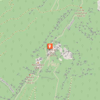
- Mont du Chat lookout is accessible by car, just 20 minutes from the town center of Saint-Paul (1 500m)
- The lacs de Chevelu leisure center can be reached on your return from the hike, only 5 minutes from Saint-Paul

Caution: crossings and sections of departmental roads. Please be careful!

Technical Information

Walking
Difficulty
Easy
Duration
2h
Dist.
6.6 km
Show more

Altimetric profile

Starting point

31 promenade du chef lieu , 73170   Saint-Paul-sur-Yenne
Lat : 45.677485Lng : 5.785221

Points of interest

image du object

Dent du Chat

The Dent du Chat is one of the peaks of the Mont du Chat, situated in the south of the Jura mountain range and reaching an altitude of 1390 m. It stretches along the western border of the Lac du Bourget, in the Savoie.Recognized as a remarkable regional site, the Dent du Chat is accessible to experienced hikers as well as cyclists via the Mont du Chat, a major stage of the 2017 Tour de France. From May to October, closer car access with parking is possible from Saint-Paul-sur-Yenne via the D42 departmental road near the Relais du Mont du Chat. The climb is also possible from the commune of Le Bourget-du-Lac. During the same period, refreshments are available on site at the bar-restaurant Les Aigles. A panoramic orientation table at Mollard Noir offers exceptional views over Lake Bourget. The site is also a stop in the treasure hunt game organized by the Yenne Tourist Office. To reach the Dent du Chat on foot, several routes are available: From the Relais du Mont du Chat parking: 1 hour one way (2 hours round trip), +110 m elevation gain. Access to the Mollard Noir orientation table in 40 minutes. The final section is exposed and difficult. From the Col du Chat parking (a different site from the Relais du Mont du Chat, located above the Chat Tunnel on the D914A road): 2h30 one way (5 hours round trip), +752 m elevation gain. Difficult hike with exposed sections. From the Saint-Jean-de-Chevelu leisure base parking: 6-hour loop, mostly through forest, +1250 m elevation gain. Very difficult. Access is not recommended for children or animals due to exposed and technical sections. The Dent du Chat is also associated with a local legend. Come and discover and listen to it at the Maison de la Dent du Chat in Yenne.

Route du relais du Mont du Chat puis chemin pédestre balisé 73170 Saint-Paul-sur-Yenne
- Office de Tourisme de Yenne -
Consulter

Additional information

Contact

Phone : 04 79 36 71 54

Email : info@yenne-tourisme.fr

Website : http://www.dentduchat.fr

Open period

All year round daily.

Environments

Overview on river
Close to GR footpath
Mountain view
Forest location
Lake view
In the country
View over the vineyards
Village 2 km away

Type of land

Grit
Not suitable for strollers

Location complements

From the Départementale 921C, go to the main town near the Mairie and the Saint-Paul-sur-Yenne multi-purpose hall.
Free parking is available.

Updated by

Office de Tourisme de Yenne - 23/02/2026
www.dentduchat.fr
Report a problem

Reception complements

The loops start from the St Paul sur Yenne town hall parking lot.

Guidebook with maps/step-by-step

Start - Parking de la mairie de Saint-Paul-sur-Yenne 435 m.
1 /Take the direction of St-Paul école.
2/ Take the track towards "Pierre des Borrels" via the hamlet of "Les Vaisselets" and take the small road to "Les Borrels".
3/ Then take the track to reach "Le Petit Creux".
4/ Head north along the track for 400 m, then along the main road for 200 m before forking left on a wide track to reach Prariond.
5/ Continue on to reach Le Châtelard and then Les Janins through alternating meadows and undergrowth.
6/ Return to the village via a wide track.

Animals

Yes

Ratings and reviews

To see around
See more
Open
Close
Show
Show
Show
Show
Show
Show
Show
Show
Show
Show
Show
Caution!
We have no information on the difficulty of this circuit. You may encounter some surprises along the way. Before you go, please feel free to inquire more and take all necessary precautions. Have a good trip! 🌳🥾