Alert
Alerts
Panoramic walk "Champet - Balancerie"

Description
Walk from the village, through bucolic paths to the pretty hamlet of Ormaret and its chapel. Mont-Blanc accompanies you throughout the journey!
In Ormaret, you will be immersed in a rural atmosphere with many farms still in activity, where modern agriculture rubs the traditional farm.
Technical Information
Altimetric profile
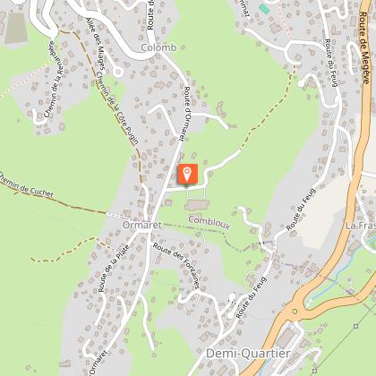
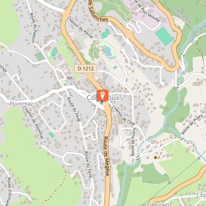
Starting point
Points of interest


Additional information
Environments
Mountain view
Mountain location
Village 2 km away
Updated by
Office de Tourisme de Combloux - 21/10/2025
combloux.com/
Report a problem
Open period
All year round daily.
In winter: the snow is not cleared from the path.
Contact
Phone : 04 50 58 60 49
Email : info@combloux.com
Type of land
Stone
Ground
Suitable for all terrain strollers
Guidebook with maps/step-by-step
1. Start from the Tourist Office, walk past the bakery “Les Délices de Combloux” and go up the Croix de Pierre road.
2. Continue uphill towards the hotel Le Coin Savoyard and cross the road to take the entrance to Le Barratti on your left.
3. Cross the small wooden bridge to reach the path on the other side of the stream, leading to Le Champet.
4. Continue uphill via the Chemin des Poses to reach the hamlet of Ormaret and its chapel.
5. With your back to the chapel, take the path on the right toward La Côte Pugin.
6. When you reach the road, walk down a few meters (watch for traffic) and cross the road to take the Chemin de Mowgli.
7. Take the fork to the right toward La Balancerie and follow the narrow path across the field.
8. You arrive at Le Bouchet. Cross the road to continue on the Chemin des Mélèzes.
9. At the bottom of the path, turn left and pass near the play area Louparc.
10. Walk past the church and take the small path on the left that leads back to the village center.
11. Turn right uphill to return to the Tourist Office.
Optional route (allow 40 extra minutes): At Ormaret, with your back to the chapel, turn left and take the Chemin de Cuchet. Walk a few meters downhill, cross the road, and go up the Fontaine Désir steps. Reach the Cuchet parking lot, walk past the terrace of Le Chalet d'Émilie and head downhill towards La Cry. In July and August, you can take the shuttle down, or cross the parking lot and go down the Route des Brons to rejoin the Chemin de Mowgli and follow the regular route.
Animals
Yes
Data author
