Alert
Alerts
Type of practice
Walking
Medium
Presentation
Description
Map
Ratings and reviews
See around
parcours dans le bugey
IGN cards
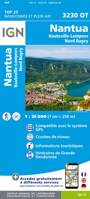
3230OT - NANTUA HAUTEVILLE-LOMPNES NORD BUGEY
Editor : IGN
Collection : TOP 25 ET SÉRIE BLEUE
Scale : 1:25 000
13.90€

TOP100D74 - HAUTE-SAVOIE ANNECY THONON-LES-BAINS MASSIF DU MONT BLANC CHAÎNE DES ARAVIS
Editor : IGN
Collection : TOP 100
Scale : 1:100 000
8.40€

TOP100D01 - AIN BOURG-EN-BRESSE AMBÉRIEU-EN-BUGEY PAYS DE GEX
Editor : IGN
Collection : TOP 100
Scale : 1:100 000
8.40€

TOP100D71 - SAÔNE-ET-LOIRE CHALON-SUR-SAÔNE MÂCON AUTUN
Editor : IGN
Collection : TOP 100
Scale : 1:100 000
8.40€

202 JURA ALPES DU NORD
Editor : IGN
Collection : TOP 200
Scale : 1:200 000
6.80€

D71 SAÔNE-ET-LOIRE
Editor : IGN
Collection : CARTES DÉPARTEMENTALES IGN
Scale : 1:150 000
5.90€

D01-69 AIN RHÔNE
Editor : IGN
Collection : CARTES DÉPARTEMENTALES IGN
Scale : 1:150 000
5.90€

D25-39 DOUBS JURA
Editor : IGN
Collection : CARTES DÉPARTEMENTALES IGN
Scale : 1:150 000
5.90€

NR15 AUVERGNE-RHÔNE-ALPES RECTO/VERSO MASSIF ALPIN
Editor : IGN
Collection : CARTES RÉGIONALES IGN
Scale : 1:250 000
6.80€

NR14 AUVERGNE-RHÔNE-ALPES RECTO/VERSO MASSIF CENTRAL
Editor : IGN
Collection : CARTES RÉGIONALES IGN
Scale : 1:250 000
6.80€

NR09 BOURGOGNE FRANCHE-COMTÉ
Editor : IGN
Collection : CARTES RÉGIONALES IGN
Scale : 1:250 000
6.80€

EUROPE
Editor : IGN
Collection : DÉCOUVERTE DES PAYS DU MONDE IGN
Scale : 1:2 500 000
7.00€
Description
randonée au dessus de la vallee de l'ain , izenore , oyonnax.cerdon
Technical Information
Walking
Difficulty
Medium
Dist.
90 km
Type of practice
Walking
Medium
Show more
Altimetric profile
Starting point
01450
Poncin
Lat : 46.11871Lng : 5.43516
Additional information
Types de sol
[EN]Bitume
[EN]Graviers
[EN]Terre
[EN]Herbe
Data author

proposed by
LA RANDO DANS LE BUGEY
France
Ratings and reviews
To see around