Alert
Alerts
Walk in Saint-Méry


Description
Located in a lush green setting and crossed by the Ancoeur stream, the village of Saint-Méry offers a refreshing countryside walk through lanes, fields, woods and streams.
Surrounded by greenery, the territory of Saint-Méry is crossed by the Ancoeur stream, the Moines stream and the Prée stream. This strong presence of water explains the large number of mills, washhouses, fountains and water pumps… The name of the village comes from Saint Médéric who is said to have stayed nearby around the year 695. This past is reflected in the name given to the inhabitants of Saint-Méry : the Médériciens and Médériciennes. The walking loop allows walkers to discover the last remains of a medieval past once organised around the church and the La Motte castle. Above all, it offers the discovery of an authentic rural heritage and a variety of landscapes.
The walk step by step…
1. From the parking area, head towards the village along Rue de Bombon (RD57). Continue straight ahead, cross Rue de la Garenne and take the green path called Chemin de l’Abreuvoir in front of you. Walk along the wall of the castle park, shaded by trees, and cross the Moines stream using the footbridge located on your left. At the end of the path turn right, then immediately left.
2. Follow the picturesque Chemin de la Pisserote for about 600 meters until you reach Rue du Gâtinais. A long time ago, this path allowed the monks from the collegiate church of Champeaux to reach the church of Saint-Méry through small family gardens. The walk begins by crossing a wetland area via a wooden footbridge, then you will cross the Prée stream. Before continuing along the old dry-stone walls, do not miss the beautiful countryside view of the church and the surrounding houses. Along the way, you will also enjoy views of the collegiate church of Champeaux and the wooded, rolling hills along the Prée stream.
3. At the end of Chemin de la Pisserote, turn left onto Rue du Gâtinais (RD57) and continue until you reach the Pont des Planches. Shortly after the bridge, still along the street, on your left, you will find a covered washhouse with two rows, built at the end of the 19th century.
4. Return to the Pont des Planches and take the small path towards Flagy, which runs alongside the Prée stream near the Ville mill. Depending on the season, this naturally flower-filled area is particularly charming. Cross the Prée stream again and continue along a path beside a field. At the crossroads, enter the woodland and follow the path through it until you reach the Flagy mill. Turn left as you leave the path and walk up Rue de l’Ancien Moulin de Flagy (also part of the GR1 trail) and continue along the paved road until the first junction : turn left onto Route de Flagy, which offers beautiful views over the village.
5. At the second junction, you will see the Michaud watering place down below. Then continue your path along Route de Flagy. You will pass attractive farm buildings until you return to the center of the village.
6. Continue left onto Rue du Jeu de Paume, then at the crossroads turn right onto Rue de l’Église. Pass in front of the Saint-Médéric church, listed as a Historic Monument since 1949, as well as the charming town hall. This church, originally built in the 12th century, is unusual in that it has two different levels due to later modifications. At the crossroads with Rue Montgimont, you will catch a glimpse of the gates of the La Motte Saint-Méry castle (closed to the public). Continue along Rue de la Garenne.
7. Turn right onto Rue aux Râles near the Saint-Méry primary school, then turn left onto Route de Mormant to return to the car park. A playground and picnic tables provide a well-deserved relaxing break, especially for children.
Municipality crossed : Saint-Méry
Distance : 3.7 km - Duration : 1h15 – Unmarked trail
Access to the map : www.cirkwi.com/fr/circuit/175741-balade-a-saint-mery
Technical Information
Altimetric profile
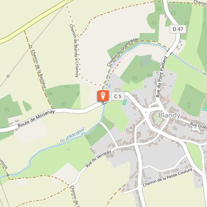
Starting point
Points of interest


Additional information
Environments
In the country
Updated by
Communauté de Communes Brie des Rivières et Châteaux - 05/06/2026
www.briedesrivieresetchateaux.fr
Report a problem
Open period
All year round daily.
Contact
Phone : 01 64 38 72 94
Email : mairie@saintmery.fr
Website : https://www.intramuros.org/saintmery
Data author

The Cirkwi brief
Nestled amidst verdant landscapes, the charming village of Saint-Méry, guided by the Community of Communes Brie des Rivers and Castles, invites explorers on a refreshing walk that beautifully melds the allure of the countryside with the whispers of its medieval past. Wander through the quiet streets, beside murmuring streams, and discover relics of a time gone by, including mills and the picturesque Saint-Médéric church, all the while being enveloped in a tapestry of rural splendor. This journey isn’t just a walk; it’s an invitation to step through time, amidst nature, and breathe in the tranquil atmosphere of Saint-Méry.
Key Details of the Route Unveiled
Spanning a distance of 3.2 kilometers with altitudes ranging from 77 to 101 meters, this picturesque trail through Saint-Méry embodies a gentle walk suitable for enthusiasts of all levels. Commencing at the crossroads of rue de Mormant and route de Bombon, participants navigate a path devoid of markers, yet rich in scenic beauty and historical appeal. This loop encapsulates a mild elevation change of 59 meters both ways, positioning it as an optimal choice for a leisurely and engaging hour-long exploration.
Tips for Year-Round Enjoyment
As your local guide, I recommend embarking on this gentle expedition through Saint-Méry during the early morning or late afternoon to capture the splendid natural lighting for photography enthusiasts. Spring offers a verdant, blossoming trail, while autumn showcases a riot of colors. Wear comfortable walking shoes, carry water, and remember that some paths may become slippery after rain. Although the trail is accessible year-round, always check the weather beforehand for a pleasant journey. Lastly, respect the tranquility and cleanliness of the area, ensuring it remains pristine for future visitors.
The Heart of Saint-Méry’s Rich Heritage
Saint-Méry stands as a testament to the profound historical and cultural richness of the Île-de-France region. With the village's name deriving from Saint Médéric, who resided nearby in the year 695, to the architectural marvel that is the Saint-Médéric church—listed as a historic monument since 1949—each corner of Saint-Méry echoes stories from its bygone era. This circuit not only offers a glimpse into the village's medieval past but also honors the legacy of its natural and architectural landmarks, preserving the essence of rural France.
Weather Insights for the Explorer
Île-de-France benefits from a temperate climate, making Saint-Méry a delightful destination throughout the year. However, for the optimal walking experience, I recommend visiting between late spring and early autumn, when weather conditions are mild, and the countryside is at its most vibrant. July and August can be warmer, yet the shaded paths offer respite from the sun. Always prepare for the chance of rain by carrying appropriate gear, ensuring the weather doesn’t dampen the spirit of your adventure.