Alert

Alerts

To see around
See more
Open
Close
Show
Show
Show
Show
Show
Show
Show
Show
Show
Show
Show

Oups... It would appear that Cirkwi does not have permission to use your location.

Presentation
Description
Map
Steps
Points of interest
Cirkwi brief's
Ratings and reviews
See around

Walk in Bombon

Balade à Bombon
Charte du Randonneur FFR
Credit : CCBRC

Description

Located along the meanders of the Ancœur Valley, Bombon is a hidden gem well worth a visit for walkers interested in history and rural traditions in the Brie region.

Vineyards were once the main crop in Bombon, but this activity disappeared during the 20th century giving way first to livestock farming and then to cereal cultivation. The village remains a living testimony of this rurality. Between old streets and fields, discover this small briard village, with its 12th century church, impressive farm buildings, and magnificent castle. The village is also steeped in history due to the establishment of the headquarters of the Allied armies led by General Foch, who received his marshal’s baton in Bombon on August 23, 1918, from the hands of Georges Clemenceau and Raymond Poincaré. The Marshal pushed back the german front during counter-offensives conceived from the château and thus ensured the victory of the Allies. This is the reason why, in 1918, in “L’Illustration”, just after the armistice of November 11, Bombon was considered as the “Cradle of Victory”.
Bombon can be enjoyed in every season!

The walk step by step…

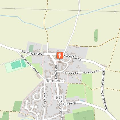
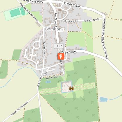
1. The start of the village walk is located at Saint-Germain Church. Walk along the church to admire the building from the front.
2. Leave the church square by turning left onto Rue Grande in the direction of the town hall. By following Rue Grande, you can see on your left the farm of Neuvy (private property).
3. Continue a little further on Rue Grande, then turn left into Rue du Bourg.
4. Take the narrow Gerbette path on your right. This path winds between private gardens and fields. You then cross Rue de Bréau. Continue the path until the end. At the end, take the street on your right for a few meters, then take on your left Rue du Château.
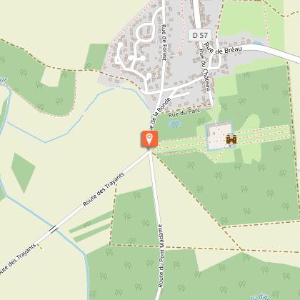
5. At the end of Rue du Château, you arrive at the north entrance of the castle of Bombon (private property). Take Rue du Parc on the right, then, when you arrive at Rue de Forest, make a detour on the left up to the main gate of the château.
6. Return towards the village by Rue de Forest and turn left into Rue du Charnois. You pass near the old washhouse, then take on your right a grassy path. Finally, walk along a field up to the village.
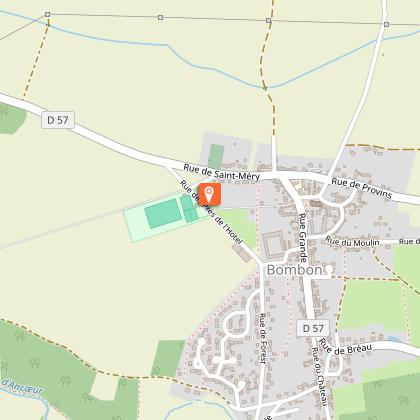
7. Turn left onto Rue des Prés de l'Hôtel. At the crossroads, you are facing the imposing farm of Forest.
8. In front of the playground, turn right onto Rue des Brissets, then on the left the Forest path. Then, take on the right Rue de Saint-Méry and immediately turn right again to reach the church in Rue Grande.

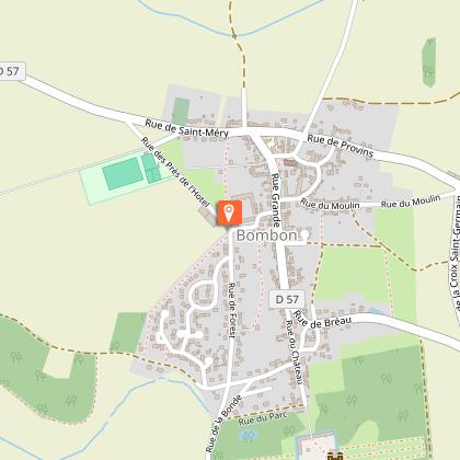
Municipality crossed : Bombon
Distance : 3 km - Duration : 1h – Unmarked trail
Access to the map : www.cirkwi.com/fr/circuit/175738-balade-a-bombon

Technical Information

Walking
Difficulty
Very easy
Duration
1h
Dist.
3 km
Show more

Altimetric profile

Starting point

9 Place de l'église , 77720   Bombon
Lat : 48.574463Lng : 2.858589

Points of interest

image du object

Château de Bombon

Le Château de Bombon, inscrit aux Monuments Historiques depuis 1949 avec les communs, le pigeonnier, la chapelle et le parc, est construit dans un style typiquement français, avec chaînes de pierre et murs de briques, et recouvert d'un toit d'ardoise.Le domaine de Bombon est attesté dès le Moyen-Âge. La famille de Brenne en détient la seigneurie à partir du 13e siècle et y fait édifier un premier château fortifié, probablement entouré de fossés. Le château actuel a été édifié au 17e siècle certainement à l'emplacement du château médiéval, à l'initiative du sieur Anthoine de Brenne pour son épouse Claude de Courtenay. La famille de Brenne domina le village pendant quatre cents ans, à partir du 13e siècle. Le château est dans un style typiquement français du 17e siècle, mêlant briques et chaînages de pierre, et marqué par des proportions architecturales symétriques et des hautes toitures d'ardoise. L'ensemble comprend un corps de logis rectangulaire à fronton, flanquée de deux ailes saillant de part et d'autres, une chapelle, une terrasse, des communs et des douves. L'alternance de chainages de pierres et de briques compose le décor principal des façades. Le château est entouré d'un parc aux lignes régulières et d'un parc à l'anglaise dans lequel se trouve un colombier. On notera aussi l'élégance de la grille d'honneur et le pavillon porche latéral du 12e siècle. En 1699, le lieu revient à Basile de Brenne de Portet et sa fille Charlotte de Brenne qui devînt Comtesse de Bombon et se maria en 1720 avec Marie-Auguste Thomas Goyon, marquis de Matignon, fils du Maréchal. Il fut ensuite la propriété des Goyon de Matignon de 1720 à 1732 qui le vendirent à Claude Geoffroy d'Assy de Montjay, secrétaire du roi. Le château est occupé en 1870 par des troupes venant de Silésie. En 1918, le château de Bombon devient un site stratégique majeur de la Première Guerre mondiale, accueillant le Quartier Général des armées alliées. C’est depuis Bombon que le maréchal Foch prépare la grande contre-offensive du 18 juillet 1918, qui fit reculer le front allemand sur toute sa largeur, marquant un tournant décisif du conflit. Aussi, le 7 août, Foch reçut-il son bâton de Maréchal dans la cour d'honneur du château en présence des chefs d'état-major et du Président de la République, Raymond Poincarré. Cet épisode historique vaudra au village de Bombon d'être nommé "Berceau de la Victoire". Le château sera vendu en 1919 à la famille Segonzac. Le château est de nouveau utilisé à des fins militaires en 1939 comme poste de commandement. En 1982, il devient la propriété de Félix Houphouët-Boigny, président de la République de Côte d’Ivoire. Depuis sa disparition en 1993, c'est la famille Grunitzky qui habite le château. Le château, entièrement privé, est aujourd'hui entouré d’un vaste parc mêlant jardin régulier et aménagement paysager à l’anglaise, ainsi que de douves, éléments caractéristiques des grandes demeures seigneuriales briardes.

3 rue du Parc 77720 Bombon
- Communauté de Communes Brie des Rivières et Châteaux -
Consulter
image du object

The Val d'Ancoeur : a protected site

The history begins like a fairy tale : "Once upon a time the Val d'Ancoeur..." with its castles, its legends and the 3 names of this small stream, which has become a myth, that from Ancoeur becomes Ancoeuil to end as the Almont... before flowing into the Seine.(Extract from the website of the Departmental Archives) The Ancoeur stream is a watercourse that has its source in the municipality of Grandpuits-Bailly-Carrois at an altitude of 125 m. It then takes the name of "Ancoeuil" in the municipality of Moisenay and joins, after a journey of 25 km from its source, the Bassin de la Poële of the Vaux-le-Vicomte castle. At the exit of this basin, it flows into the "Almont" 5 km downstream into the Seine at Melun. It constitutes, with its tributaries, a catchment area of approximately 306 km². The Ancoeur stream flows through the municipalities of Grandpuits-Bailly-Carrois, La Chapelle-Gauthier, Bréau, Bombon, Saint-Méry, Blandy-les-Tours, Moisenay, Maincy and Melun. Classified as an "Exceptional Site" since October 14, 1985 by the Regional and Inter-Departmental Directorate for the Environment and Energy of Île-de-France, the Ancoeur stream offers enchanting landscapes. The classified site covers 1,861 hectares. Along the watercourses — the Almont, the Ancoeuil (or Ancueil) and then the Ancoeur — the Val d'Ancoeur unfolds its panoramas : villages, forests, castles (Vaux-le-Vicomte, Blandy-Les-Tours...) but also, at the confluence of the Seine, urbanised areas. "The Ancoeur is a very low-flow river, highly irregular and regularly at risk of running dry. The annual runoff depth within its catchment area is 96 millimeters annually, which is among the lowest in France, more than three times below the national average, and above all well below the average for the entire Seine basin (approximately 240 millimeters). The constant flow of the Ancoeur has, however, for centuries made it possible to operate the many mills. The large number of hydraulic structures, such as canals, basins and ponds, small reservoirs and mills, give the landscape a particular identity centred on water and its management. This is to be understood in relation to the wet character of the land." A place of life, production and creation, the Val d'Ancoeur brings together major heritage sites across the entire territory : churches and works of art dating back to the 12th century, castles, farms, mills, rural dwellings, small rural heritage... It has also become a subject of reflection and aesthetic admiration thanks to the artists who have captured its beauty and interpreted it in their own way. - The Ancueil ("Anqueil" in its 17th-century spelling) gave its name for example to a majestic statue in the park of Vaux-le-Vicomte, located to the left of all the grottos (1659–1662), facing the Tibre installed to the right in 1659. - The painter Paul Cézanne immortalised the bridge called Pont de Maincy in 1879 (now held at the Musée d'Orsay). - And the sculptor Auguste Rodin dedicated magnificent drawings to the collegiate church of Champeaux (1890–1917), as testimony to his admiration. For several years, the Communauté de Communes Brie des Rivières et Châteaux and the Communauté d'Agglomération Melun Val de Seine have joined forces to develop a Landscape Plan, revealing the assets of the Val d'Ancoeur. An opportunity for the protection and enhancement of the landscape heritage. The perimeter, which is based on the classified site, encompasses 11 municipalities across an area of approximately 56 km². It extends over a straight-line distance of nearly 17 km.

- Communauté de Communes Brie des Rivières et Châteaux -
Consulter

Additional information

Environments

In the country

Updated by

Communauté de Communes Brie des Rivières et Châteaux - 25/06/2026
www.briedesrivieresetchateaux.fr
Report a problem

Open period

All year round daily.

Contact

Phone : 01 64 38 72 98

Email : accueil@bombon.fr

Website : https://bombon.fr/

Data author

The Cirkwi brief

Discover the Historic Charm of Bombon on Foot

Embark on a mesmerizing journey through the picturesque landscapes and rich history of Bombon. This quaint village, nestled in the heart of the Val d'Ancœur, offers a unique blend of rural traditions and historical significance. Proposed by the Communauté de Communes Brie des Rivières et Châteaux, this walking tour invites travelers to delve into a borough where vineyards once flourished and now, agricultural prowess reigns. Experience the tranquility of ancient streets, marvel at a 12th-century church, and get captivated by the majestic château that has stood the tests of time. Feel the essence of rural France and its historical vibrations in every step.

Path Details: Numbers and Gradient

Covering a distance of 2.9 km with an elevation ranging between 93 to 114 meters above sea level, this walk is perfect for enthusiasts of all levels. The total ascent and descent vary slightly, marked at 36 to 38 meters, presenting a gentle slope. The itinerary, curated by the Communauté de Communes Brie des Rivières et Châteaux, is unmarked, adding an element of adventure yet is straightforward, circling back to the starting point at Saint-Germain Church. Analyzed technically, this route is an excellent choice for a short, leisurely exploration of Bombon's historical gems.

Seasonal Tips and Safety Recommendations

Regardless of the season, Bombon's beauty is evergreen. However, spring offers a lush, vibrant setting, making it an ideal time for photography enthusiasts. Summer brings out the full grandeur of the countryside, though staying hydrated is key. Autumn surrounds you with a palette of colors, perfect for leisurely walks, while winter, often mild, still requires appropriate attire for colder days. Always ensure to wear comfortable footwear and carry water, especially during warmer months. Familiarize yourself with the route beforehand to enhance your experience, and respect private properties, particularly around the château.

A Walk Through History in Bombon

Bombon, a gem in the Brie region, is not just a village; it's a living museum showcasing rural traditions against a backdrop of significant historical events. The presence of the Allied Generals’ Headquarters during WWI and the Marshal Foch's strategic brilliance that led to the Allies' victory, earmarked Bombon as the “Cradle of Victory.” This village, with its ancient church and the historical château, is a testament to the resilience and evolution of rural France. The architectural and historical layers of Bombon offer a captivating glimpse into the past, enriching the walking experience with every step.

Regional Weather and Best Visit Times

Bombon experiences a temperate climate, characterized by mild winters and warm summers. Precipitation is relatively evenly distributed throughout the year, making Bombon a year-round destination. However, the best time to visit is between late spring and early autumn when the weather is most favorable for walking. During these months, temperatures are comfortable, and the natural scenery is at its peak, offering an unrivaled walking experience through the historical and natural landscapes of Bombon.
Automatically generated.

Ratings and reviews

To see around
See more
Open
Close
Show
Show
Show
Show
Show
Show
Show
Show
Show
Show
Show
Caution!
We have no information on the difficulty of this circuit. You may encounter some surprises along the way. Before you go, please feel free to inquire more and take all necessary precautions. Have a good trip! 🌳🥾