Alert
Alerts
Enjoy a touch of southern atmosphere between Larzac and Lévézou


Description
This pastoral breakaway which takes place on the upper part of Saint-Rome-de-Cernon is very easy to get to and offers to walkers a view over this village located at the crossroads of roads and hilly areas.Starting point and finish of the hike are located at the carpark, which is on the left side when watching the castle. Walk across a small square and right at the first street (rue du château) take left for approximately 40 m. When reaching the fountain, take to the right the D999 for 40 m. Before the petrol station, take right and walk along the church an ascending slope. Keep on going for 100 m up to the D31, follow this road for 50 m, and then take a tarred track for 300 m. Right at the first tarred hairpin bend to the left, carry straight on the dirt track. The path first goes through a wooded section then leads to a plateau. Take right up to the D31 and walk across the road to the left. Turn immediately to the right on a tarred track towards Puech Ricard. Carry straight on for 800 m, leaving to your right the road that leads to the Cazals farm. 500 m further, look up at the lavogne (a paved pond to water the flock of sheep). Walk for 200 m and leave to your left a stone cross. 200 m further, fork to the right and take a stone path towards St-Rome-de-Cernon. Keep walking up to a steep path overlooking Saint-Rome and enjoy the panoramic view. Walk to the left side of the castle and the “old graveyard”, then follow to the left a cemented path and you're back to the carpark, the starting point of your hike.
Technical Information
Altimetric profile
Starting point

Additional information
Public transport
Travel by bus or train: www.mobimipy.fr/carpooling : BlaBlaCar, Rézo Pouce, Covoiturage-libre, Idvroom, LaRoueVerte, Roulez malin
Advice
Box tree moths are active from May to October. During the caterpillar phase, they feed on the leaves of box trees. They crawl down trees and move on long silken threads, although these threads are annoying when hiking they do not pose any health risk
Is in the midst of the park
This itinerary is located in the World Heritage zone Causses and Cévennes, mediterranean agropastoral cultural landscape.
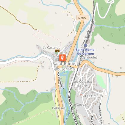
Advised parking
Passade's carpark
Access
The village is situated on the D992, 15 km from Millau towards Saint-Affrique
Arrival
Parking de la Passade à Saint-Rome-de-Cernon
Ambiance
This rural stroll offers you an alternative way of exploring Saint-Rome-de-Cernon by walking along dirt and stone tracks. Head your way to the esplanade of the old graveyard and enjoy the perfect panoramic viewpoint over the village. Contemplate the artistic heritage, throughout Greschny’s frescoes in the church, but also the rural heritage such as a lavogne which testifies to the agro-pastoral roots of the village.
Departure
Parking de la Passade à Saint-Rome-de-Cernon
Data author
