Alert
Alerts
PR 20- The circuit of the Three Crosses

The Cirkwi brief
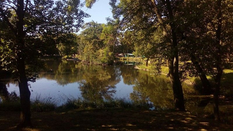
Embark on a captivating journey through the heart of Clichy-sous-Bois with the PR 20- Le circuit des Trois Croix, meticulously curated by FFRandonnee Seine-Saint-Denis. This route offers a unique blend of natural beauty and architectural heritage, revealing the diverse ecosystems and rich biodiversity of the Séquano-Dionysian parks. As you traverse this green oasis nestled within the city, let the serenity and charm of Clichy's landscapes inspire your inner explorer. It's an invigorating escape that showcases the unexpected natural splendors awaiting discovery by urban dwellers.
Technical Insight: 7+ km of Discovery
The PR 20 circuit spans approximately 7.06 km, navigating through varying elevations with a minimum altitude of 78 meters and a maximum of 119 meters. The loop possesses a total positive elevation change of 66 meters, challenging yet accessible for most. This moderate hike, crafted with precision by FFRandonnee Seine-Saint-Denis, promises not only a fulfilling physical excursion but also a seamless connection with Clichy-sous-Bois's sprawling natural landscapes. Preparation and proper equipment are essential for an optimal experience on this track.
Seasonal Tips for Trail Adventurers
Regardless of the season, PR 20 offers a distinctive experience. However, spring and autumn provide the most scenic vistas, adorned with blooming flora or the crisp hues of fall leaves. It's advisable to wear layered clothing and sturdy, waterproof hiking boots to adapt to varying weather conditions and terrain. Additionally, carrying a water bottle, sun protection during the warmer months, and a flashlight can enhance safety and comfort. Always check the weather forecast before your journey to ensure an enjoyable adventure.
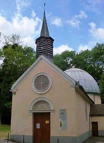
Clichy's Rich Heritage Unveiled
Clichy-sous-Bois, nestled in the Seine-Saint-Denis region, is more than a mere suburb of Paris. Its profound historical roots stretch back to the medieval era, offering a glimpse into its evolving timeline. The city and surrounding areas have played significant roles, from the bustling activity in the Middle Ages to its transformation into a green urban retreat. This hike not only showcases the natural beauty but also threads through the fabric of Clichy's architectural and cultural heritage, making it a holistic exploration of the town's identity.
Climate Guide: Best Times for Your Visit
The climatic conditions in Clichy-sous-Bois generally include mild winters and warm summers, with the region experiencing moderate rainfall throughout the year. The best periods to explore the PR 20 circuit are late spring through early summer (May to June) and early autumn (September to October), offering pleasant temperatures and fewer rain interruptions. These months provide an optimal balance of comfort and natural splendor, making your outdoor adventure both memorable and comfortable.
Technical Information
Altimetric profile
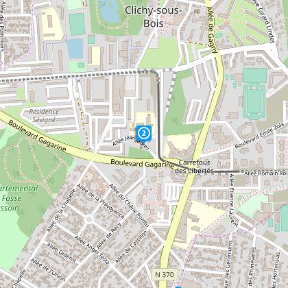
Starting point
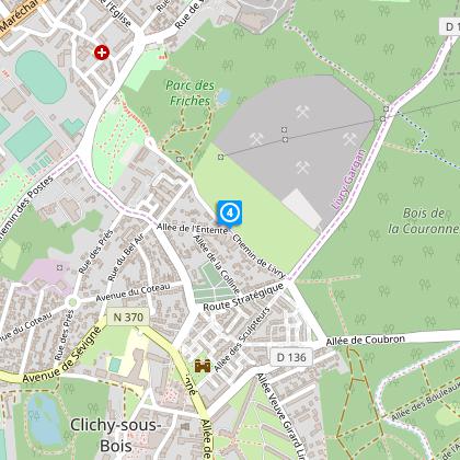
Steps
Data author
