Alert
Alerts
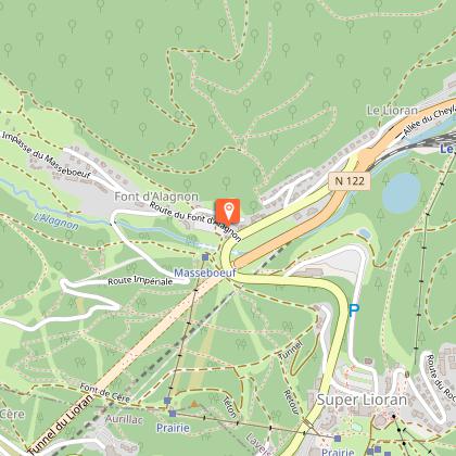
Font d'Alagnon
IGN cards


Description
Easy, rolling trail on a forest road used as a cross-country ski trail in winter. Mixed trail: pedestrians, horse riders and mountain bikers, please respect pedestrians' right of way. Itinerary suitable for VTTAE (green level: easy).
Technical Information
Altimetric profile
Starting point
Steps
Additional information
Updated by
Hautes Terres Tourisme - 24/11/2025
www.hautesterrestourisme.fr
Report a problem
Environments
Mountain view
Mountain location
Ski resort
Close to GR footpath
10 - 20 min from a train station by bike
Less than 10 minutes from an SNCF train station by electric bike
Open period
All year round.
Subject to favorable snow and weather conditions.
Contact
Phone :
04 71 20 09 47
04 71 49 50 08
Website : https://www.hautesterrestourisme.fr
Topo guides and map references
Topo guides references :
Fiche téléchargeable sur table numérique et imprimée dans les bureaux de tourisme de Hautes Terres Tourisme.
Type of land
Ground
Hard coating (tar, cement, flooring)
Grit
Tricky passages
Steep descent into a parking lot with a stop sign suddenly appearing. Slow down.
Data author
