Alert
Alerts
The Pinatelle wood
Description
A trail of great diversity: passages in the mysterious Pinatelle forest, alongside agricultural plots, in the village of Chalinargues to discover its architectural treasures, around wetlands.
Technical Information
Altimetric profile
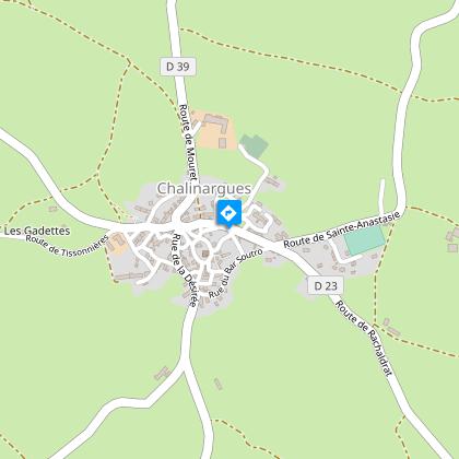
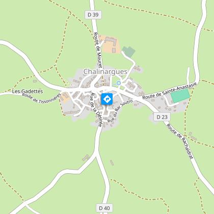
Starting point
Steps
Points of interest

Additional information
Updated by
Hautes Terres Tourisme - 24/11/2025
www.hautesterrestourisme.fr
Report a problem
Environments
In the country
Forest location
Village 2 km away
Type of land
Ground
Hard coating (tar, cement, flooring)
Tips
-For your safety, please check the weather forecast before setting off on your hike. -To preserve the environment in which you are located, please avoid leaving garbage in nature. -Remember to take equipment adapted to the weather conditions and the hiking itinerary (hiking boots, water bottle, cap, sunglasses, jacket...).
Contact
Phone : 04 71 20 22 62
Website : https://www.hautesterrestourisme.fr
Open period
All year round.
Subject to favorable weather.
Guidebook with maps/step-by-step
Start - The starting point is in Chalinargues, on the square before the town hall. Opposite the start sign, take the road to the right (D23) and walk up towards the village for 100 metres (wash-houses on your right). Turn right just before the stop sign and take the lane leading to the D39. Continue straight ahead for approx. 500 m.
1. Take a wide grassy path on the right. It stretches between meadows and joins a road. Follow it to the left.
2. Then take the track on the left.
3. At a bend, below Rancillac, follow the tarmac opposite for 150m. Descend to the right under the loblolly pines. After a sharp bend, this wide track leads to the old Rancillac mill. Cross the Mouret stream and climb a shrub-lined path. Turn right at a house. At the next crow's-foot, go left towards the first houses in Mouret. At a watering place, head towards the church and reach the war memorial square. Continue slightly left and cross the D39.
4. Go straight on, descend and pass the old Pic mill. Continue up the Mouret stream valley for over 1 km.
5. At the crow's-foot with an equally wide track, take the left-hand branch. Climb through the Pinatelle woods, leaving the forks behind, until you reach the D23.
6. Turn left on a track that quickly penetrates the forest canopy. Go alongside an old peat bog. At the crossroads, go straight ahead, then along the edge of a meadow. Ignore a track coming from the left and reach a crossroads.
7. Turn right, overlooking Chalinargues and the surrounding area. At the first houses, cross the road and continue straight ahead, between the buildings. Further down, turn left to reach the war memorial square.
8. Continue past the public weighbridge to a large cross. Climb left towards the church. Go around it to the right and down to the starting point.
Animals
Yes
Data author
