Alert
Alerts
The pierced rock
Description
This forest trail leads to the "lime kiln" waterfall and the "pierced rock", a troglodyte dwelling on three levels. A surprising discovery. A place for contemplation and mediation.
Technical Information
Altimetric profile
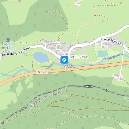
Starting point
Steps

Additional information
Open period
All year round.
Subject to favorable weather.
Tips
-For your safety, please check the weather forecast before setting off on your hike. -To preserve the environment in which you are located, please avoid leaving garbage in nature. -Remember to take the appropriate equipment for the weather conditions and the hiking itinerary (hiking boots, water bottle, cap, sunglasses, jacket...).
Environments
Forest location
Lake view
Mountain view
Village centre
Lake 5 km away
Troglodyte site
Contact
Phone : 04 71 20 22 62
Website : https://www.hautesterrestourisme.fr
Type of land
Ground
Hard coating (tar, cement, flooring)
Updated by
Hautes Terres Tourisme - 24/11/2025
www.hautesterrestourisme.fr
Report a problem
Tricky passages
The climb to Roche Percée can be slippery in wet weather.
Guidebook with maps/step-by-step
Start - At the lake. With your back to the lake, walk up the street that passes the cemetery on your right, past the Place du Monument aux Morts to the church square. Pass the church square on your right, take rue du 19 mars 1962 and turn right around the school and tennis court.
1- At the crossroads, turn left between the houses towards the Fraisse-Haut waterfall. Continue on this good track past the lime kiln quarry. Stay on the right-hand track. It overlooks the village and reaches a stream. Cross the stream.
2- At the intersection, turn right. The track becomes a path that climbs several hairpin bends through the beech forest.
3- At the plateau, turn left onto the path between the ferns to climb up to the pierced rock and back. Return to the plateau and continue climbing until you come to a gate. Go through the gate onto a wide track.
4- Turn right, following the signs.
5- When you reach the road, turn right at the first house in Les Pindorios.
6- 20 metres after the house, take the small track on the left which descends into the woods.
7- Return to the main track and turn left.
8- Leave the track and keep right to take the grassy track lined with brambles. Descend following the signs, then return to Laveissière via rue des Barthes, then rue du Peyre Arse. Under the church, turn left and drive down to the parking lot at the lake.
Animals
Yes
Data author
