Le Plomb du Cantal
Description
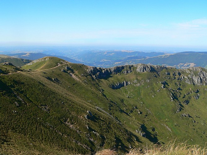
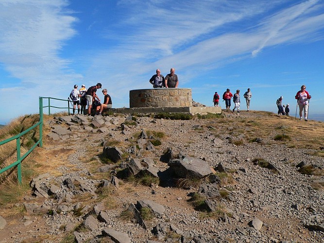
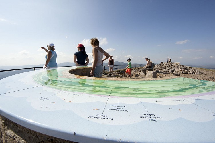
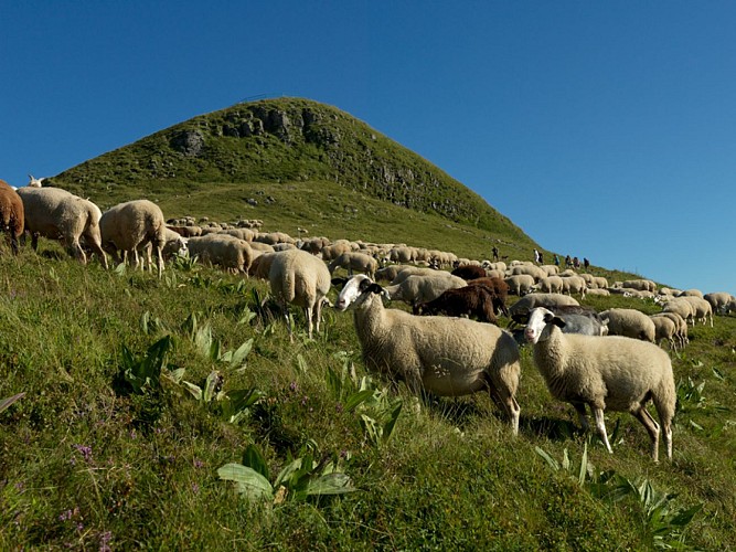
A must! Head for the highest summit of the Cantal volcano, the Plomb du Cantal at 1855m. At the summit, an orientation table will help you put a name to the neighbouring peaks, and on your way you may come across a marmot!
Technical informations
8 km
|
max. 1853 m
min. 1386 m
471 m
471 m
| ||||||
Altimetric profile
Starting point
Additional information
Type of land
Rock
Stone
Ground
Grit
Not suitable for strollers
Contact
Phone : 04 71 20 09 47
Email : contact@hautesterrestourisme.fr
Website : www.hautesterrestourisme.fr
Open period
All year round.
Subject to favorable snow and weather conditions.
Updated by
Hautes Terres Tourisme - 15/02/2024
www.hautesterrestourisme.fr
Report a problem
Guidebook with maps/step-by-step
Departure-
The route starts from the parking lot at the Col de Prat de Bouc. Head towards the Prés Marty buron, reach the gate and continue straight ahead on this wide track for about 400 m.
1-
Before the stream, turn left, go through the gate and the snow fence, then continue on the track that rises up opposite. After 250 m, pass another snow fence and continue straight ahead.
2-
After about 1.3 km of ascent, reach a flat area and the ridge line (view of the Grandval cirque and the Brezons valley). Turn right and follow the fence on your left, continuing uphill. Cross two Canadian crossings in succession and continue straight ahead along the fence. After about 1 km, find a gate and go through it.
3-
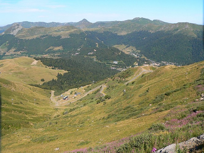
At the plateau, climb right towards the summit. Take the wooden staircase to the summit of the Plomb du Cantal (panorama, orientation tables). Climb back down the wooden stairs. Leave the cable car station on your left and head for the green ski slope in the direction of Prat de Bouc.
4-
At the pas des Alpins (1750 m), turn right onto this wide, stony track, which winds its way down to Prat de Bouc. Cross several gates over a distance of about 3 km and return to the start.
5-
VARIANTE "Plomb du Cantal Sud". At Les Près Marty, you can take the Rochers de Chamalières option, following a path that descends to the left into the mountain pastures (follow the sign for "Prat de Bouc par les Rochers de Chamalières"). Allow 2.7km and a further 45 minutes' walk.
Tips for the photographer
Enjoy a 360° panoramic view from the summit of Plomb du Cantal!
Tips
-For your safety, please check the weather forecast before setting off on your hike. -To preserve the environment in which you are located, please avoid leaving garbage in nature. -Remember to take equipment adapted to the weather conditions and the hiking itinerary (hiking boots, water bottle, cap, sunglasses, jacket...).
Environments
Mountain view
Mountain location
Close to GR footpath
Data author
