Alert
Alerts
Type of practice
Walking
Easy
2h30mn
Presentation
Description
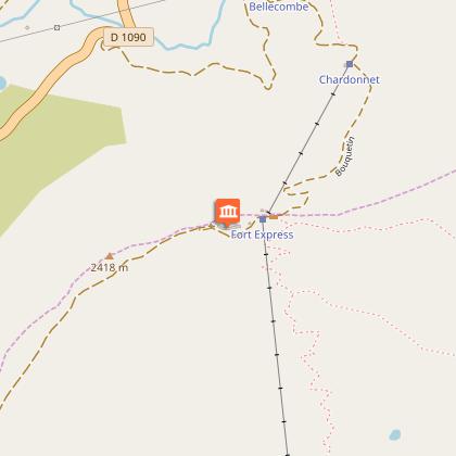
Map
Points of interest
Ratings and reviews
See around
Le Chemin des Militaires
Description
Depuis les sommet du télésiège de Roches Noires, emprunter le sentier qui se rend vers le site stratégique du fort de la Redoute Ruinée à 2399 m d'altitude.
Les plus courageux pourront poursuivre se sentier qui revient vers La Rosière par le Plan de l'Arc.
Technical Information
Walking
Difficulty
Easy
Duration
2h30mn
(1d)
Dist.
8.4 km
Type of practice
Walking
Easy
2h30mn
Show more
Altimetric profile
Starting point
Unnamed Road
,
73700
Montvalezan
Lat : 45.64699Lng : 6.86174
Points of interest
Data author

proposed by
LA ROSIERE
Ratings and reviews
To see around