Alert
Alerts
Le Gâteau
IGN cards


Description
From the Tourist Office, this alpine trail through the forest allows you to discover the summit of Gâteau and join its orientation table with its exceptional panorama of Mont Blanc and Beaufortain!
After a departure from the Tourist Office, go up to the CHURCH then head towards CAHOT, THE CHAR, BELLAVARDE, and the BALMETTES. From there, take the track towards TRÉLACHAT, then continue until the CAKE. Then take PIED DE LA CRÊTE, then CRÊTE DU SCIOZIER, continue on THE SIGNAL OF THE BAG, BOIS DES ÉCUELLÉS, the STOZALETS and go down again on the SCIOZIER, then LE PONT DE FER, LA TOUVIÈRE, and finish on THE BIOLLAY. Continue the path on LE PETIT BIOLLAY, then THE MORETTES PONTETS and finally return by THE CHAR. Finish by the same route.
Technical Information
Altimetric profile
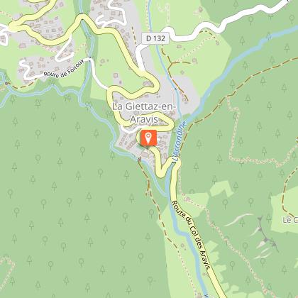
Starting point
Date and time
- From 01/06/2026 to 31/10/2026
Additional information
Open period
From 01/06 to 31/10.
Updated by
Office de Tourisme du Val d'Arly - 09/09/2025
www.valdarly-montblanc.com
Report a problem
Contact
Phone : 04 79 31 61 08
Email : info@flumet-montblanc.com
Website : www.flumet-montblanc.com
Facebook : www.facebook.com/flumet.stnicolaslachapelletourisme
Type of land
Stone
Ground
Location complements
Departure from the Tourist Office, parking available.
Topo guides and map references
Topo guides references :
Topoguide "Itinéraires Trail Val d'Arly / Beaufortain" on sale in tourist offices.
Reception complements
Duration: between 1h45 and 3h30.
Animals
Yes. Pets allowed on a leash only.
