Tour of Mont de Grange from Chapelle d'Abondance
Description
Mont de Grange is a Natura 2000 and hunting reserve.
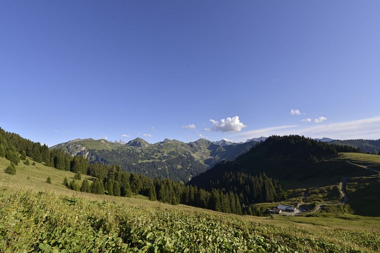
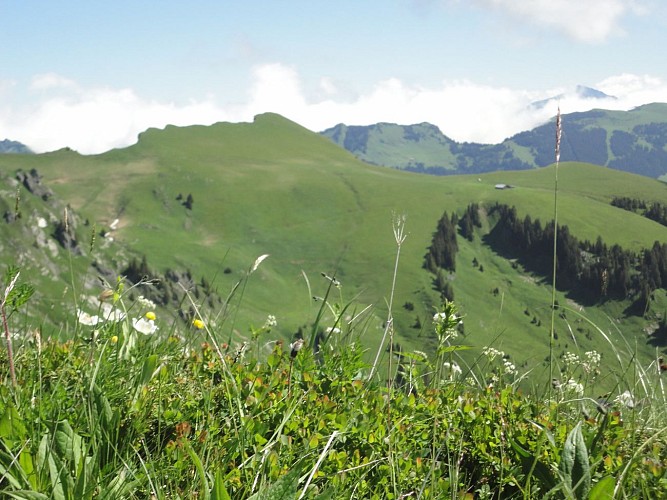
This hike enables to discover a nature shared between wildlife and alpine pastures. This itinerary offers you beautiful views of Abondance, La Chapelle d'Abondance and Châtel.
The Mont de Grange tour is a hike for experienced walkers.
Mont de Grange is a 3,000-hectare nature reserve, classified Natura 2000.
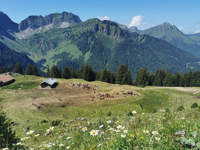
It's also a hunting reserve where deer, chamois, roe deer, mouflons, marmots, black grouse, ptarmigan, golden eagles... all live side by side. You can easily observe them early in the morning. This hike also invites you to discover wild flora such as martagon lily, paradise lily, alpine columbine, gentian and genepi.
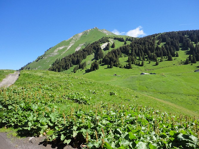
From the Plan des Feux in La Chapelle d'Abondance, take the gravel path towards Enquernaz. You cross the La Chapelle d'Abondance ski area and the Plaine Joux mountain pasture.
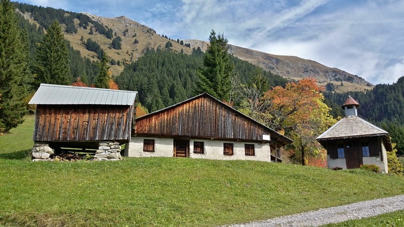
From l'Enquernaz, head towards the Saint-Théodule chapel. On the way to the chapel, you'll pass through a number of local villages and discover the traditional houses of Charmy l'Adroit in Abondance.
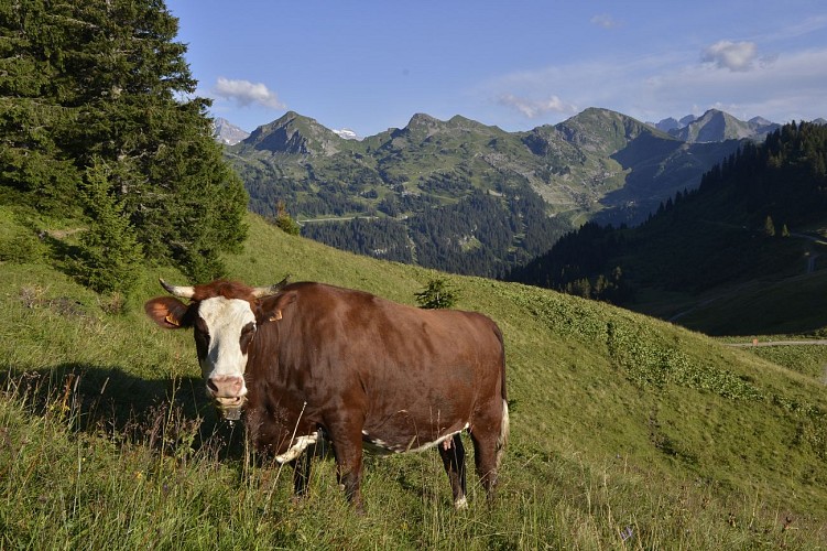
After the Chapelle Saint Théodule, you'll take a mountain path to the Lenlevay viewpoint, passing the Bailly and Jouly mountain chalets. You'll meet Abondance cows on these mountain pastures during the summer season. A beautiful panorama of Abondance and Châtel awaits you.
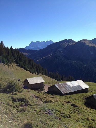
From Lenlevay, take the GR5 path via the Etrye, Pron and Mattes chalets. You'll follow the Pointe des Mattes down to the Chalet de Trebentaz and then back to the starting point.
Variations: possible departures from Chapelle Saint Théodule in Abondance or Tré-les-Pierres in Châtel.
Technical informations
23 km
|
min. 99999 m
1670 m
| |||
Public : Reserved for experts/confirmed | ||||
Altimetric profile
Starting point
Points of interest
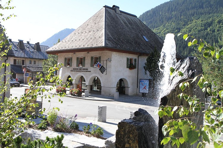
Tourist Information Office of La Chapelle d'Abondance
La Chapelle d'Abondance Tourisme is at your disposal for all the various information concerning the resort-village of La Chapelle d'Abondance and its surrounding villages of the Evian country-Abondance valley as well as neighboring Switzerland.La Chapelle d'Abondance Tourisme and its holiday advisors welcome you all year round and offer the following services: - tourist information on La Chapelle d'Abondance and its summer and winter activities, - tourist information on the Evian-Vallée d'Abondance region, the Portes du Soleil and the surrounding area in France and neighboring Switzerland, - availability center for furnished rentals, - accommodation options: furnished apartments, bed & breakfasts and gîtes, hotels and vacation centers, - wide choice of maps and topo-guides, free or for sale: hiking, trail, mountain biking, road biking, climbing, via ferrata, snowshoeing, ski touring, - ticketing for various tourist services: events, visits and activities, - sale of Multi Pass and Léman Pass during the summer season - sale of fishing cards - sale of 10-trip EVA'D bus passes - sale of Swiss motorway vignettes - pocket wifi rental - photocopying and scanning service - goodies store
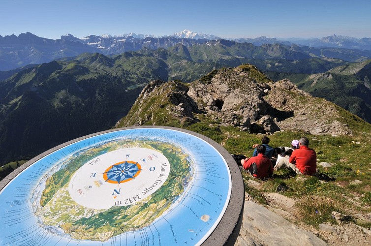
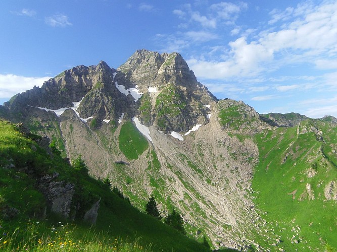
Mont de Grange summit
Culminating at an altitude of 2432 m, the Mont de Grange (Natura 2000) is the highest summit in the pays d'Evian-vallée d'Abondance territory and the second highest in the Chablais. It sublimates the valley of Abondance in company of the Cornettes de Bise.The most discreet hikers can observe chamois, marmots, ptarmigan, foxes ... As well as many mountain flowers. Natura 2000 is a network of protected natural sites across Europe, identified for the rarity or fragility of their wild species, and the natural habitats that house them. The objective is to preserve the biodiversity of these spaces in the long term without banishing all human activities and to enhance the natural heritage of this territory. Natura 2000 is not a nature reserve in the strict sense.
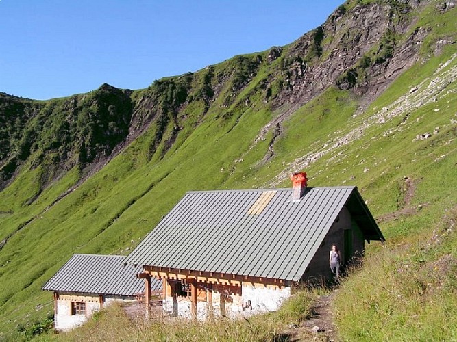
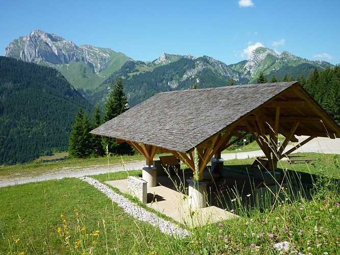
Trebentaz Refuge
Located at 1900 meters above sea level, in the heart of the Mont de Grange hunting reserve with panoramic terrace, this refuge is a privileged stopover, stage of the GR5 via the Col des Mattes.Mountain restaurant, stage refuge, within a Natura 2000 classified site. Access by car to the Plan des Feux car park then about 2 hours of walking or 3 hours from the village. Accessible and open from the end of June to mid-September (depending on weather conditions) every day.
Date and time
- From 01/06/2024 to 30/09/2024
- From 01/06/2025 to 30/09/2025
Additional information
Updated by
Office de Tourisme Leman Mountains Explore - 08/03/2024
leman-mountains-explore.com
Report a problem
Tips
- From Les Mattes, you can branch off to the Trebentaz refuge.
- From the Chapelle Saint Théodule, you can branch off to the refuge des Tindérêts, via the Lac des Plagnes.
Guidebook with maps/step-by-step
0/ Departure point: Parking du Plan des Feux, La Chapelle d'Abondance
1/ Take the gravel path towards "L'Enquernaz". You cross the La Chapelle d'Abondance ski area and the "Plaine Joux" mountain pasture.
2/ At "L'Enquernaz", descend towards "La Chapelle Saint-Théodule". At "Les Fauges", follow the asphalt road to "Les Poses". From here, take the path behind the chalet to "Les Séchets". Follow the asphalt road on your right to "Fontaine Froide". At the crossroads, turn left towards "La Plagnette". At "La Plagnette", the road becomes a path that leads to the "Chapelle Saint-Théodule".
3/ After the chapel, follow the road to "Lenlevay", passing the "Chalets du Bailly" and the "Chalets du Jouly".
4/ At "Lenlevay", turn left onto the GR5 path which passes through the chalets towards "l'Etrye". Pass the chalet and then the Etrye stream. The path then climbs up to the "Pron" chalets, then to "Les Mattes" and down to "Chalet de Trebentaz". You will then pass the viewpoint "La Corne" and "Les Chalets du Folliet".
5/ Finally, turn left onto the forest track that leads to "Plan des Feux".
Variants : You can reach the summit of Mont de Grange via the Coincon ridge. You can also start from Saint-Théodule in Abondance or from Très les Pierres in Châtel.
Environments
Mountain location
Close to GR footpath
Reception conditions for animals
Dogs must be kept on a leash because of the presence of herds, Natura 2000 reserve and hunting reserve.
Open period
From 01/06 to 30/09.
Accessible outside the snow period and depending on weather conditions. Check with the Tourist Office beforehand to find out the current access conditions. Recommended practice period: spring - summer - autumn.
Topo guides and map references
Topo guides references :
On sale in the tourist offices of the Abondance valley.
Map references :
Portes du Soleil hiking map in France and Switzerland
TOP 25 N°3528 ET Morzine Massif du Chablais Les Portes du Soleil
Type of land
Stone
Ground
Contact
Phone : 04 50 73 51 41
Email : lachapelledabondance@ot-peva.com
Website : lachapelledabondance-tourisme.com
Location complements
Recommended parking: Plan des Feux - La Chapelle d'Abondance
The closest bus stop: La Sauge by the Colombus (summer only), to join Sur Bayard and the GR5.
