Alert
Alerts
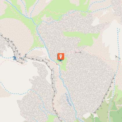
Hiking itinerary: Tour des Dents Blanches GR®P mini 4 days on foot - Stage 2: Refuge de Bostan-Tornay > Refuge de la Vogealle
Description
This stage has a high-mountain character, with equipped passages and magnificent panoramic views: Cirque du Bout du Monde, Pointe Rousse, Lac de la Vogealle, the Dents Blanches, the Pointe de Bostan.
From the Bostan-Tornay refuge, head up the Combe des Verdets towards the Col de Bostan. You cross a mineral landscape, passing Lac de Verdets on your right. At the Col de Bostan, you have 2 options: the Swiss part of the Dents blanches or our French route to the refuge de la Vogealle. At the pass, pass the Golette de l'Oule, then the chain-equipped Pas du Taureau via the Col du Taureau. Take care. Take a right-hand path to the Folly refuge, reach a plateau and follow a grassy ridge down into the Combe de Praz Riant. Go to "la Combe aux Puaires". Leave the Refuge de Folly and head for the Refuge de la Vogealle, via the lake of the same name, following its left bank.
Technical Information
Altimetric profile
Starting point
Points of interest

Date and time
- From 01/06/2026 to 30/09/2026
- From 01/06/2027 to 30/09/2027
Additional information
Updated by
Haut-Giffre Tourisme - 07/04/2026
www.haut-giffre.fr
Report a problem
Environments
Lakeside or by stretch of water
Mountain view
Waterside
Lake view
Mountain location
Open period
From 01/06 to 30/09 daily.
Subject to favorable snow and weather conditions.
Contact
Phone : 04 50 34 40 28
Email : infos@samoens.com
Website : http://www.samoens.com
Facebook : http://www.facebook.com/samoensofficiel
Type of land
Stone
Ground
Not suitable for strollers
Reception complements
Whatever your hike, remember to take cereal bars, sufficient water, sunglasses, sun cream, a small first aid kit, as well as clothes adapted to your outing according to the season and the weather forecast.
Animals
No
Data author
