Alert
Alerts
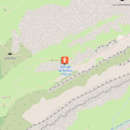
Hiking itinerary: Tour des Dents Blanches GR®P mini 4 days on foot - Stage 1: Les Allamands > Refuge de Bostan-Tornay
Description
A beautiful panoramic view of the Giffre valley, the Pointe de la Golèse, the Bottière chalets. An amazing site, consisting of boulders, grassland and alpine flora.
From the parking lot, turn right onto the Grande Randonnée de Pays (GRP) "Tour des Dents Blanches" trail, which you will never leave. At the "Plan" crossroads, continue straight on towards the Bostan-Tornay refuge. The trail twists and turns through forest and alpine pastures, past the Bostan chalets. Follow the path between the Dents d'Oddaz and the Avouille to reach a flat area where the Bostan-Tornay refuge is located. The short itinerary provides a good warm-up for this first day. Tip: discover the Col de la Golèse above the refuge, a 30-minute walk away. Retrace your steps and take the path to the right towards the Col. You'll enjoy a breathtaking view of the Terres Maudites, the Golèse Refuge and the Giffre and Morzine Valleys. The tête de Bostan to the right of the Col can be reached in 2 hours 50 minutes.
Technical Information
Altimetric profile
Starting point
Date and time
- From 01/06/2026 to 30/09/2026
- From 01/06/2027 to 30/09/2027
Additional information
Updated by
Haut-Giffre Tourisme - 07/04/2026
www.haut-giffre.fr
Report a problem
Environments
Mountain view
Mountain location
Open period
From 01/06 to 30/09 daily.
Subject to favorable snow and weather conditions.
Contact
Phone : 04 50 34 40 28
Email : infos@samoens.com
Website : http://www.samoens.com
Facebook : http://www.facebook.com/samoensofficiel
Type of land
Stone
Ground
Not suitable for strollers
Reception complements
Whatever your hike, remember to take cereal bars, sufficient water, sunglasses, sun cream, a small first aid kit, as well as clothes adapted to your outing according to the season and the weather forecast.
Animals
No
Data author
