Alert
Alerts
Walking route: Arvouin Lake Loop

Description
A beautiful hike which starts from the centre of the village of La Chapelle d'Abondance and offers superb views of the Cornettes de Bise, the lake of Arvouin, the village and the valley of Abondance.
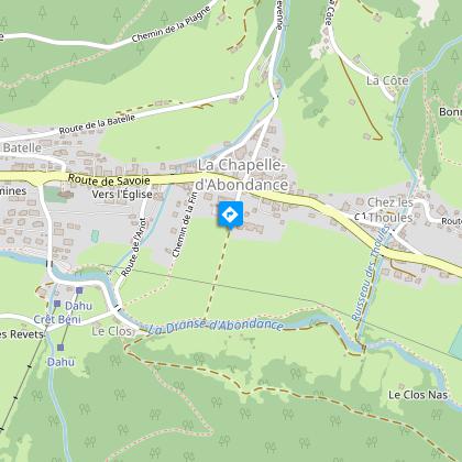
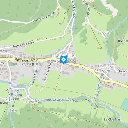
This hike starts in the centre of the typical Haut Savoyard village of La Chapelle d'Abondance. It is located within the natural site of the Cornettes de Bise, classified Natura 2000.
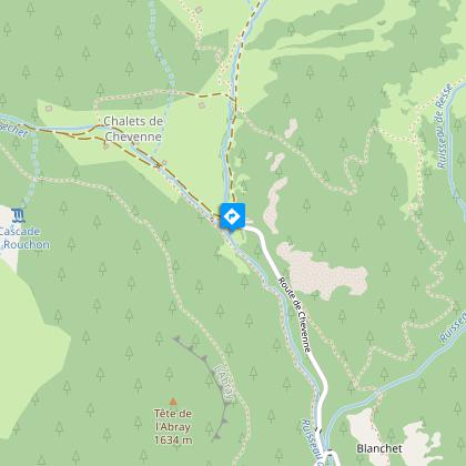
You will take the road and then follow a forest path in the direction of Chevenne.
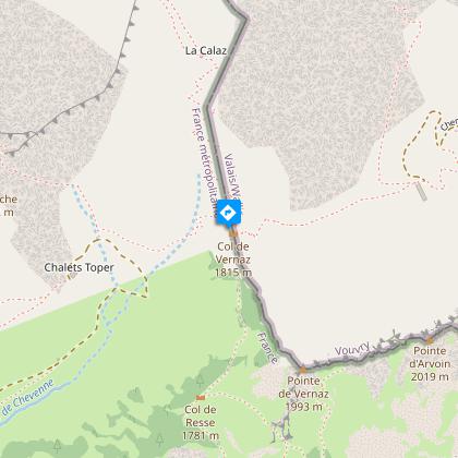
You will then take a pastoral track and a path towards the Vernaz pass at the foot of the imposing Cornettes de Bise mountain. At the pass, a magnificent view awaits you on its southern face.
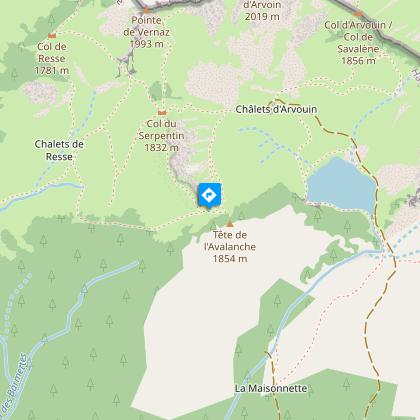
You will then reach the Col de Resse and then the Col du Serpentin and the Tête de l'Avalanche, the highest point of the route at 1854m. This viewpoint on the lake of Arvouin, the Dents du Midi and the valley of Abondance is worth the diversions.
It is also an area frequented by mouflons, marmots and grouse roosters.
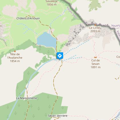
After a short descent through the alpine chalets, you can enjoy a moment of relaxation at the edge of the Arvouin lake. You may meet Abondance cows or ibexes, which are very present on this site.
The return to the village of La Chapelle d'Abondance is via a fairly steep path through the Tête de la Maisonnette mountain pasture and a long descent through the forest.
Technical Information
Altimetric profile
Starting point
Steps
Points of interest


Date and time
- From 01/06/2026 to 15/10/2026
Additional information
Open period
From 01/06 to 15/10 daily.
Check with tourist offices in advance to find out the current access conditions.
Subject to favorable snow and weather conditions.
Sustainable tourism
The wetland bordering the Lac d'Arvouin below the chalet is a sensitive and protected heritage area.
To avoid trampling and preserve this rich and fragile ecosystem (protected flora and breeding ground for aquatic fauna), please do not walk around Lac d'Arvouin and stay on the main track leading up to the chalet.
Our mountain lakes are fragile environments, and our actions have an impact on these ecosystems, so please don't swim in them (dogs included).
When you swim, you leave behind sunscreen, bacteria and organic particles that disturb the ecological balance.
Updated by
Office de Tourisme Leman Mountains Explore - 12/12/2025
leman-mountains-explore.com
Report a problem
Environments
Lakeside or by stretch of water
Forest location
Waterside
Lake view
Mountain location
Contact
Phone : 04 50 73 51 41
Email : lachapelledabondance@ot-peva.com
Website : https://leman-mountains-explore.com
Type of land
Stone
Ground
Grit
Not suitable for strollers
Rock
Location complements
Free parking under the tourist office or access to the starting point by shuttle (line C and line 12).
Topo guides and map references
Topo guides references :
Hiking maps and guidebooks are available for purchase at tourist offices throughout the Evian and Abondance Valley region.
Map references :
- Map guide to 65 walks and hikes in the Evian region and Abondance valley
- Map of walking routes in the Portes du Soleil area in France and Switzerland
- IGN TOP 25 No. 3528 ET Morzine Chablais Massif Portes du Soleil
Reception complements
Whatever your hike, remember to pack cereal bars, plenty of water, sunglasses, sun cream, a small first aid kit, and clothing suitable for your outing depending on the season and the weather forecast.
The route is strongly discouraged without appropriate equipment if snow persists, as the passages through the corridors and certain slopes are very exposed.
Tricky passages
To cross a steep passage towards the Col de Resse, you will need to use a handrail (chain) for a short distance.
Guidebook with maps/step-by-step
0/ Start : "route de Chevenne".
1/ Take the road to "Chevenne" on foot.
2/ Follow the forest path on your left towards " Chevenne ".
3/ At the Chevenne car park, take the path on your right towards the "Col de Vernaz".
4/ Once at the pass, turn right towards the "Col de Resse" and the "Tête de l'Avalanche".
5/ After reaching the "Tête de l'Avalanche", go down the path towards the "lac d'Arvouin". Rejoin the road that runs alongside the lake.
6/ The return to the village of La Chapelle d'Abondance is done by the path starting at the level of the outlet of the lake and going down through the "Alpage de la Maisonnette".
Animals
Yes. Dogs must be kept on a leash due to the presence of livestock and wildlife.
