Hike to Salvadon mountain pasture and chalets
Description
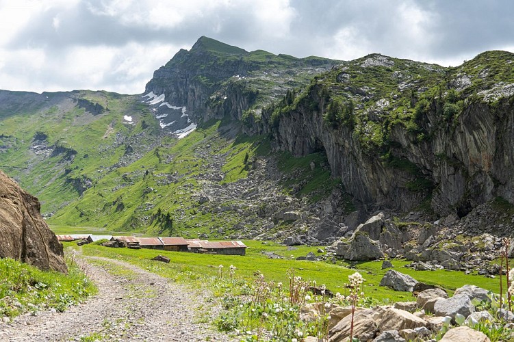
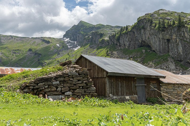
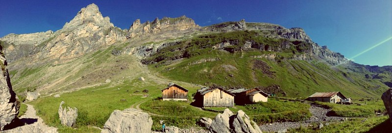
The Salvadon chalets are huddled together in a magnificent valley below Les Avoudrues, the Pointe de Bellegarde and the Pointe de Sambet. These Alpine pastures are still exploited today.
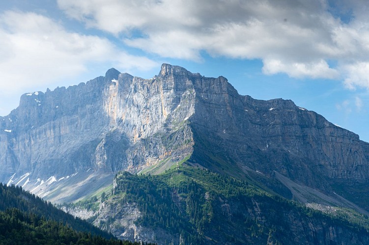
Take the wide track that begins at the end of Le Crot hamlet. It climbs up through the woods and some sections are fairly steep! Half way up, you can admire the view from the "Miches de Salvadon", over the north-west side of the Grenier de Commune. The path then rises through some beautiful mixed forest, passing some more modest buildings before leading up to a beautiful panoramic viewpoint from where you can observe the surrounding mountains: just above you, the impressive drops and peaks between the Dent de Verreu and the Pointe Rousse and, to the south-west, the unmistakable silhouette of the Fiz range. You can even make out the famous Rouget waterfall.
After entering the Sixt-Passy Nature Reserve, you'll find the forest less dense. After the forest, the path becomes more gentle and gradually joins the beautiful Salvadon valley. Follow the track to the chalets, which you won't actually see until you're practically there.
Technical informations
11 km
|
min. 99999 m
890 m
890 m
| |||
Altimetric profile
Starting point
Date and time
- From 16/06/2024 to 30/09/2024
- From 16/06/2025 to 30/09/2025
Additional information
Updated by
Conseil Départemental de la Haute-Savoie - 25/04/2024
www.hautesavoiexperience.fr
Report a problem
Environments
Mountain view
Mountain location
Open period
From 16/06 to 30/09.
Subject to favorable snow and weather conditions.
Contact
Phone : 04 50 34 49 36
Email : contact@haut-giffre-tourisme.fr
Type of land
Stone
Ground
Location complements
Hamlet of Le Crot (on the road to the Cirque du Fer-à-Cheval, on the left after the hamlet of Les Curtets)
Data author
